Ontario: Powerful winds, localized flooding as storm tracks east

Intense wind gusts Monday have already caused tens of thousands of power outages across southern Ontario, with more expected overnight behind the departing low. Meanwhile, snow continues to fall across northern Ontario.
A significant Colorado low is continuing to trek east after delivering heavy rain, strong winds, and a swath of snow across much of the province.
Snow continues to fall in northern Ontario overnight, with totals between 30-50 cm expected by Tuesday morning.
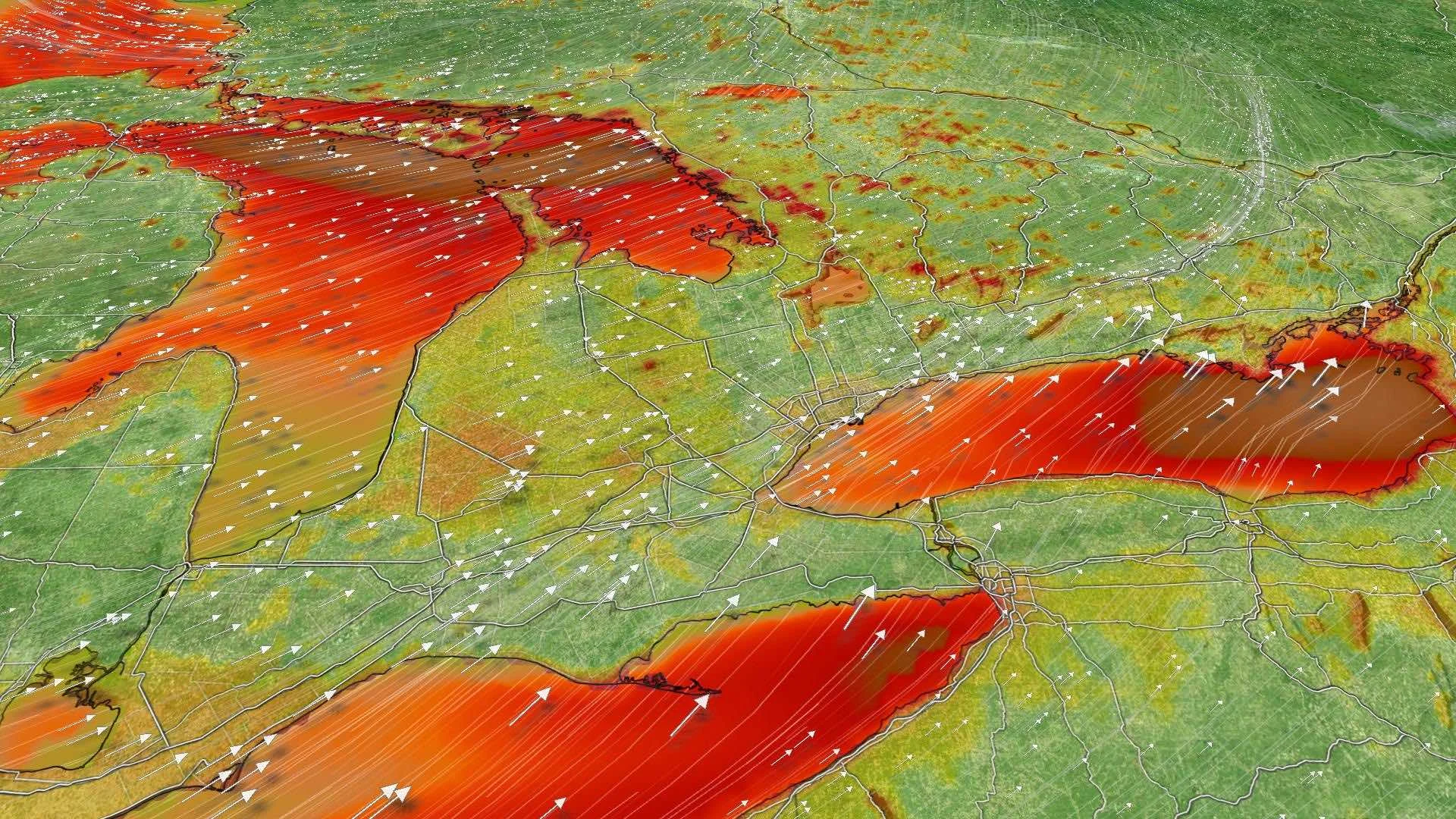
Across southern Ontario, strong winds continue to gust, leaving significant damage and power outages. As the system departs, widespread gusts of 50-70 km/h are expected to continue overnight, with the potential for flooding in areas along Lake Ontario and Lake Erie. Details below.
WEATHER HIGHLIGHTS:
Snow lingers overnight for northern Ontario
Lake-effect flurries to develop for some areas Tuesday morning
Widespread winds of 50-70 km/h in southern Ontario overnight
Risk of flooding along the lakes in the wake of heavy rainfall and strong winds
Keep track of ALERTS in your area
OVERNIGHT: SNOW CONTINUES, WINDS EASE
The system's heaviest rainfall has tracked to the east and has eased across southern Ontario.
Gusty winds will continue for some areas overnight, and lakeshore flooding remains possible in typically prone areas.
A seiche did occur along some shorelines Monday, as winds gust of over 80 km/h were reported in parts of southwestern Ontario. This caused water levels to drop on one end of the lake and rise at the other end, prompting strong waves to form.
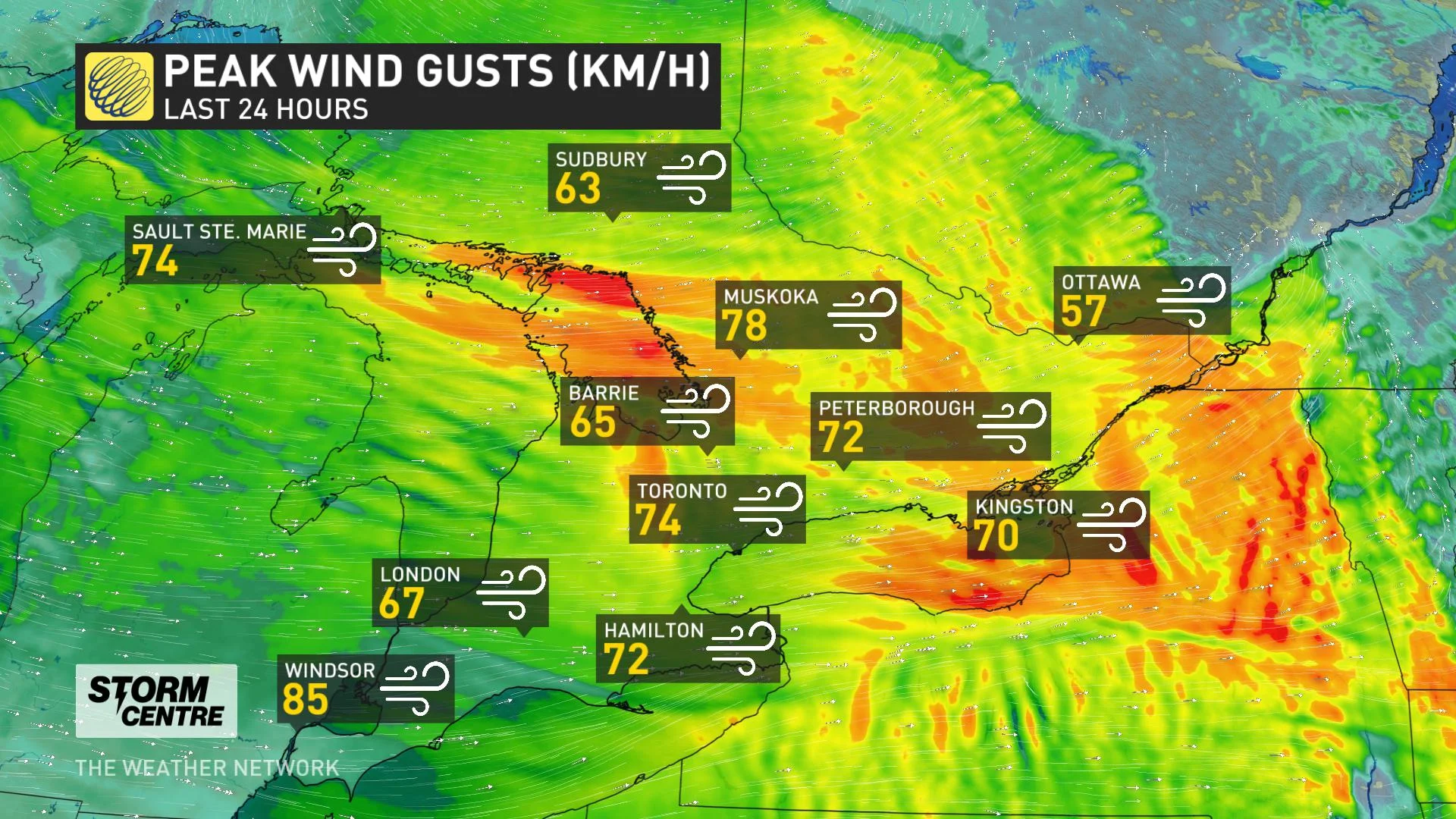
Environment Canada issued special weather statements and wind warnings across southern Ontario that warn of the potential for power outages, many of which remained in place late Monday.
NEARLY HALF A METRE OF SNOW FOR NORTHERN ONTARIO, WATCH BELOW
Light snow will continue overnight for northern Ontario, however lake-effect bands will also set up and stick around for Sault Ste. Marie up toward Wawa, shifting through the day with minimal precipitation.
Overall, regions along and northeast of Lake Superior will have seen accumulations between 30-50 cm by Tuesday morning.
LOOKING AHEAD: TEMPERATURES DROP, UNSETTLED CONDITIONS REMAIN
As the storm tracks east, much cooler air will spill in behind Tuesday, keeping daytime highs in the single digits for Ontario. Winds will be much calmer than on Monday, but will remain somewhat brisk in the south. A weak trough will bring isolated flurries to parts of central and southern Ontario through the day.
Temperatures will remain chilly through the week, along with unsettled conditions, but daytime highs could slightly climb to near seasonal on the weekend.
"We are closely watching a system expected to track well south of the border on Saturday. At this point we expect that we will remain dry, but a truck further to the north would bring rain and snow showers into parts of southern Ontario," says Weather Network meteorologist Dr. Doug Gillham.
Check back as we continue to monitor the forecast.