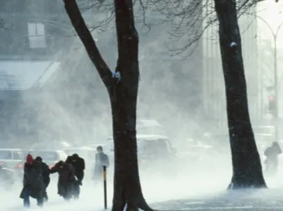
Expect tricky travel in the GTA from intense lake-effect snow squalls

Shifting winds threaten the Greater Toronto Area with a band of intense lake-effect snow Wednesday.
Wednesday will once again see the threat for more lake-effect snow squalls, but the focus of them will be in the Greater Toronto Area (GTA) as a result of a change in wind direction. An easterly flow, combined with chilly temperatures, will create a favourable setup for lake-effect snow bands to develop off western Lake Ontario. While it's difficult to say how much snow is to be expected, these bands could overachieve and produce up to 15 cm in parts of the western GTA. The first round will affect the morning commute in central areas, so motorists in Toronto should expect tricky travel from the slippery road conditions. More on the timing and impact of this setup, plus a "last minute" shot at a white Christmas, below.
WEATHER HIGHLIGHTS:
East wind off of Lake Ontario triggers band of lake-effect snow Wednesday morning, which will affect the GTA
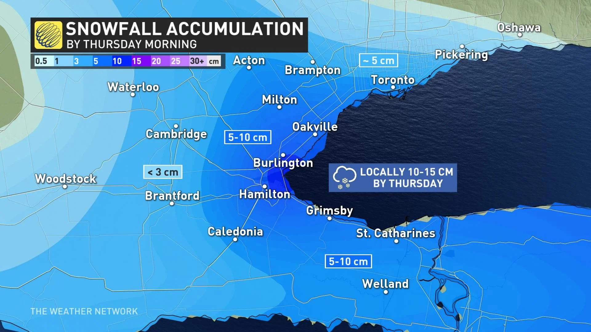
Western GTA, from Toronto to Hamilton, including QEW, west end of Highway 407, could see overachieving snowfall amounts
Conditions trend milder for the weekend, period of rain and snow showers
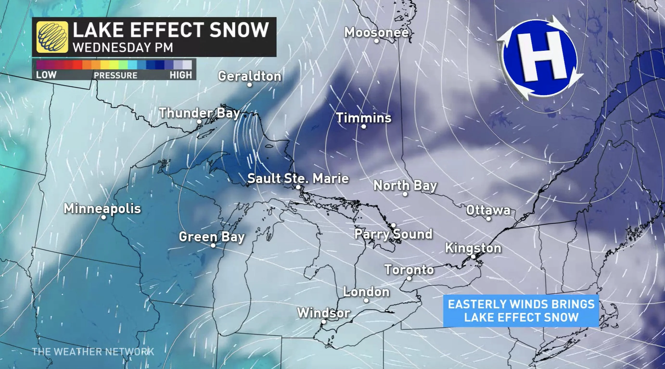
WEDNESDAY: EASTERLY WINDS THREATEN GTA WITH MORE INTENSE LAKE-EFFECT SNOW
With chilly and below seasonal temperatures hanging on Wednesday, winds will shift to the east ahead of a potent and impactful storm south of the border.
Visit our Complete Guide to Winter 2021 for an in depth look at the Winter Forecast, Canada's ski season, and tips to plan for everything ahead!
With this easterly flow, there will be a lake-effect snow band developing off of the western end of Lake Ontario, which could bring accumulating snowfall and tricky driving conditions to areas from Toronto to Hamilton on Wednesday.
There will be multiple rounds of snow, with the first occurring for the morning commute in the central GTA including Toronto. By the afternoon, the snow will ease off, but then another shot is expected for the evening. This band of lake-effect snow is expected to have more of an impact for the western side of the GTA.
"During the evening, the lake-effect snow band will reorganize between Burlington and Mississauga...[eventually drifting] south to areas between Burlington, Hamilton, and Grimsby," said Weather Network meteorologist Dr. Doug Gillham.
Areas from Oakville to Hamilton, also encompassing the QEW and western end of Highway 407, will be seeing the most intense bands. While snowfall amounts are currently on the low end, there is the possibility of overachieving accumulations, with 15 cm not out of the question for the Burlington and Highway 406 corridor.
However, it's difficult to predict just how much snow a given area is likely to receive over the course of these events.
"Lake-effect snow is notorious for wide ranges in snow totals over short distances, so we will see a range in snow totals across the region," says Gillham.
Most places between Toronto and Hamilton should see between 5-10 cm of snow, but if the bands overachieve, locally higher totals up to 15 cm are possible. Meanwhile, most areas outside of the lake-effect snow band will just see a trace to 2 cm.
However, with the stateside system now expected to head a little further north, the Niagara region could see 5-10 cm of snow.
The snow will continue through the overnight and taper off Thursday morning.
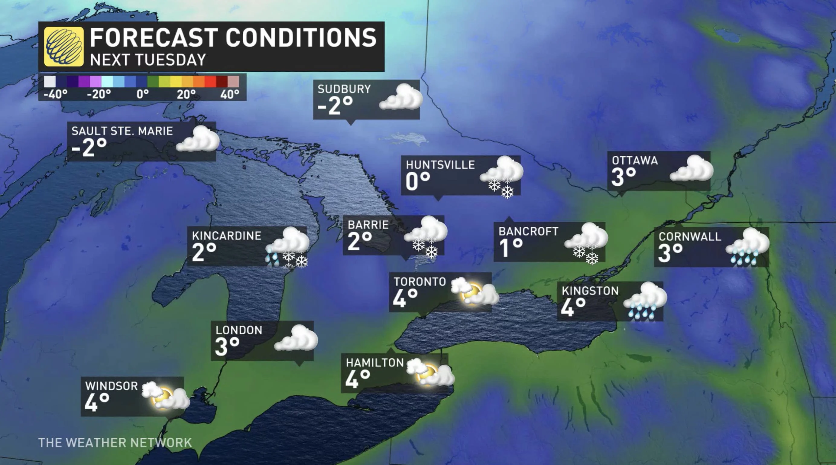
LATE WEEK AND BEYOND: TEMPERATURES GRADUALLY RECOVER, CHANGEABLE PATTERN AHEAD OF CHRISTMAS
As temperatures remain cold through Thursday, more sunshine and fair conditions will round out the work week, with daytime highs climbing above freezing and a milder weekend in store. A weak system will also track across the region this weekend, with scattered rain and snow showers expected late Saturday.
For the week and days leading up to Christmas, a changeable pattern is forecast, but with temperatures likely tipping to the mild side of seasonal.
"Whether or not we see a white Christmas will likely come down the the wire and depend on the track of another system around Christmas Eve which could bring rain or snow to our region," says Gillham. "Behind this system we expect a few days of cold weather, likely including Christmas and Boxing Day."
Check back as we continue to monitor the forecast and latest weather conditions in your area.