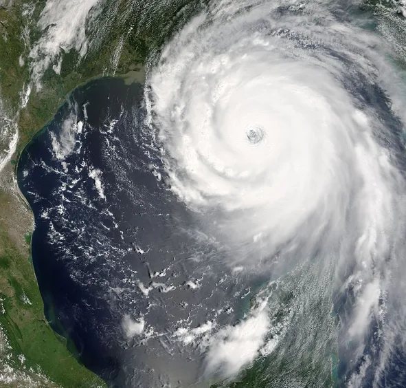
Using nuclear weapons on hurricanes is "not a good idea" says NOAA
After reports emerged that U.S. President Donald Trump inquired about the possibility of using nuclear weapons to destroy hurricanes, the National Oceanic and Atmospheric Administration (NOAA) stated that this strategy would be "devastating."
NOAA explains in the FAQ on their website that nuclear weapons would not be an effective strategy to diffuse hurricanes because the amount of energy a nuclear bomb could release is minimal compared to the significant and prolonged energy generated by hurricanes.
Given these energy differences, there is a possibility that a nuclear bomb would not even alter the storm. NOAA states that considering using nuclear weapons to mitigate hurricanes neglects the danger of released radioactive material that would be widely circulated across the globe due to tradewinds and other atmospheric circulation processes.
Interfering with tropical disturbances and tropical storms is not a promising strategy either, says NOAA. In the Atlantic basin, approximately 80 of these disturbances occur every year and only about five become hurricanes.
The energy released in a tropical disturbance is only about 10 per cent of that released in a hurricane and since forecast models are not able to tell which ones will develop, NOAA explains that attempting to diffuse the growing storms would require and waste an exorbitant amount of energy.
Trump later denied making the claim. But it is hardly a new idea — as many have noted, nuking hurricanes was first floated in the 1950s and mentioned in a speech by the head of the U.S. Weather Bureau in 1961.
A LOOK AT THE 2019 HURRICANE SEASON
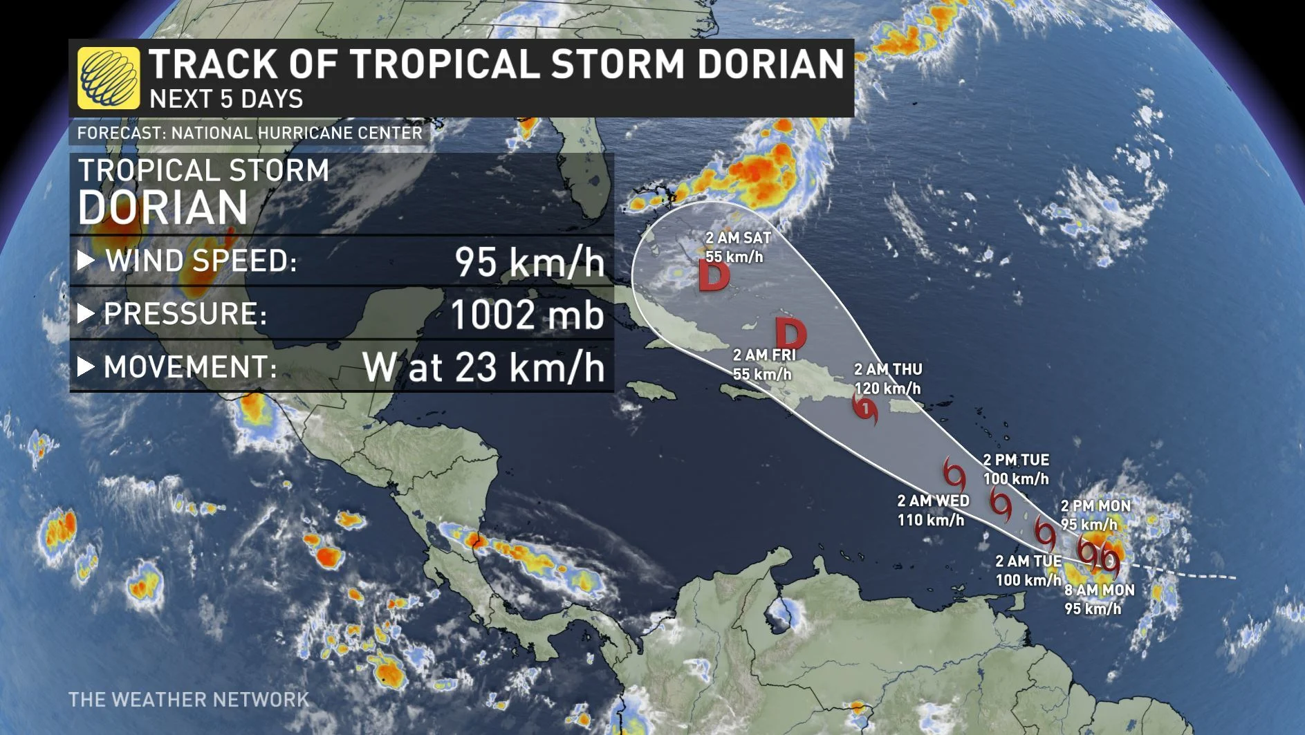
Tropical Storm Dorian is currently approaching the Lesser Antilles and is expected to produce heavy rainfall and strong winds for the region including Puerto Rico, St. Vincent, Martinique, and Barbados. There is the possibility for impacts in the Bahamas and Florida, however the probability is uncertain since the system could interact with the high terrain of Hispaniola, says NOAA.
A tropical disturbance that is east of the Carolinas has the potential to become Tropical Storm Erin and is expected to travel in a northeast direction. It will likely stay well offshore of the eastern coast of North America but could bring widespread beneficial and potentially locally excessive rain to parts of Nova Scotia and Newfoundland.
These regions of Canada could experience localized rainfall totals exceeding 50 mm during the later part of the week and strong winds, however wind speeds are unlikely to become dangerous. Sea surface temperatures off the northeastern coast of the U.S. have lately been warmer than normal, which helps fuel storm development and has contributed to the formation of these systems.
Hurricane season runs from June 1 to November 30 and so far June, July, and most of August has been relatively quiet. The climatological peak of the Atlantic hurricane season falls near September 10 and late August to early October is typically the most active time of the year for hurricanes. Last year, Hurricane Florence (Category 1 at landfall) and Hurricane Michael (Category 5 at landfall) both occurred in the second half of the season.
Source: NOAA