East Pacific hurricane season expected to be very active

An above-average Northeast Pacific hurricane season is predicted
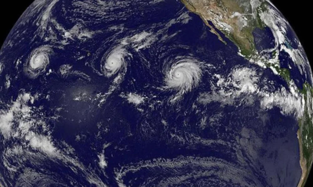
Hurricane season in the northeast Pacific is officially underway and will extend until November 30th. This year could be a repeat of 2018 as forecasts are calling for a well above normal season in terms of activity.
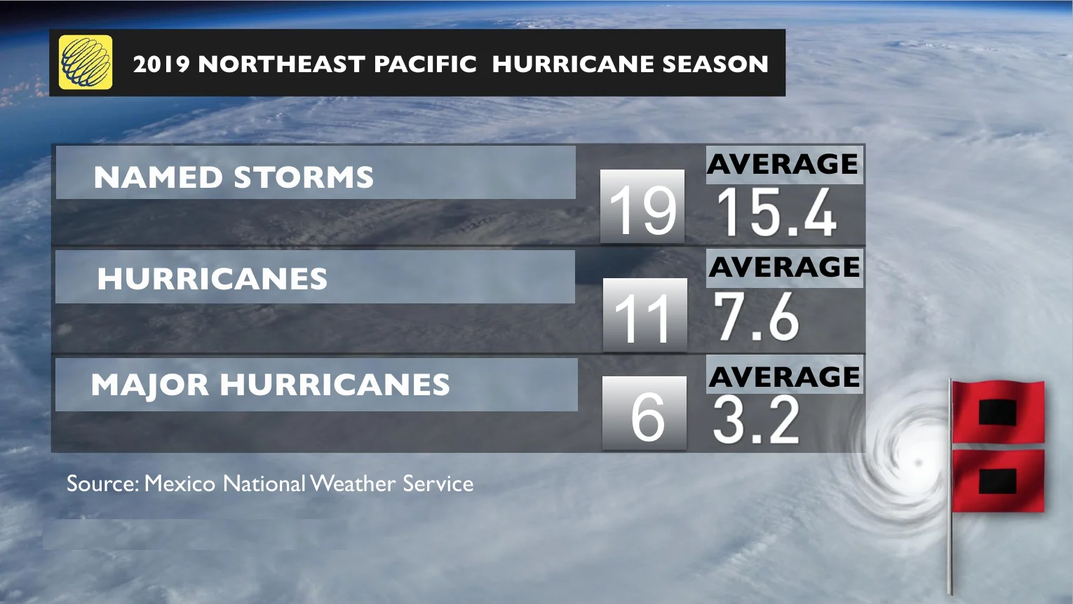
Mexico's National Weather Service has forecasted 19 named storms during the coming six and a half months, which is above the average of 15.4. Eleven of those storms will become hurricanes, which is also a value above the average of 7.6.
SEE ALSO: This summer is shaping up to be the best beach year yet
Perhaps the more significant part of the forecast is that six of those hurricanes are expected to be major, with categories of 3, 4 or 5. That would mean having almost twice the number normally seen on an average year.
Above normal sea surface temperatures (SST) in the region should help fuel developing tropical depressions that will eventually intensify into hurricanes. Despite forecasts calling for a weakening of El Niño early in the year, the equatorial Pacific waters are still warmer than average. This means that the season is starting under the influence of El Niño in the region.
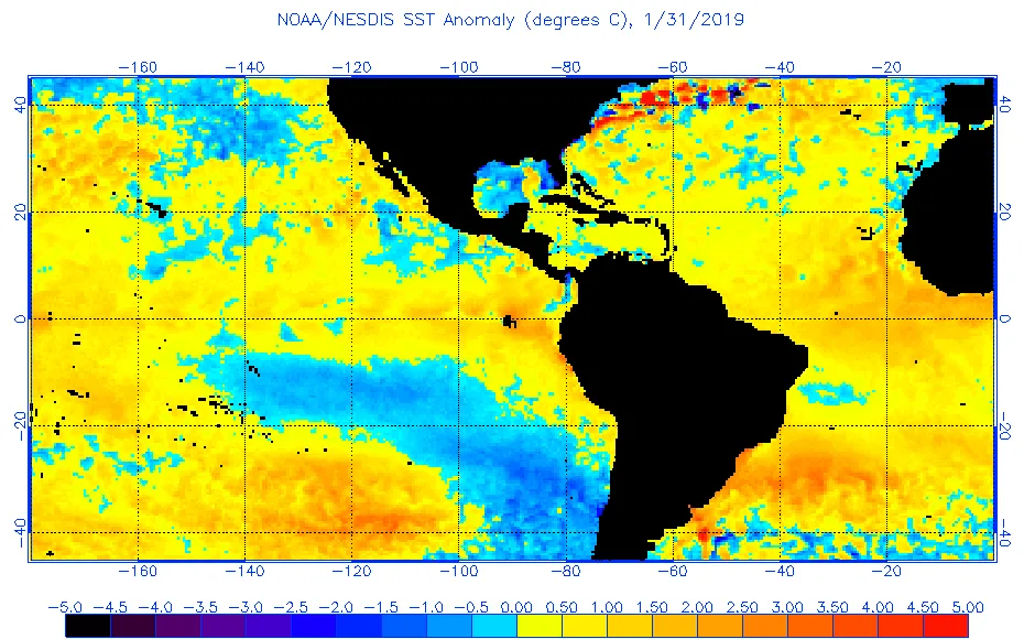
Graphic: SST anomolies (Courtesy: NOAA)
But this weak and persistent ENSO scenario is expected to continue into the summer as predicted by most models. Although the positive anomalies are not expected to exceed the 1°C mark in the 3.4 Pacific region during the coming months, the signal will be most likely present throughout most of the 2019 season. On top of that, there are many other areas of the Pacific displaying positive SST patterns, and that all means additional energy for storm formation.
DON'T MISS: Glaciers disappear as more rain falls in winter
The atmosphere is also expected to contribute to this more active season, by providing a more favourable environment characterized by lower overall wind shear in the region. This, however, does not rule out the occasional periods of strong vertical wind shear will occur, limiting storm formation along the Pacific coast of Mexico or other nearby areas of Central America and Hawaii.
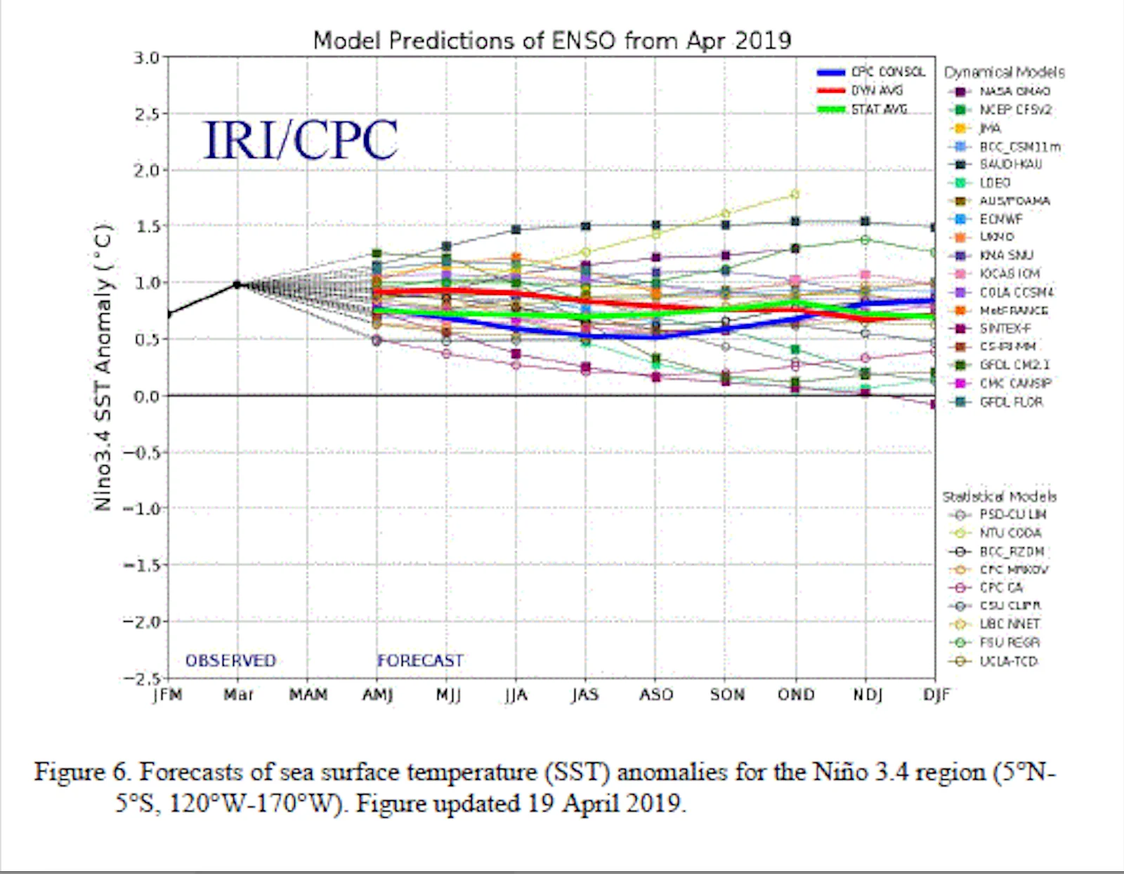
Graphic: 2019 El Niño forecast (Courtesy: NOAA)
The stronger storms (up to six forecasted for the 2019 season) normally form later in the season, in August, September or October, when water temperatures in the region tend to be higher. This is the time of year when the chances of seeing a Category 3, 4 or 5 are the highest.
It is also normal to have a more active season when El Niño is present in the equatorial Pacific, although the timing and intensity of the positive anomaly also plays an important role on how much cyclogenesis amplification you get.
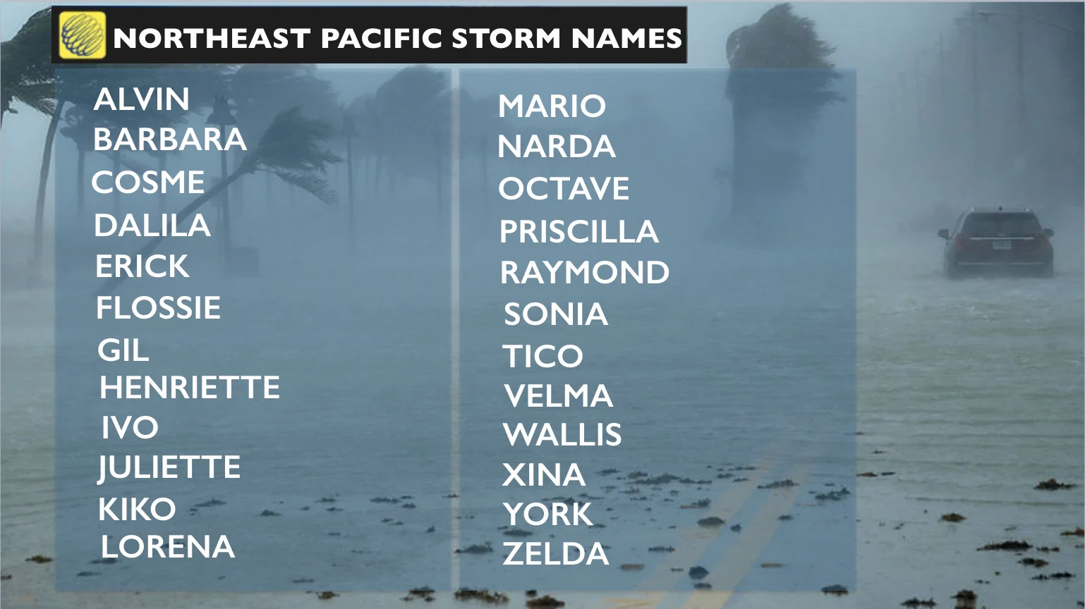
2019 East Pacific storm names
From Central America, up to Mexico and across to Hawaii, the chances of a storm impacting the coast this season will be high. In the case of Hawaii, the chances of seeing tropical storms or hurricanes moving near or across the islands can start as early as July and extend into October.