Hard-hitting winter storm wallops the East Coast with copious impacts

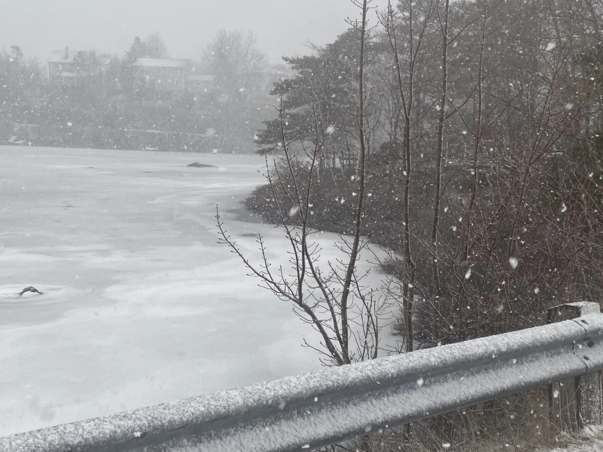
Another potent winter storm is trekking through Atlantic Canada, bringing with it heavy, wet snow, high snowfall rates and strong winds. These elements are likely to impact travel and contribute to power outages in some of the hardest-hit areas.
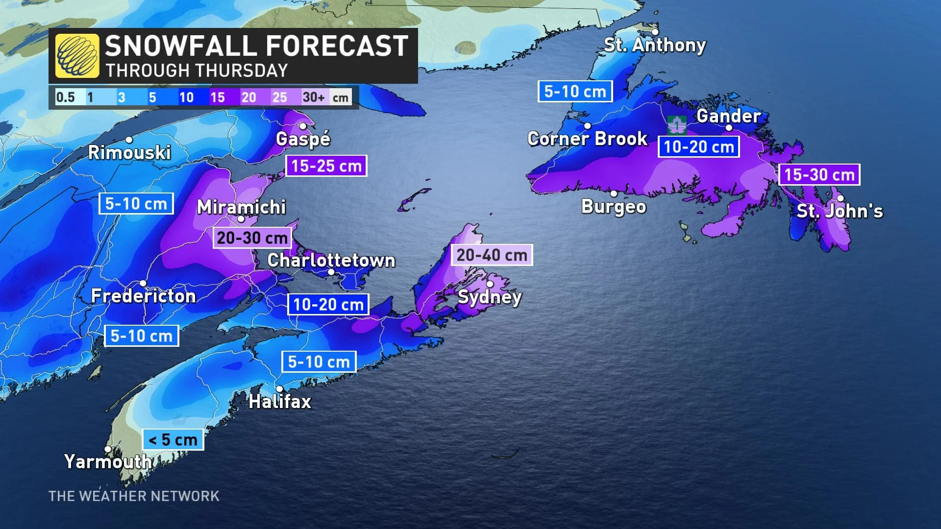
Snowfall and winter storm warnings, along with special weather statements, are widespread. Snowfall totals of 20-40+ cm are possible for some local areas of the Maritimes, with 15-30 cm potentially for parts of southern Newfoundland.
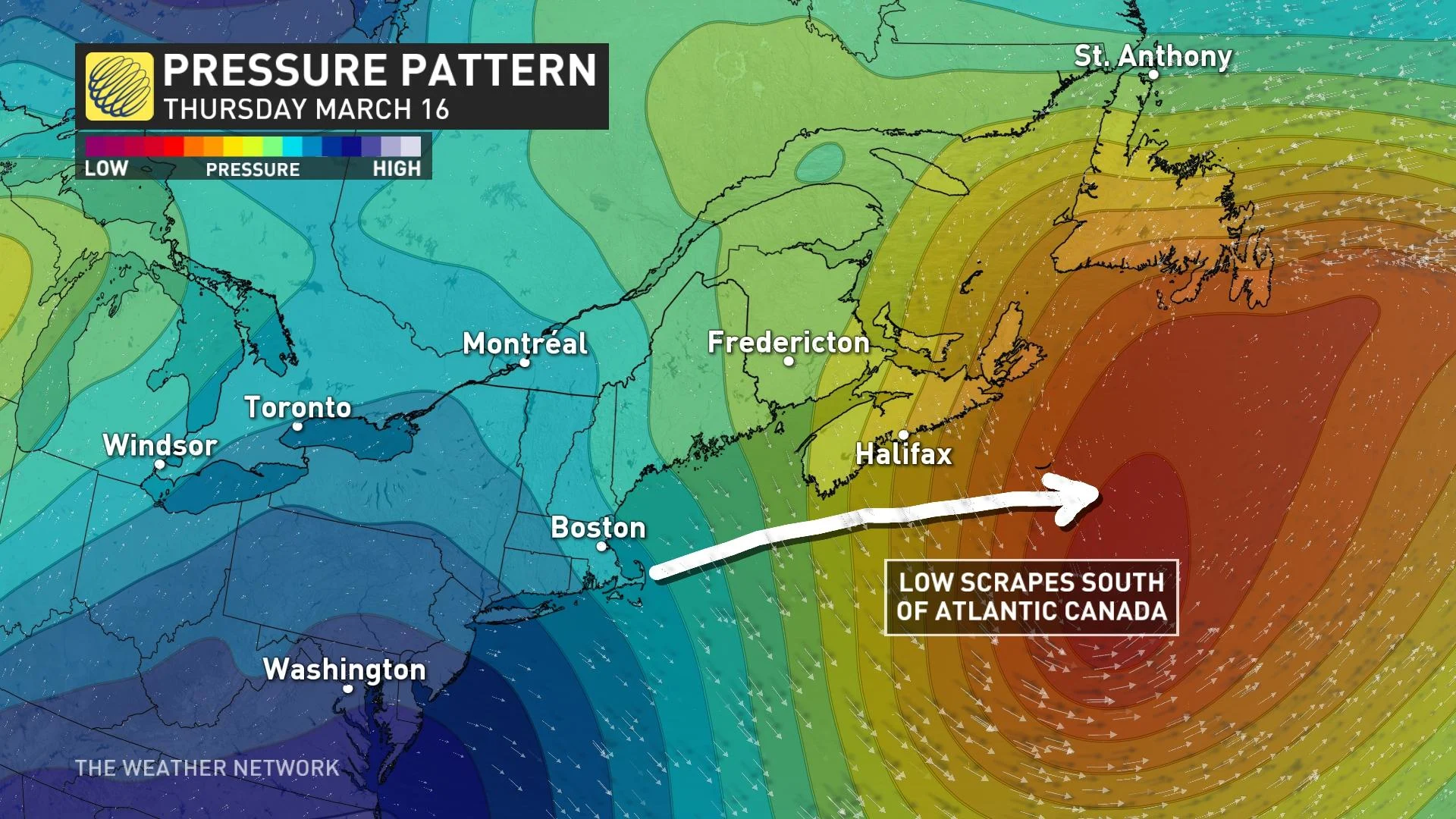
This forecast is tricky, however, as temperatures will oscillate above and below the freezing mark during this storm event, contributing to a messy mix of precipitation of rain, ice and snow.
Visit our Complete Guide to Spring 2023 for an in-depth look at the Spring Forecast, tips to plan for it and much more!
Snow will continue to spread northward and eastward across the Maritimes Tuesday overnight, reaching Newfoundland late Wednesday.
Thousands are already without power in Nova Scotia, according to the provincial agency. The numbers may fluctuate throughout the storm.
Snowfall rates will intensify overnight into the pre-dawn hours on Wednesday, with rates of 2-3 cm an hour for parts of New Brunswick and P.E.I. Snow will transition to a wet mix and then straight rain through Wednesday for much of Nova Scotia, excluding Cape Breton, where heavy snow is forecast to persist.
Heavy snow will target eastern Newfoundland Thursday and linger into Friday.
MUST SEE: Science behind the weather: The infamous nor'easter
Charlottetown, P.E.I., Moncton, N.B., and Sydney, N.S., look to be in the bull’s-eye of the heaviest snow. Cape Breton Island could see as much as 40 cm of snow, with 20-30 cm possible for eastern New Brunswick and 10-20 cm for parts of P.E.I.
Lower snowfall amounts are expected for mainland Nova Scotia and the Bay of Fundy shores as rain or mixed precipitation is expected to fall when temperatures rise.
The heavy, wet snow will make for accumulations that will stick to tree branches and power lines, which could contribute to further power outages. Travel issues are likely, as well, with the high snowfall rates and gusty northeast winds.
Higher-than-normal waters levels and pounding surf will also affect the Atlantic coast during high tides Tuesday overnight and near midday on Wednesday.
WATCH: Maritimers brace for a nor'easter: Who will see the worst of the storm
Fair conditions and slightly cooler than seasonal temperatures are expected for the first half of next week. The next system to watch will be during the second half of next week, with the potential for a more active pattern during the final week of March.
Keep checking back to The Weather Network for more forecast information and updates for Atlantic Canada.


