Science behind the weather: The infamous nor'easter

What, exactly, is a "nor'easter"?
Anyone living in Atlantic Canada or the U.S. Northeast certainly knows the term nor'easter and perhaps cringes at hearing it in their weather forecast. What exactly is a nor'easter, how does it differ from a tropical storm or hurricane, and what gives these storms their strength?
A nor'easter is one specific type of storm that impacts the northeast coast of the United States and Atlantic Canada, typically between September and April. For their wind speeds and the amount of precipitation they can deliver, they can rival even the most powerful hurricane. In fact, they take their name from the strong, persistent northeast winds that blow onshore during the storm.
Rather than having the swirling vortex shape of a tropical cyclone, however, they have the distinctive 'comma' look of an extratropical storm.
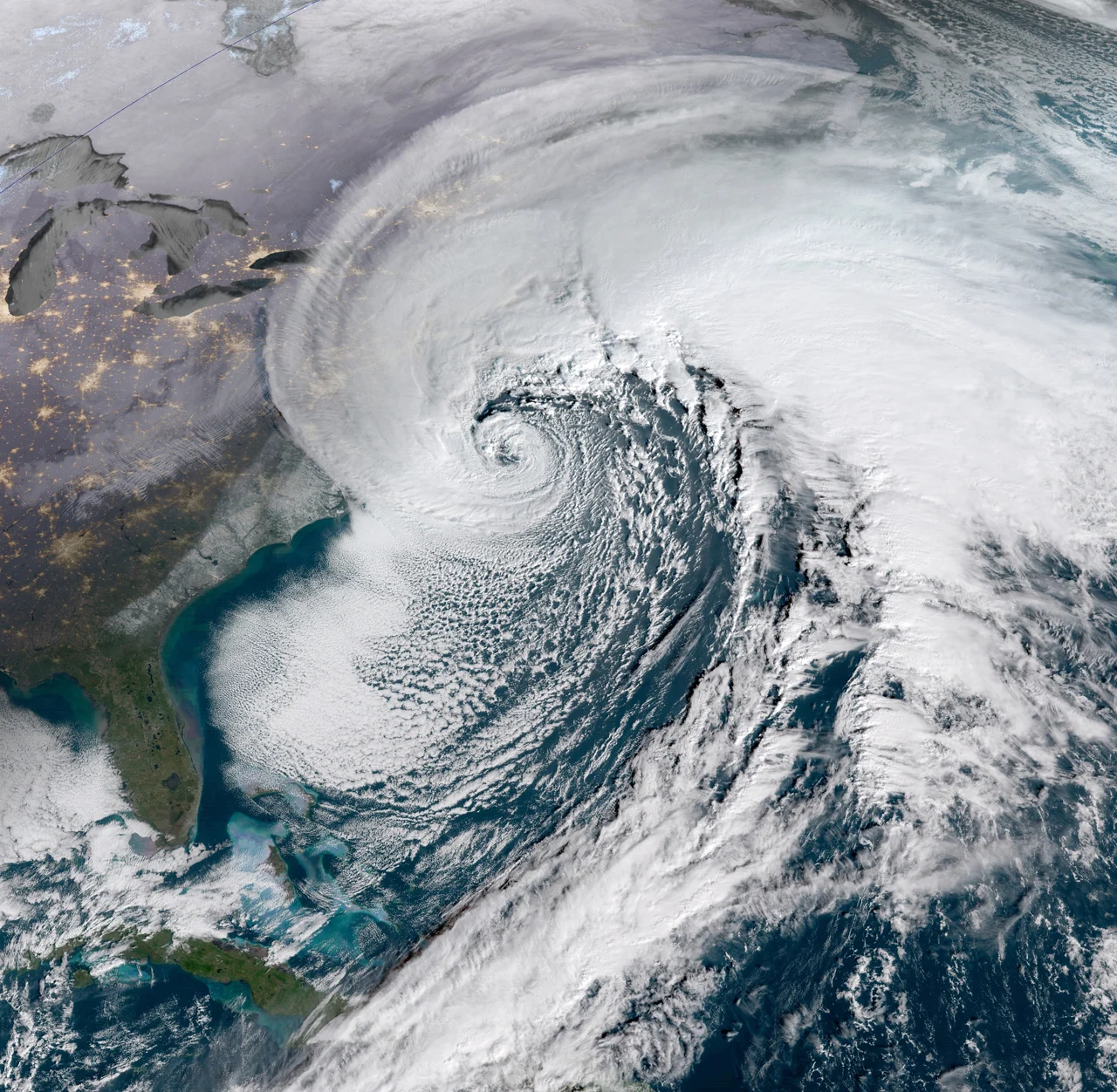
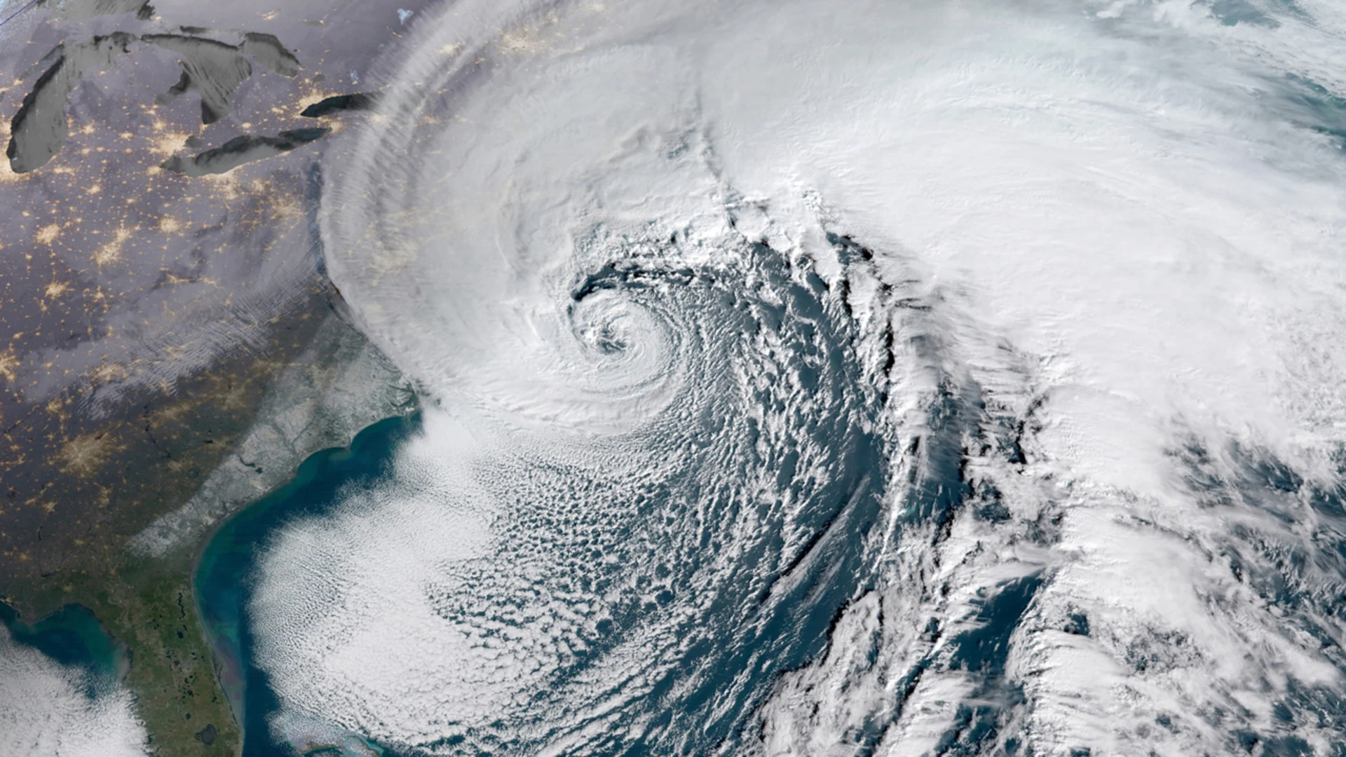
This nor'easter, imaged by the GOES-16 satellite on January 4, 2018, produced a powerful blizzard throughout Atlantic Canada and the U.S. Northeast. Credit: NOAA
RELATED: How Colorado lows and Texas lows affect our weather in Canada
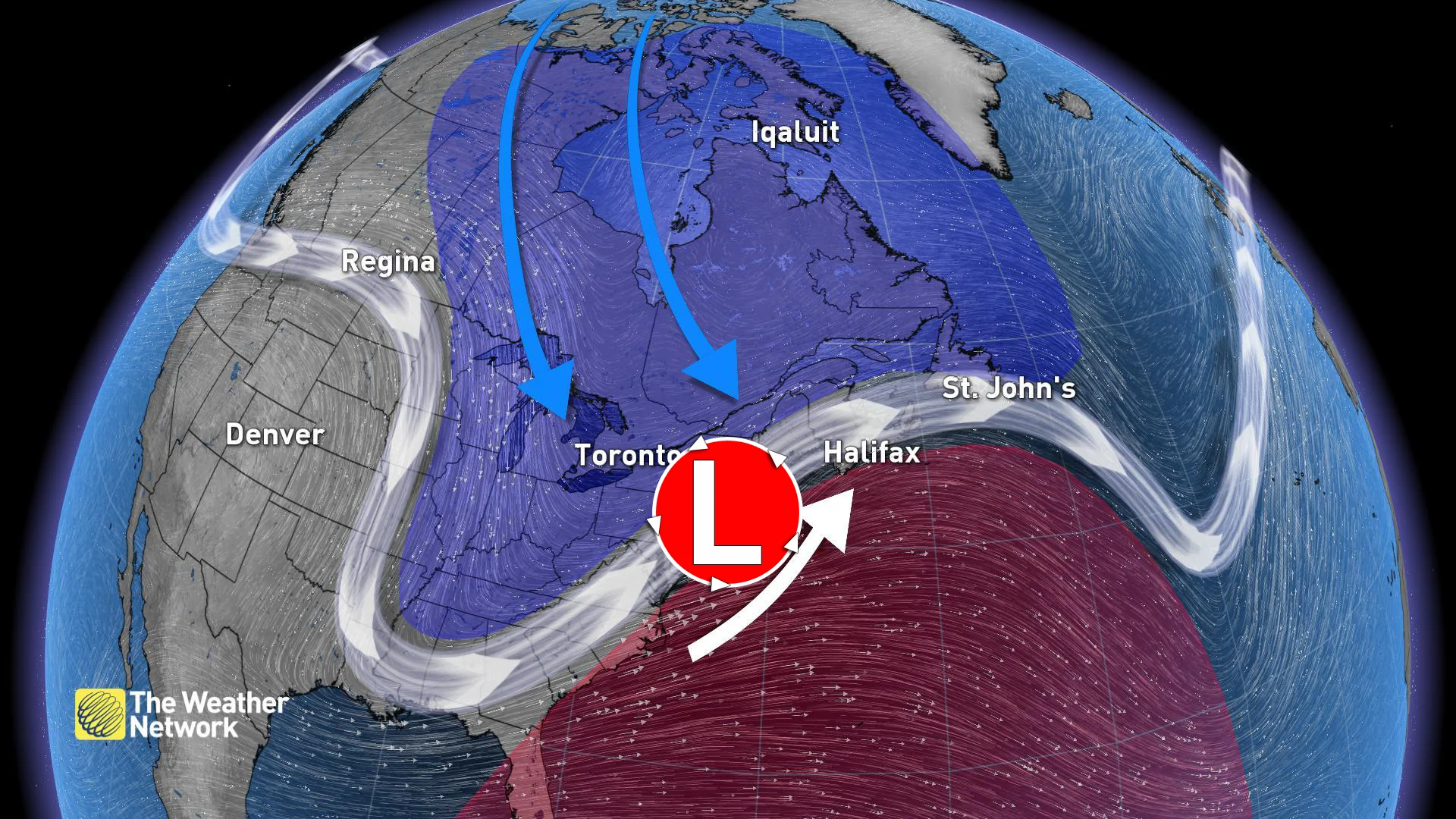
While of comparable strength to a tropical storm or hurricane, a nor'easter can be considerably larger.
As shown in the GOES-16 satellite image above, the nor'easter that caused the blizzard of January 2018 was immense — with the outer bands of its cloud deck grazing Newfoundland and Labrador in the north, and the full extent of its snowfall reaching all the way to south Georgia. While a hurricane can certainly produce impacts along that same stretch of the continent, it could not affect the entire area at once.
Nor'easters also differ from tropical cyclones in two key ways: how they form and where they get their energy.
Atlantic tropical cyclones form over the ocean due to a combination of warm, dry waves of air flowing from western Africa and warm, humid air rising from tropical ocean waters.
These cyclones thrive on the heat and moisture rising from warm water, which is drawn up into the vortex surrounding the storm's eye, fueling powerful winds and contributing to heavy rains. The air that reaches the top of the vortex — now significantly depleted of both heat and moisture — is then drawn back down through the centre of the eye. There, it warms, gathers more humidity and then cycles back into the storm clouds surrounding the eye. With the storm's core consistently warmer than its surroundings, these are called 'warm-core' systems.
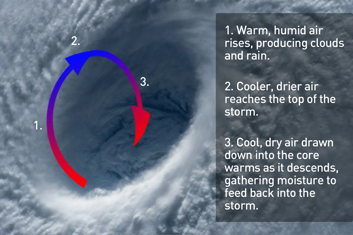
This image of the eye of SuperTyphoon Maysak, taken by NASA astronaut Terry Virts from the International Space Station in April of 2015, highlights the 'warm-core' of is tropical cyclone. Credit: NASA/Scott Sutherland
SEE ALSO: 'Weather bombs' - Explosive storms that create ferocious conditions
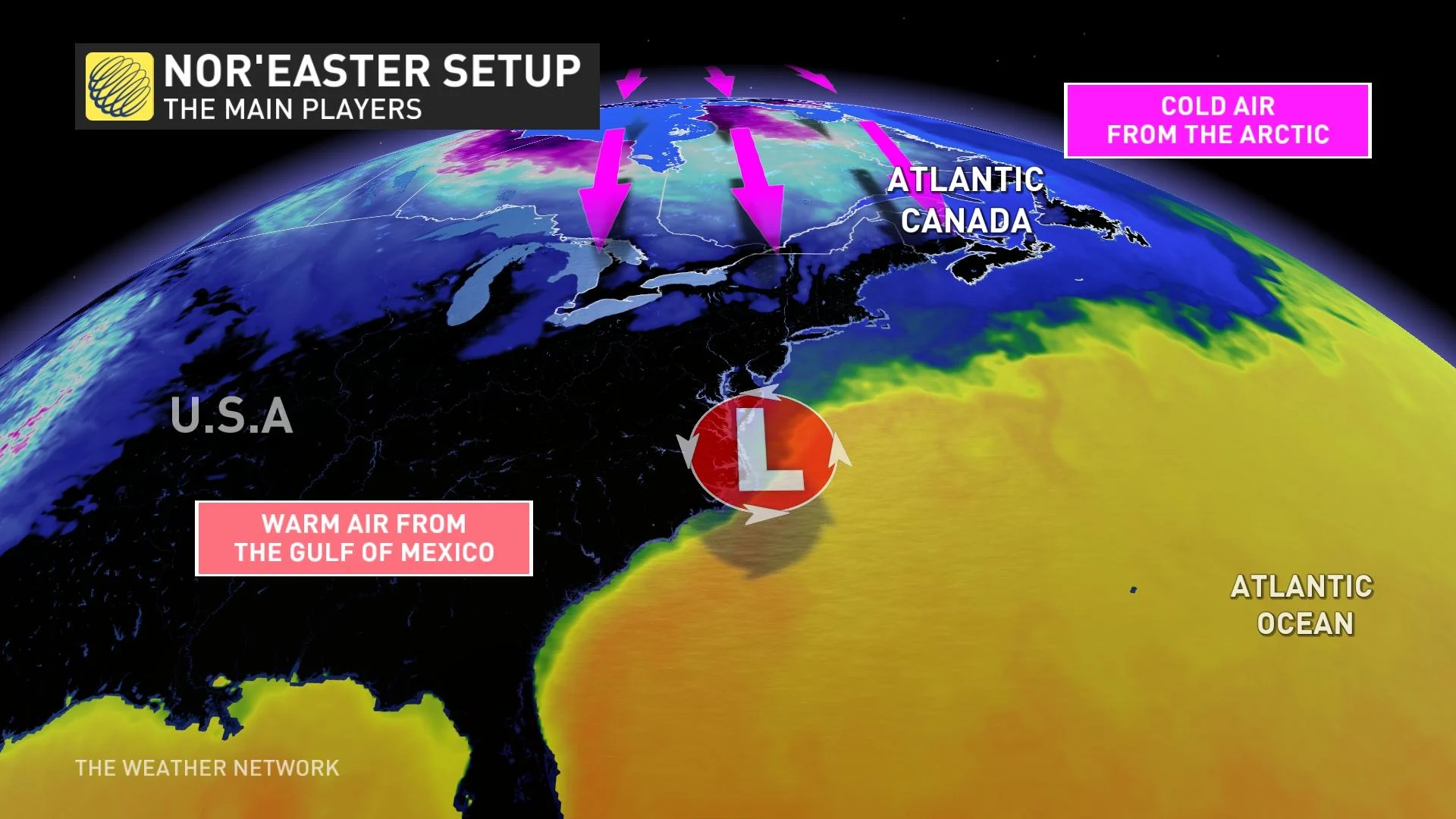
By contrast, nor'easters are born out of the coupling of cold and warm air masses.
When a deep dip in the polar jet stream pulls cold, dry air down across the eastern half of Canada, this cold air crashes up against warm, humid air along the Atlantic coast.
Watch below: The flow of the Polar Jet Stream extends into deep loops in this NASA animation
The mixing of cold and warm air masses is always volatile. This is how most large-scale weather systems over land get their start. A nor'easter, however, is given an added boost from two different sources.
The first comes from the warm current of water off the Atlantic coast, known as the Gulf Stream. As air flows up the coast from the south, it passes right over Gulf Stream, where it picks up more heat and humidity. Just as we see in a tropical cyclone, this extra heat and humidity adds more energy and potential precipitation to the storm.
The second comes from a strong vortex of frigid air situated at the top of the storm. Spinning due to the rapid flow of air in the jet stream, this vortex sets up a strong 'pressure gradient' with the surface below. Basically, it pulls air up from the surface very rapidly, which ramps up the storm's wind speeds. Also, the rapid rise causes the warm, humid surface air the vortex is tapping into to rapidly cool. This results in it quickly dumping its water vapour into clouds and precipitation.
With the cold pool of air aloft and the lowest pressures high above the storm, the storm's structure gives this kind of system the name 'cold-core' low. It's this 'cold core' that drives the storm, powering its persistent winds and heavy precipitation.
When a nor'easter forms in warmer weather, its impacts can be nearly indistinguishable from those of a tropical cyclone. Both types of storm can deliver lashing winds, heavy rain, storm surge, and flooding to regions of northeastern North America.
In the colder months of the year, however, nor'easters are quite distinctive. They turn into nasty snowstorms and blizzards, dumping metres of snow on some regions before their cold-core migrates out to sea, carrying its effects along with it.