
30+cm of snow or 30+mm of rain? Ontario gets taste of winter and spring

A robust low-pressure system will swirl over the Great Lakes region this week, bringing a classic spring setup that will see heavy snow in the north and rain, along with mild temperatures, in the south.
The tale of two seasons will be firmly planted in Ontario this week, with wintry weather in northern sections while southern areas get a fling with milder spring temperatures and rainfall. A classic spring storm may bring 30+ cm of snow and 30+ mm of rain through Friday, depending on where you are situated. Regardless of which abundance of precipitation you receive, travel will be impacted in the hardest-hit areas. More on what to expect with the spring storm, and what lies beyond it, below.
DON'T MISS: Deprived of warmth: Patience will pay off for Canadians in the cold
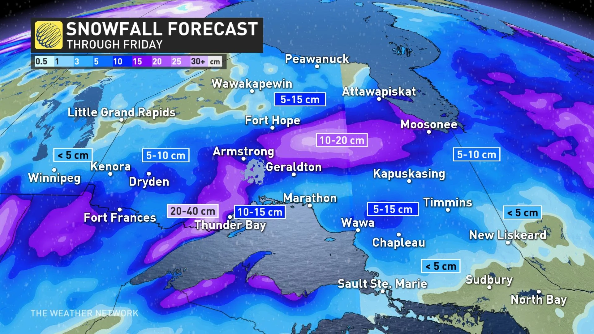
HEAVY SNOW TO HAMPER TRAVEL IN NORTHERN ONTARIO
A low-pressure system will push across northwestern Ontario, with effects starting Tuesday overnight and lasting through Thursday morning across the region. Snow, which could be heavy at times, is expected. Special weather statements and snowfall warnings are in place.
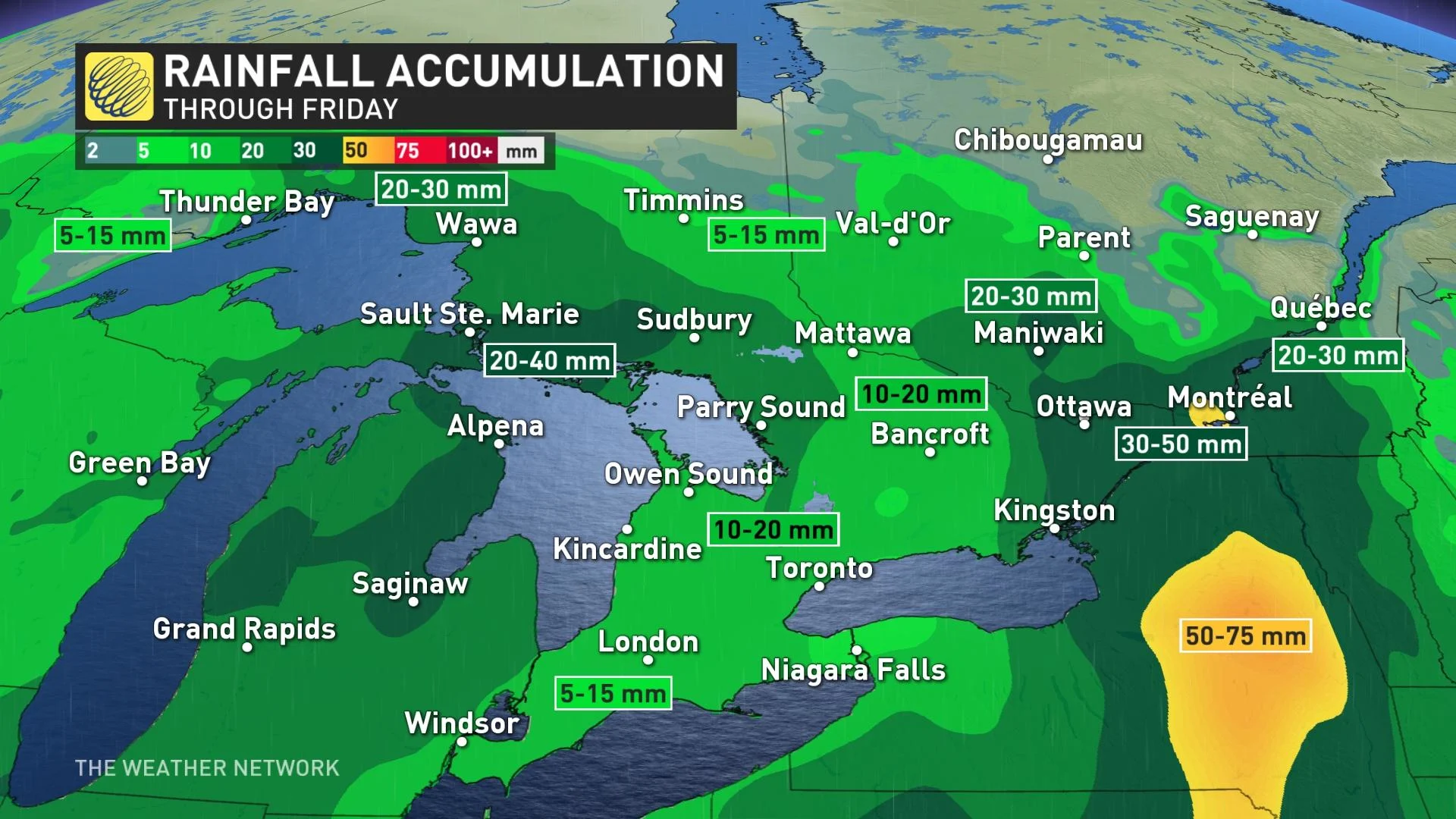
Temperatures are expected to be near the freezing mark in some areas, which may allow rain to mix in with the snow at times. Areas east of Lake Superior, including the Nickel Belt, will see heavy rain due to milder temperatures, with 20-40 mm possible through Friday.
The deep snowpack in the Nickel Belt region should absorb much of the rainfall, but, when combined with the frozen ground, could lead to ponding and localized flooding issues for some areas.
Hazardous travel due to possible rapidly accumulating snow. If rain mixes in with the snow it could lead to very slippery road conditions. Motorists are advised to exercise caution.
Communities along the western shores of Lake Superior stand to see the heaviest snowfall totals, with 20-40 cm possible through Thursday. Thunder Bay will just barely miss the heaviest accumulations, with 10-15 cm expected. Elsewhere, totals of 5-15 cm will make for slow travel along the Trans-Canada Highway.
RAIN FOR SOUTH AND EAST, GREETED BY MILDER TEMPERATURES
Folks across southern Ontario will enjoy milder temperatures with this system, but also some rain, which will push in by late Wednesday afternoon or early evening. lasting into Thursday morning before subsiding. Rain will reach eastern Ontario on Wednesday night, where it’ll continue through Thursday afternoon.
Widespread rainfall totals of 10-20 mm are likely across southern Ontario, with higher totals in eastern sections of the province where rain will persist longer into Thursday. Ottawa and surrounding communities could see 40-50 mm of rain through Thursday.
The system’s southerly flow will allow daytime highs to nudge into the teens for most of southern and eastern Ontario through the end of the week. Ottawa could reach 14°C on Wednesday, and Toronto’s forecast high for Thursday reaches a balmy 13°C, which is a few degrees above seasonal for the date.
LOOKING AHEAD: WARMER WEATHER ARRIVES NEXT WEEK
Partly sunny will greet the southern sections this weekend, with a risk for showers. Chillier conditions are expected across the Greater Toronto Area (GTA) on Saturday, then becoming seasonal on Sunday.
Spring’s quintessential temperature roller-coaster will climb to the top of the hill next week as a ridge of high pressure looks to build over the eastern half of Canada. We’re likely to see a streak of above-seasonal high temperatures early next week.
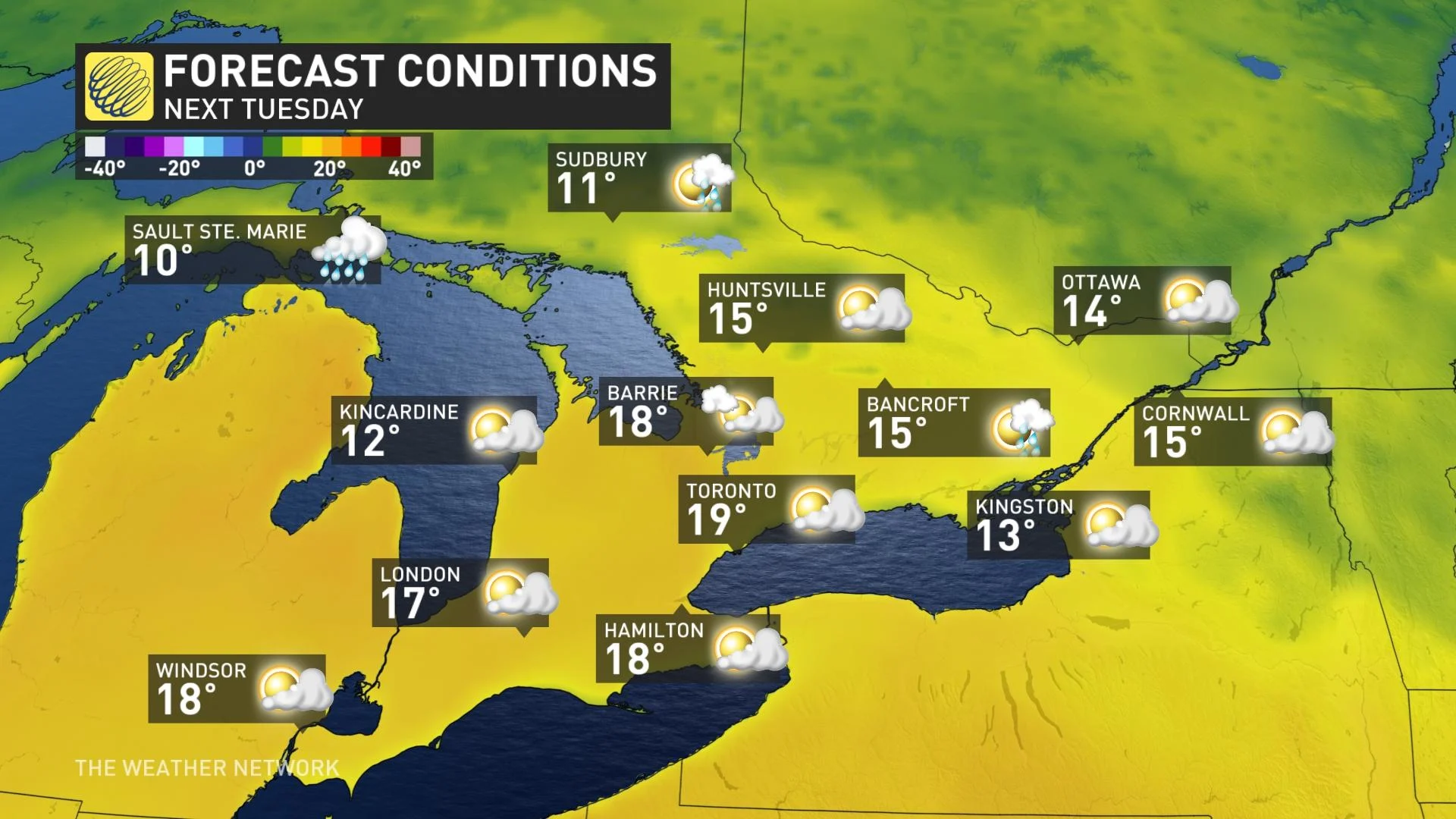
Temperatures will easily push into the upper teens for many locations in southern Ontario, with the potential for highs in the 20s in spots. Cool water temperatures will keep temperatures down for folks near the lakes, while an approaching system could also factor into how warm things ultimately get.
Don’t get too attached, however -- the roller-coaster will slide down the hill once again, and forecasters expect a cooler pattern to prevail for the second half of April.
Stay tuned to The Weather Network for your latest forecast across Ontario.