Humidity returns in Ontario causing storm risk

Humidity builds back up Wednesday causing storm risks. The week continues with the return of uncomfortable heat and humidity.
The cold front that triggered Sunday's round of severe storms (which produced four tornadoes) did bring temperatures down to more comfortable levels on Tuesday. We're back at it Wednesday, high humidity with a new inbound system bringing more storm risk to southern Ontario. Beyond that, the heat and humidity build back in once again for the province. A better look at impacts and timing, below.
Visit our Complete Guide to Summer 2020 for an in-depth look at the Summer Forecast, tips to plan for it and much more
WEATHER HIGHLIGHTS:
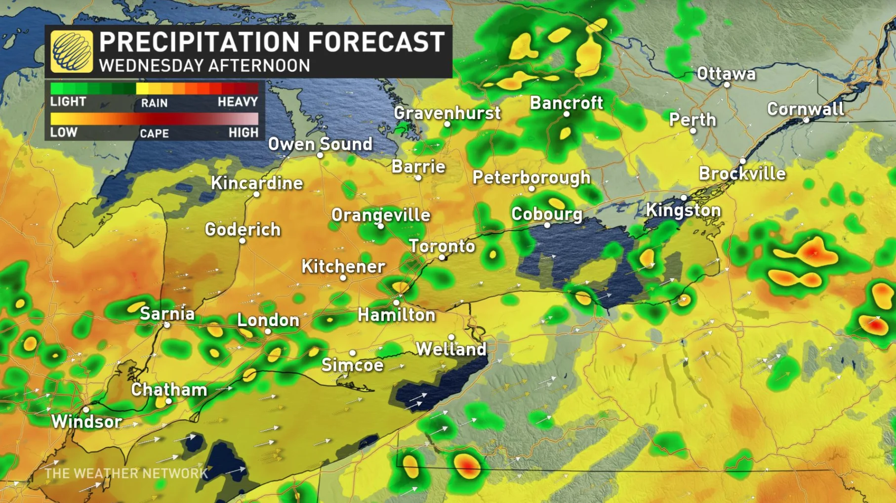
System brings showers and storm risk throughout Wednesday
Areas with highest risks for storms include London through Windsor
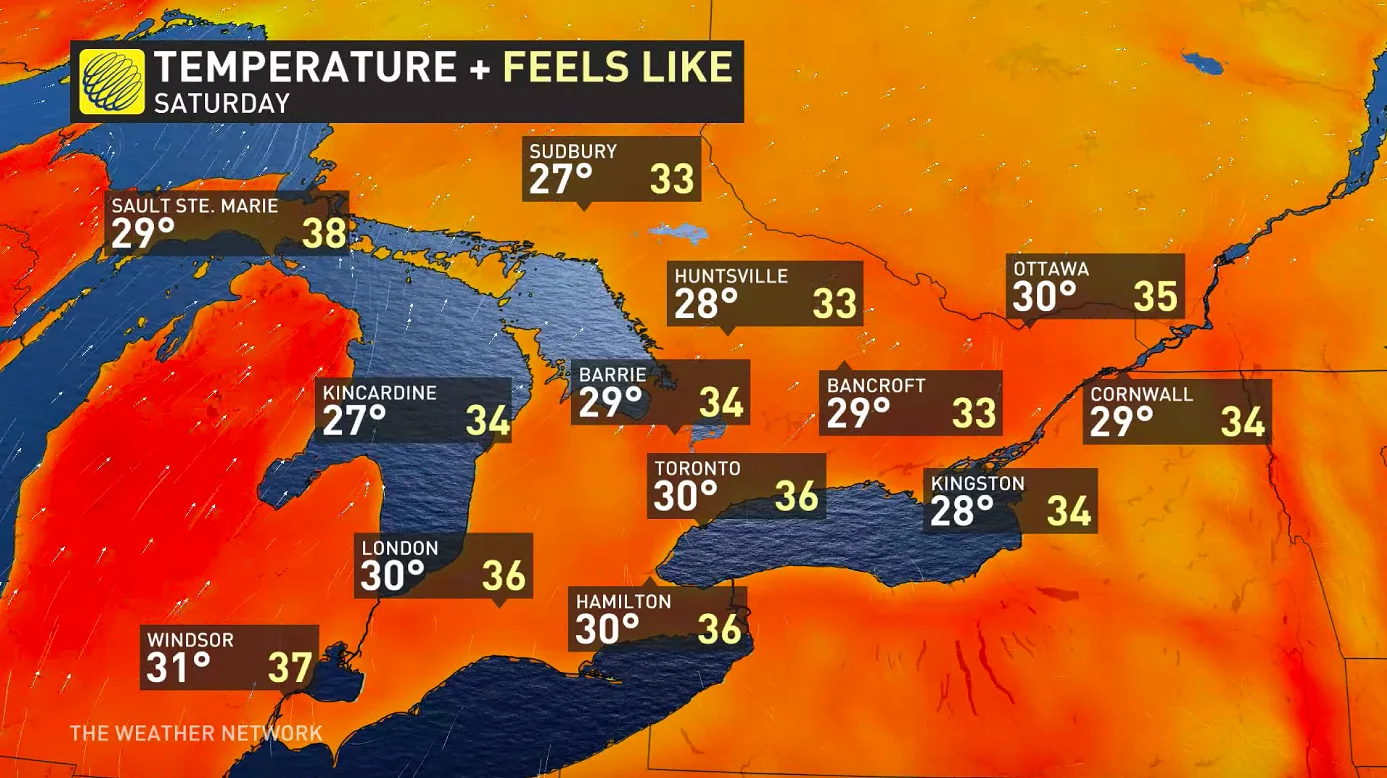
Temperatures rise to uncomfortable levels once again by the weekend
Keep an eye on weather ALERTS in your area
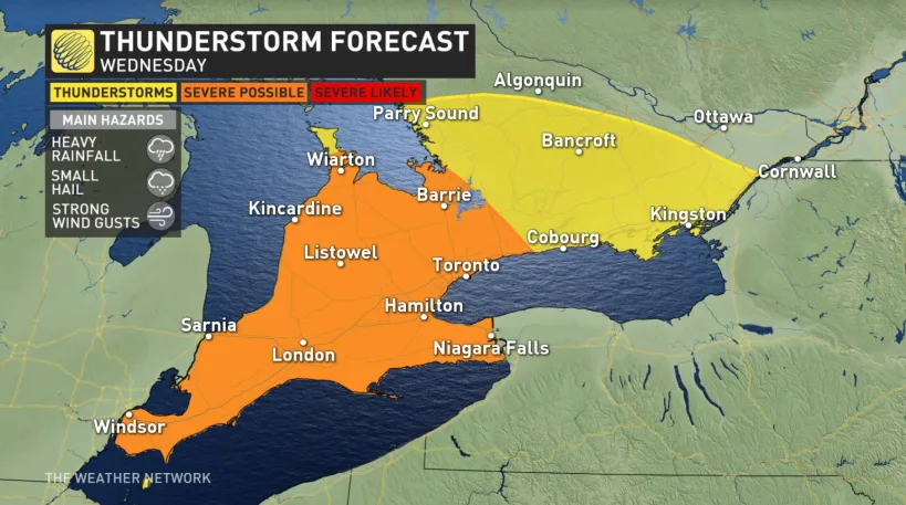
WEDNESDAY: SEVERE POTENTIAL FOR THE SOUTHWEST
There's a system lingering from Tuesday overnight that brings storms into Wednesday morning.
The bigger risk for thunderstorms comes in the afternoon, however, as the system's cold front is set to slice through, with the biggest risks being strong winds and heavy local downpours. The threat of storm increases in Ontario as you move southwest.

People will experience this system's effects somewhat differently depending on location, with some people seeing this second round so close on the heels of the morning showers as to not see much of a break. Others will see off-and-on effects, and forecasters say the area from Barrie to the GTA is most likely to experience it as two distinct morning and afternoon rounds, with a good break in between.
BEYOND: SCATTERED STORM RISK, HEAT BUILDS BACK IN
That passing cold front won't leave a long-lived cooldown in its wake. As an area of high pressure moves off from the province, it will clear the way for a surge of heat from the south, sending Ontario back into hotter conditions.
We do see a chance for isolated pop-up showers on Thursday, though Friday looks clear, and all the while daytime highs will surge closer to 30°C, keeping slightly above or slightly below it for the next few days.
By the weekend, the building humidity will make it feel like the mid-30s across the province, a little higher in the southwest.
A peek ahead reveals not much in the way of relief from the heat, with temperatures staying at or a little below 30°C into at least early next week.
Check back as we continue to monitor the forecast.