7th Ontario tornado confirmed after damaging Sunday outbreak

Sunday's severe storms caused widespread damage to structures and trees, with seven confirmed tornadoes so far.
Sunday's long line of severe thunderstorms produced at least seven confirmed tornadoes in southern Ontario.
On Wednesday, investigators at the Western University-based Northern Tornadoes Project (NTP) confirmed a sixth and seventh twister from the storms, in what NTP called an outbreak. The Sunday total includes 6 tornadoes and one waterspout.
The sixth tornado was rated EF-1, occurring in the Blythe area with maximum wind speeds of 135 km/h and a preliminary track length of 6.7 km. There was also an EF-0 downburst in the Brussels/Cranbrook area.
The team also verified an EF-1 tornado in the Lambton Shores area, east-northeast of Sarnia. It had maximum wind speeds of 155 km/h and a preliminary track length of 15.4 km.
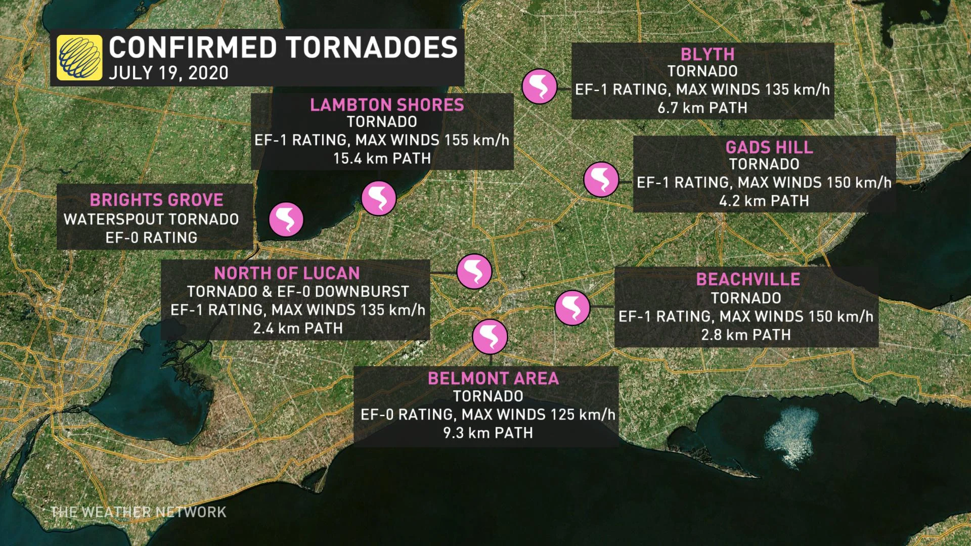
On Tuesday night, the team confirmed a fifth tornado occurred, causing EF-1 damage at Gads Hill. It had maximum wind speeds of 150 km/h with a preliminary track length of 4.2 km. It resulted in damage to a farm and trees.
Sunday's tornadoes were spawned from an intense line of storms that rocketed through southwestern Ontario toward the GTA's western edge late morning and early afternoon.
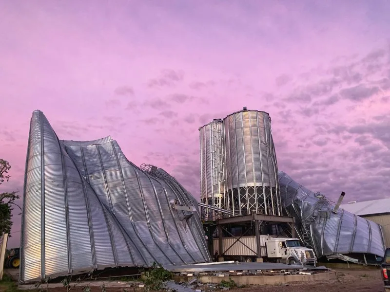
Regarding the other twisters, investigators say an EF-1 tornado struck north of Lucan, with a preliminary track length of 2.4 km and maximum winds of 135 km/h. Several farm structures in the area were badly damaged, as were some trees.
Farm damage near Lucan, Ont. Photo: Mark Robinson
A downburst was also reported near the site, with EF-0-equivalent wind strength.
Elsewhere, damage to roof shingles and trees in the Belmont area also suggested a tornado was present. That twister was given a rating of EF-0, with a preliminary track length of 9.3 km and maximum wind gusts of 125 km/h.
Another EF-1 tornado spun through Beachville, a town near Woodstock. The EF-1 rating was given due to the tree damage caused by the heavy winds. The wind speeds were clocked at a max of 150 km/h. The track length is estimated to have been 2.8 km, with the tornado's width pegged at 100 metres.
A waterspout was also spotted on Lake Huron, just offshore of Brights Grove, a town north of Sarnia. There is no evidence it came ashore, and no reported damages, thus given an EF-0 ranking.
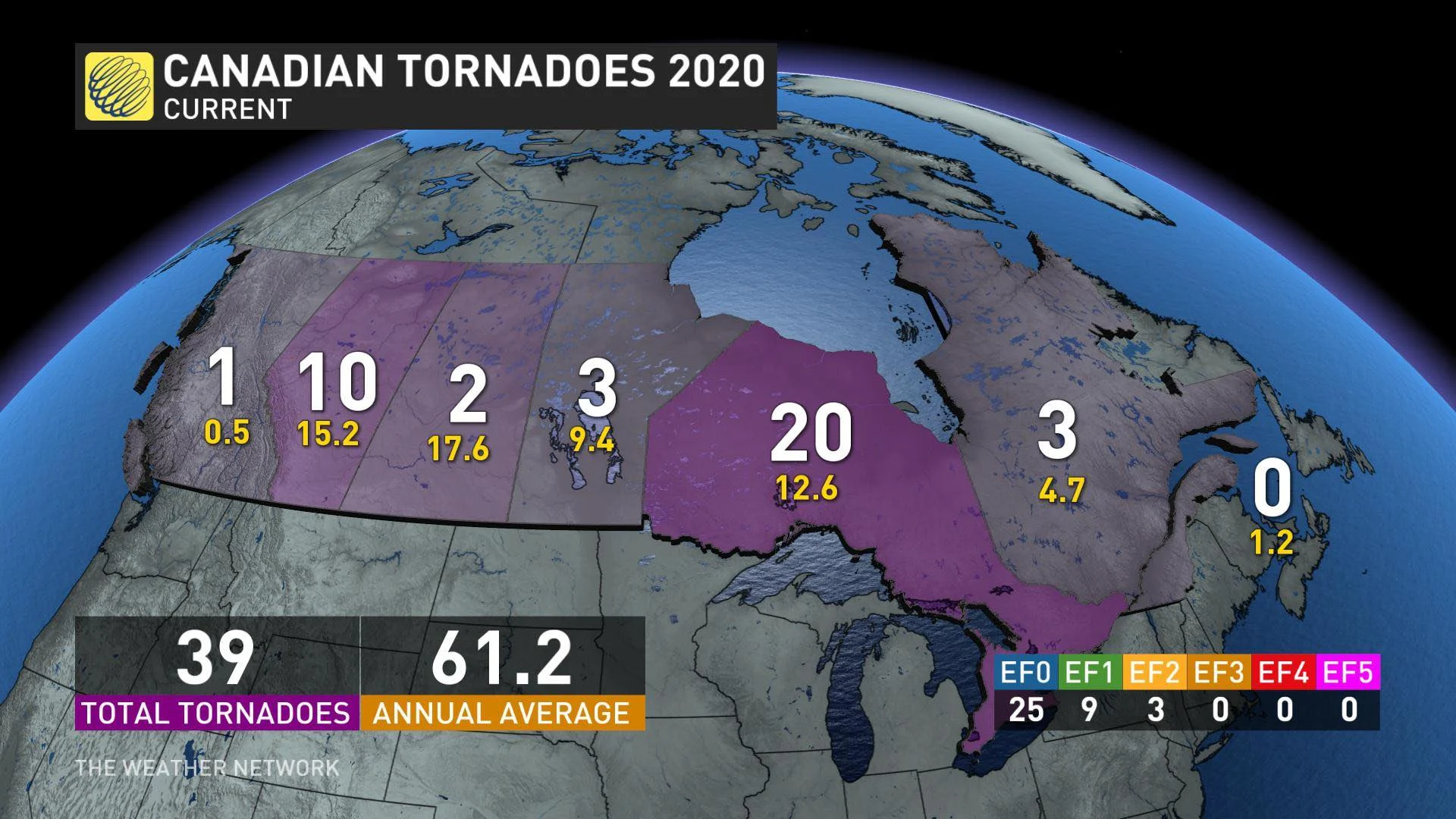
Ontario's confirmed tornado count is now at 18, above the 12-13 annual average. Seven of those twisters came from the June 10 outbreak.
The storms that produced these tornadoes were fuelled by the intense humidity of the past weekend coming into contact with a passing cold front beginning late Sunday morning. Tornado warnings followed these storms for around two hours, reaching into the western GTA at one point before ending.
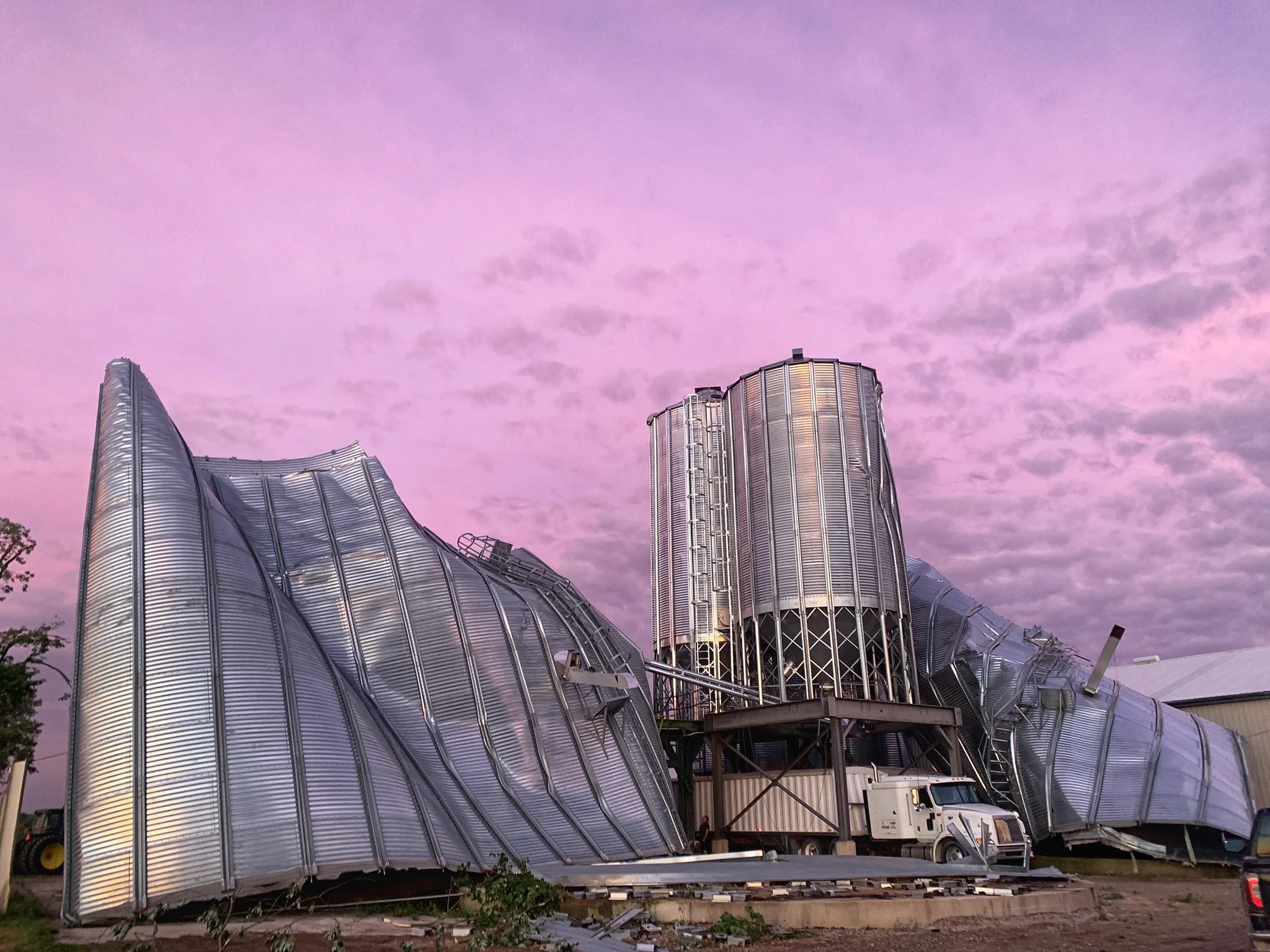
Even in areas that weren't tornado-warned, severe thunderstorms caused major damage to homes, farms and other structures, as well as trees and hydro poles, causing tens of thousands of power outages.
Below is a look at some of the damage from the storms.
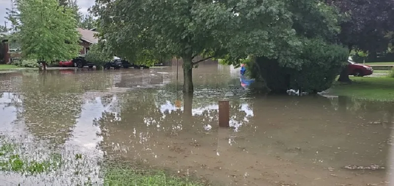
Flash flooding in Lakeshore, Ont. Photo: Nicole Trealout.