Marathon snow finally eases in Ontario, but Arctic air complicates clean-up

Some lingering travel troubles expected across southern Ontario on Friday as the marathon snow finally eases and Arctic air settles in once again.
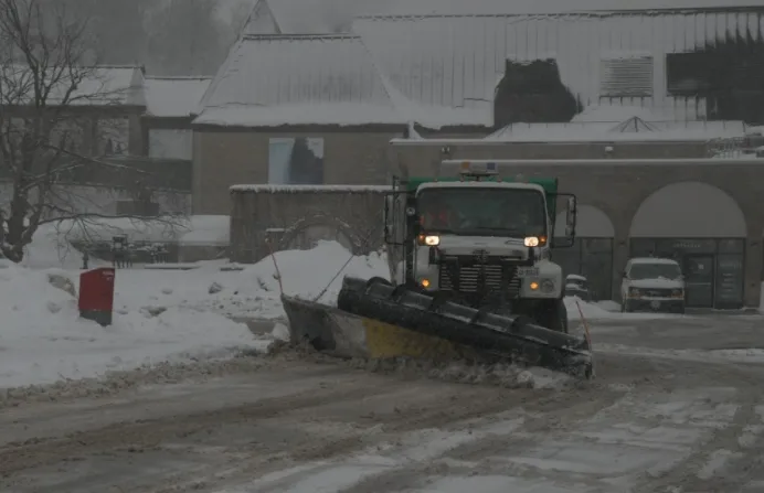
It's been quite the winter's marathon this week as a prolonged period of snowfall has brought some significant accumulations and difficult travel across much of southern Ontario. While the heaviest amounts took aim at the Hamilton and Niagara regions, slick and icy travel has made a mess of the roads across much of the Greater Toronto Area as well. Some lingering snow will persist across Niagara and parts of eastern Ontario on Friday, with a surge of Arctic air now complicating clean-up efforts for most. More on what’s left to come with the snow, and a look at how long the frigid temperatures will last, below.
MUST SEE: February shows its hand early as pattern change repeats this month
FRIDAY INTO SATURDAY: LINGERING SNOW AND TRAVEL IMPACTS, ARCTIC AIR SETTLES IN
Much of southern Ontario woke up to yet another fresh layer of snow on Friday, as the second wave of moisture in this widespread and prolonged snow event picked up through the evening and overnight hours on Thursday.
Snow, blowing snow, freezing temperatures and slippery conditions all gave drivers another difficult night on the roads to contend with. OPP Sgt. Kerry Schmidt was advising motorists to just stay home if they could, with several reports of vehicles off the roads due to the ongoing troublesome conditions.
"The sanders, salters and snow plows are out, but it's all up to all of us as well to drive according to these conditions, and these conditions are not great," Schmidt said, adding that the highway on ramps and off ramps can be particularly dangerous for drivers.
WATCH BELOW: HIGHWAY RAMPS FREEZE FAST
The marathon of wintry weather will wrap up on Friday as the system pushes into Atlantic Canada, but some lingering snow will still persist across Niagara and parts of eastern Ontario. Winter storm warnings remained in effect for the region first thing Friday, with the threat for snowfall rates possibly reaching up to 2 cm per hour at times.
Reduced visibilities due to heavy snow could complicate travel once again along the QEW and 401 corridors.
Adding insult to injury following this week's snowy conditions will be another surge of Arctic air, which will bring cold temperatures and frigid windchills on Saturday.
Widespread daytime highs in the minus teens will feel even colder thanks to a breezy northwesterly flow. This could become challenging for additional snow removal, as 10-20+ cm of snow fell across the region this week.

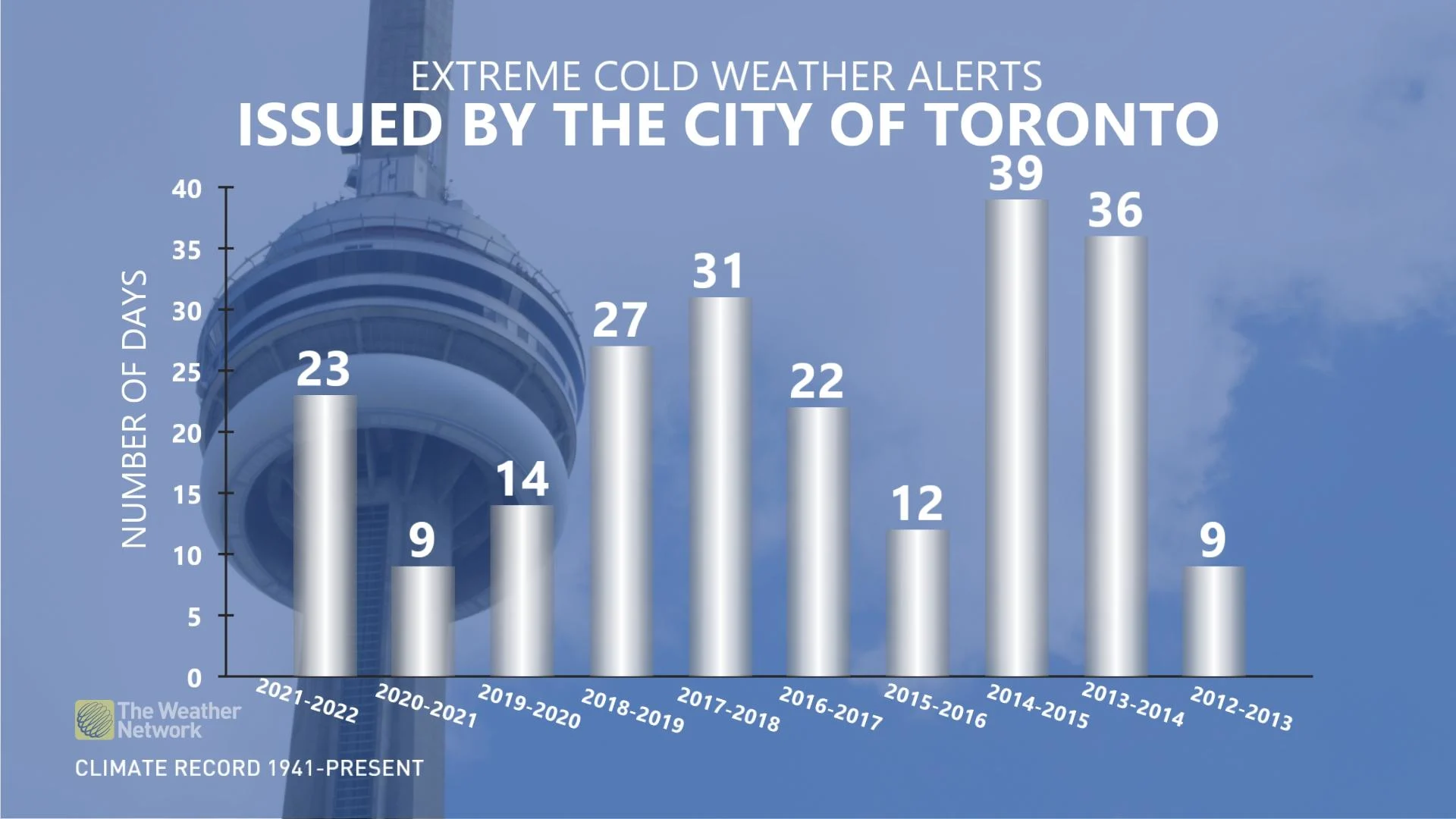
So far this season, the City of Toronto has issued 23 Extreme Cold Weather Alerts. That's when a temperature of -15° C or colder is forecast for Toronto, or a wind chill of -20. The alerts may also be issued when the forecast includes factors that increase the impact of cold weather on health.
In comparison to last year, just nine of these alerts were issued for the duration of the season.
LOOK AHEAD: BRIEF WARM-UP BEFORE COLDER AIR WINS OUT AGAIN
The frigid pattern will relax somewhat as we head into next week, as temperatures recover to near seasonal for a couple of days. However, it looks like the cold weather will win out once again, returning for the weekend and into the following week.
The pattern for the mid-February mark looks to be conducive for an active pattern, with plenty of winter weather still ahead through the month.
Stay tuned to The Weather Network and check back frequently for all the latest updates as we head into the beginning of February.