Manitoba faces extended recovery after wintry blast

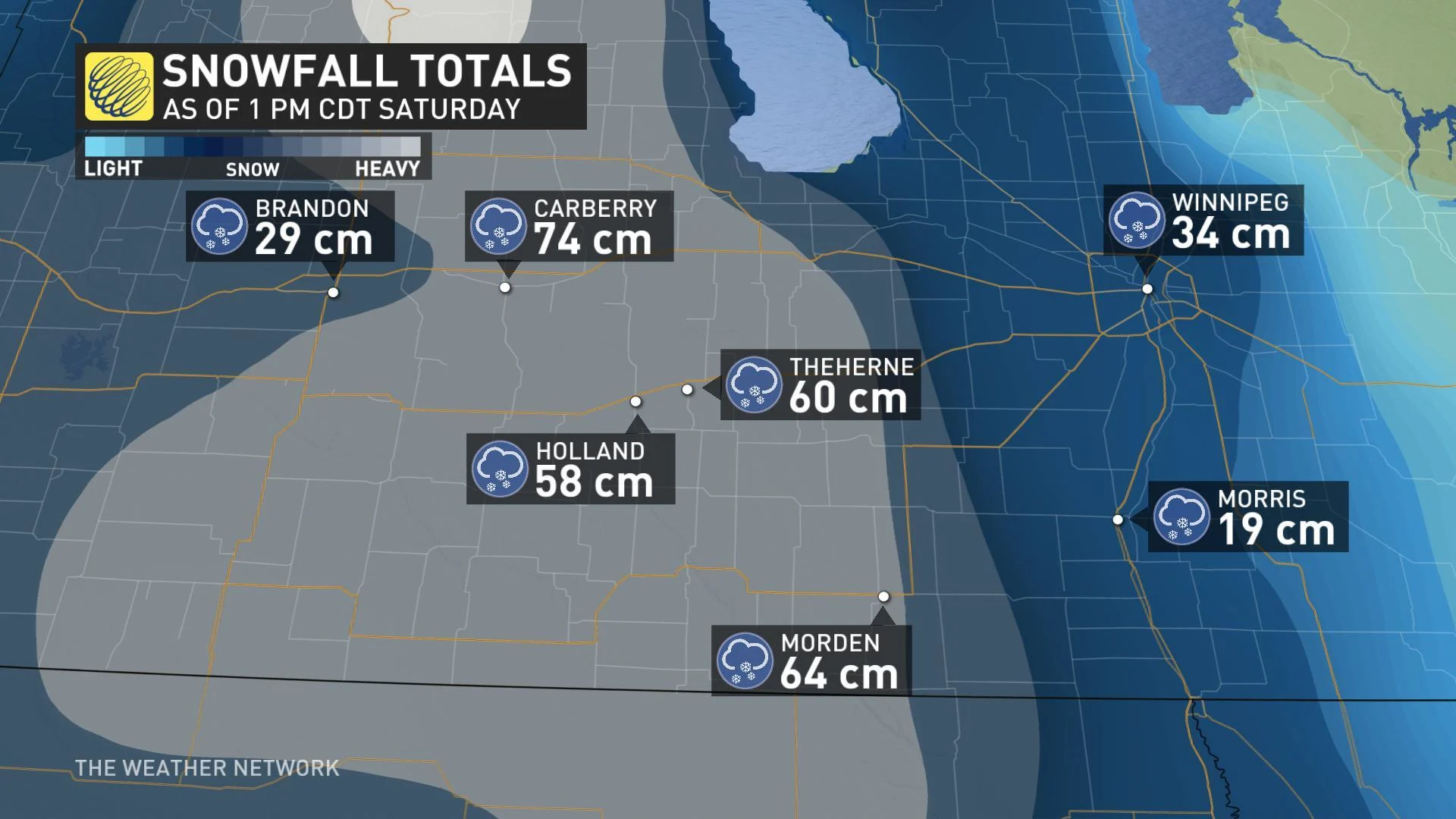
Manitoba premier Brian Pallister declared a state of emergency for the province late Saturday night in the wake of a powerful wintry blast that's left tens of thousands without power. As of early Sunday morning, nearly 40,000 customers are still in the dark, according to Manitoba Hydro. The storm, which blasted southern parts of the province with as much as 70 cm of wet snow, has caused extensive damage to power lines in some areas. While snow tapers off on Sunday, temperatures flirting with the freezing mark will make flooding a concern as the soggy snow begins to melt. We take a look at what to expect for the rest of the long weekend, below.
Visit our Complete Guide to Fall 2019 for an in-depth look at the Fall Forecast, tips to plan for it and a sneak peek at the winter ahead
WEATHER HIGHLIGHTS
Non-essential travel not advised across much of southern Manitoba
Some road closures still in effect, mainly south of Portage la Prairie and Brandon
Flurries will linger through Sunday, lake-effect snow possible Sunday night/Monday
Next shot of rain, snow expected on Tuesday
Stay up-to-date on the ALERTS in your area
WATCH BELOW: SNOWFALL TIMING ON SUNDAY
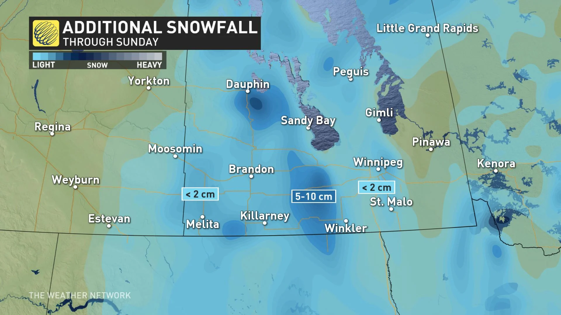
Widespread flurries will linger across much of southern Manitoba on Sunday, but it's a band of lake-effect snow off of Lake Manitoba that will add 5 to 10 cm of snow for some. That's on top of the 50 to 70 cm that fell between Friday and Saturday.
"Through Sunday and Monday, conditions will be much improved, with widely scattered wrap-around light rain/snow mix as the low continues to weaken into northwestern Ontario," says Weather Network meteorologist Nadine Hinds-Powell.
Temperatures in the low single digits for the early part of the week will contribute to the risk of flooding due to melting snow. Rivers in southern regions of the province have already been facing unusual fall flooding. Rising water levels from meltwater will further enhance the threat for localized flooding.
SEE ALSO: Major snowstorm blasts southern Manitoba
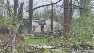
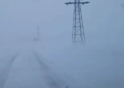
THOUSANDS WITHOUT POWER AS HEAVY, WET SNOW TAKES DOWN TREES AND POWERLINES
By early Sunday morning, Manitoba Hydro's website listed nearly 38,000 customers without power, down from a record-breaking 100,000 reported on Friday afternoon. The utility reported roughly 14,000 outages in Winnipeg alone at the peak of the storm.
"If you see a damaged or fallen power line, stay away and call 911," Manitoba Hydro tweeted on Thursday. "Treat all lines as energized. Stay away from them or anything they touch."
Stay tuned to The Weather Network online, on TV and social media for the latest updates on the storm.