
Catastrophic Hurricane Ian continues lashing Florida into Thursday

Hurricane Ian, one of the most powerful hurricanes ever recorded on landfall in the United States, will continue lashing Florida through Thursday.
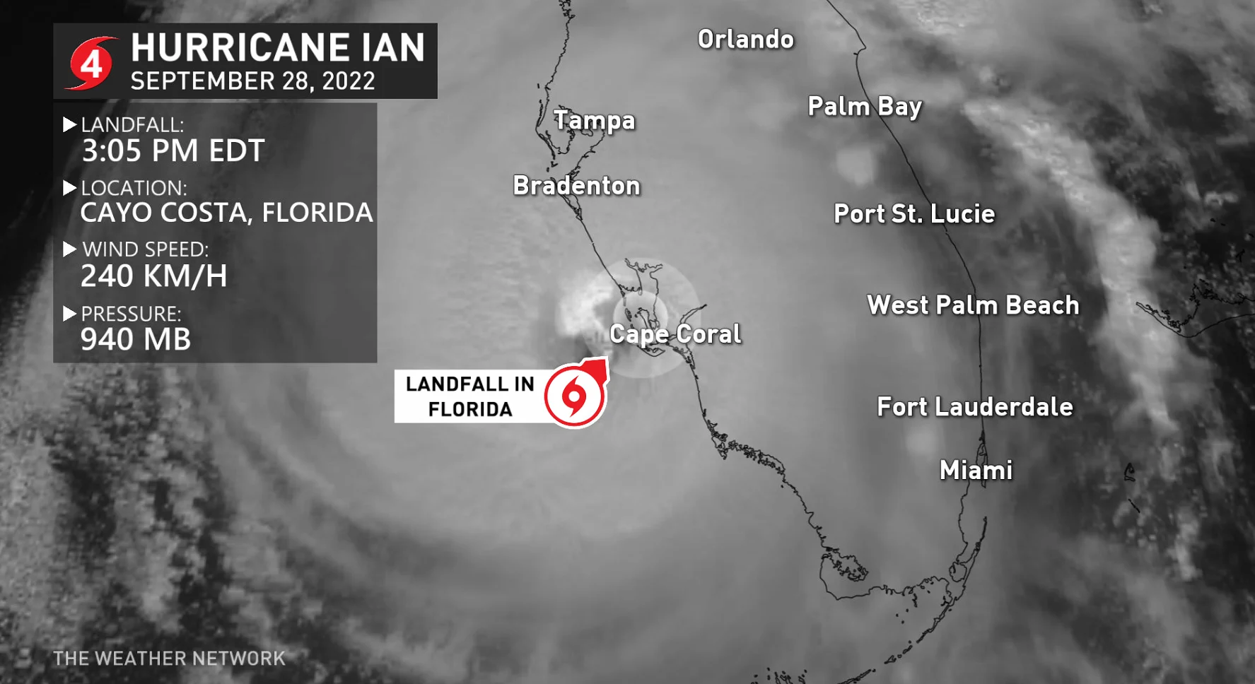
Hurricane Ian made landfall in southwestern Florida on Wednesday afternoon as a high-end Category 4 storm with fierce winds of 240 km/h. The storm hit land just shy of Category 5 intensity.
The official landfall occurred at 3:05 p.m. EDT when the centre of the eye came ashore near Cayo Costa, Florida.
PHOTOS: Towns devastated as destructive Hurricane Ian hits Florida
The U.S. National Weather Service (NWS) issued a rare extreme wind warning for areas around the point of landfall, covering nearly 1.3 million residents in the area.
“Treat these imminent extreme winds as if a tornado was approaching and move immediately to an interior room or shelter NOW!,” forecasters implored in their warning.
Hurricane Ian’s high winds will cause widespread damage to homes and businesses, extensive tree blowdowns, and long-lasting utility outages across the Florida Peninsula.
WATCH: Florida couple on why they left their home ahead of Ian
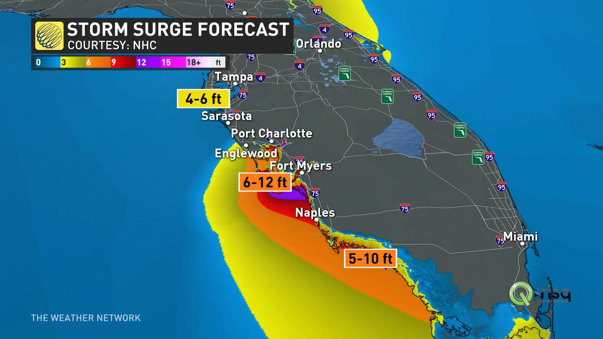
Ian’s fury pushed a tremendous storm surge into coastal communities across southwestern Florida, measuring more than 1.8 m (6 ft) above ground level as the eyewall crashed inland. The U.S. National Hurricane Center (NHC) warned that the deepest surge could potentially reach 5.4 m (18 ft) above ground level in the hardest-hit areas.
More than 1.8 million customers across Florida were without power as the storm pushed ashore Wednesday, according to data collected by PowerOutage.us, and the extent of the outages will continue to grow as Ian moves inland across the peninsula.
WATCH: Power lines burst into flames as Hurricane Ian makes landfall in Florida
"The storm is here," Florida Division of Emergency Management Director Kevin Guthrie said at a news conference. "Stay indoors. Stay away from windows."
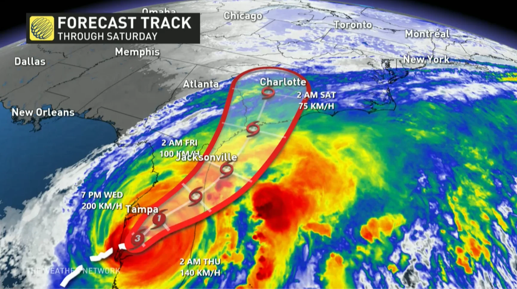
Forecasters expect Ian to continue across the Florida Peninsula through Thursday morning, bringing hurricane conditions to the Orlando metro area and parts of the state’s east coast, including Melbourne and Daytona Beach.
Current forecasts call for Ian to emerge over the southwestern Atlantic Ocean late Thursday night before making another landfall between Savannah, Georgia, and Charleston, South Carolina, during the day on Friday. The storm could be on the verge of hurricane strength when it makes its third landfall on Friday.
This was Ian’s second landfall. The storm first hit western Cuba on Tuesday as a major hurricane.
The state of Florida will receive remarkable amounts of rain through Friday. The Tampa area has the potential to see 500+ mm of rain, an unthinkable amount to fall in just 72 hours. Daytona Beach could see 200-300 mm, and the Miami area could get up to 150 mm.
Flooding rains will push into the southeastern states into the weekend, as well, bringing the potential for flooding to Georgia, the Carolinas, and the Mid-Atlantic through Sunday.
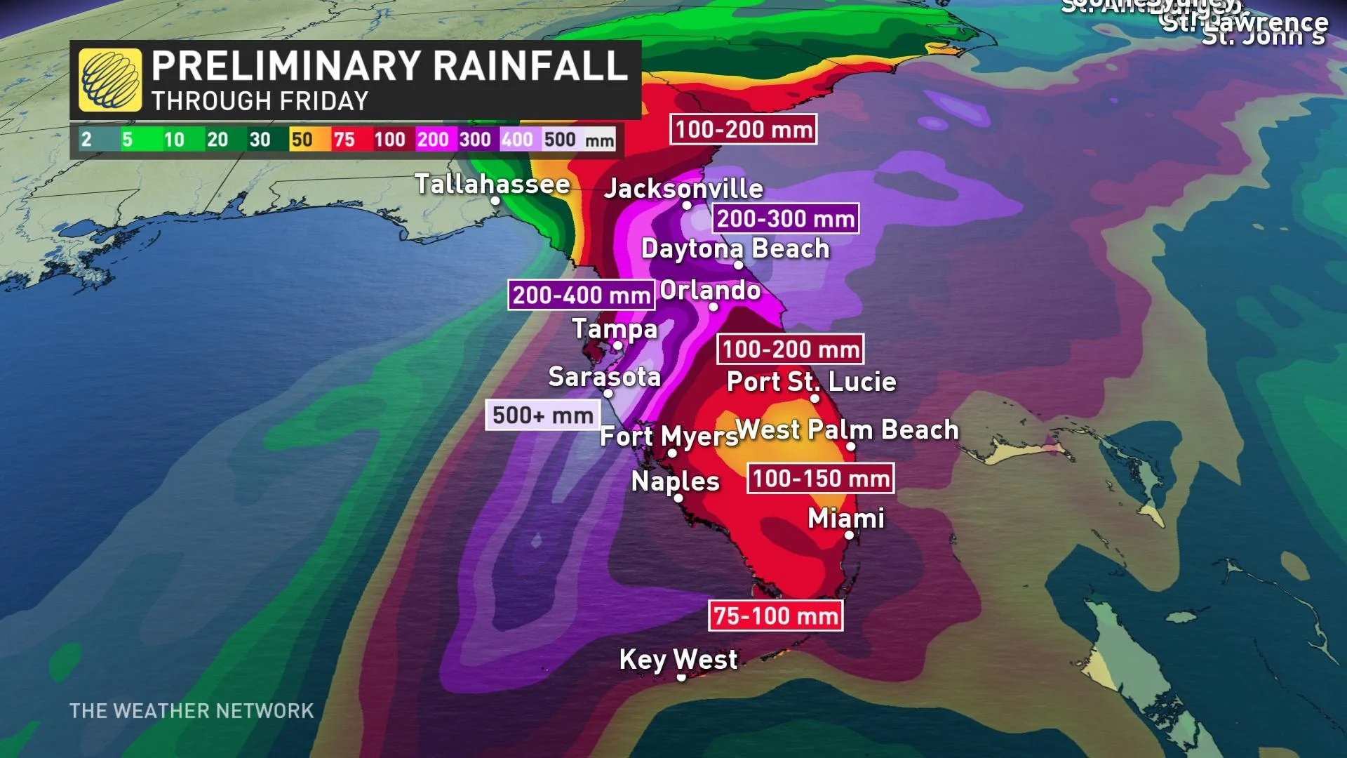
"Widespread, life-threatening catastrophic flash, urban, and river flooding is expected across central Florida," the NHC says.
"Widespread considerable flash, urban, and river flooding is expected across portions of southern Florida through Wednesday, and northeast Florida, southeastern Georgia, and coastal South Carolina later this week through the weekend."
Ian’s remnant moisture could climb through the United States and appear in Canadian long-term forecasts. Depending on the direction of the storm’s remnants, southern Ontario could see a bit of rain from the system next week. More likely, though, the system will stay east and exit into the Atlantic, moving beyond our shores.
WATCH: The devastating consequences behind 'stalling' hurricanes
Stay tuned to The Weather Network for the latest forecast updates on Hurricane Ian.
With files from Reuters.