
Potent storm puts Quebec on alert for a significant winter wallop

A developing low-pressure system over the southwestern United States will move up toward New England on Wednesday, clipping southern Ontario and Quebec on its path toward the coastal state.
READ MORE: Ice & Snow: How to master the art of winter driving
Wednesday during the day will provide a bit of a lull before the heavy snow moves in the overnight period, spreading east into early Thursday morning. Another round will move in Thursday evening.
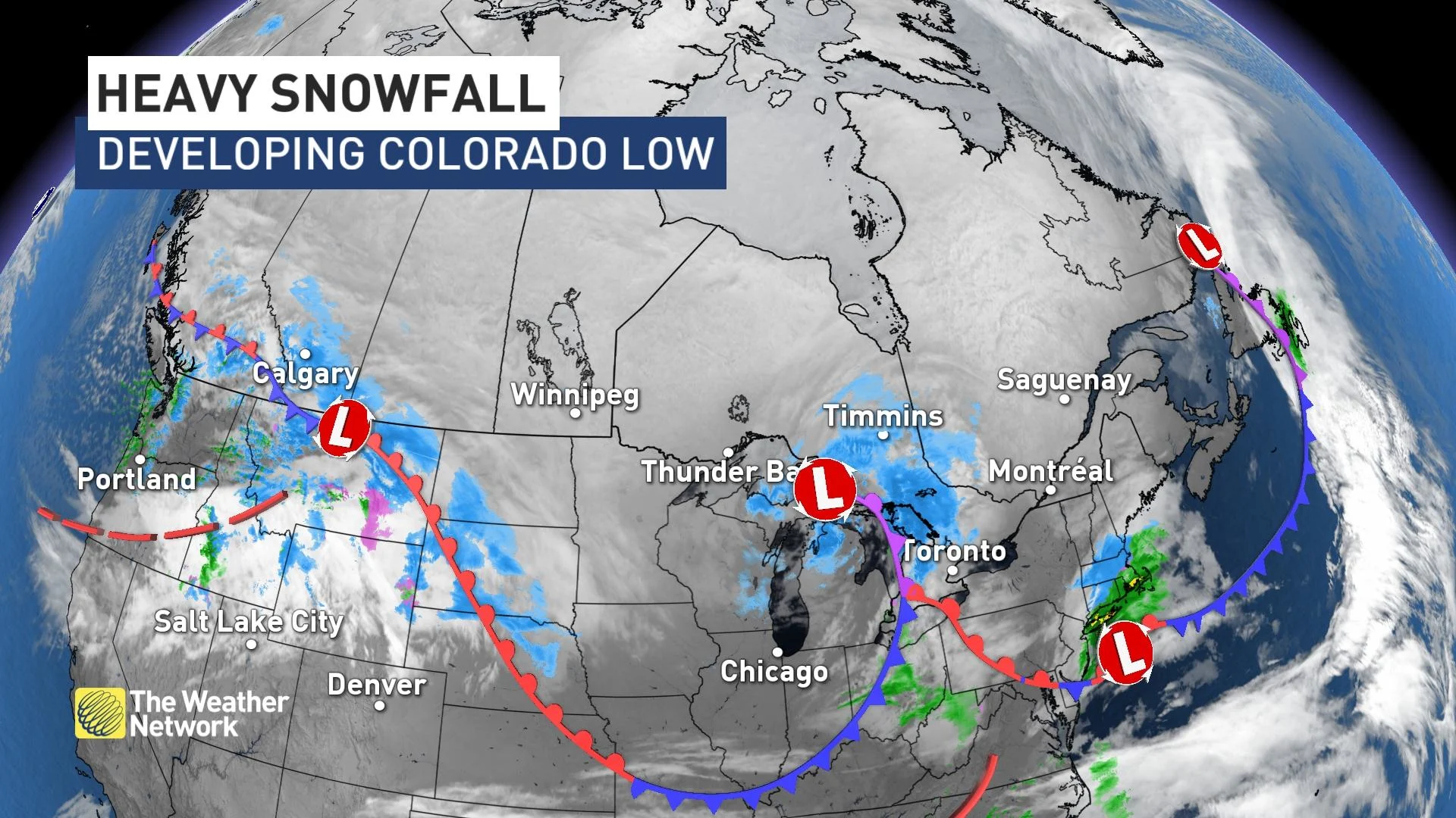
High pressure in northern Quebec will direct this late-week storm through New England while driving Arctic air southward.
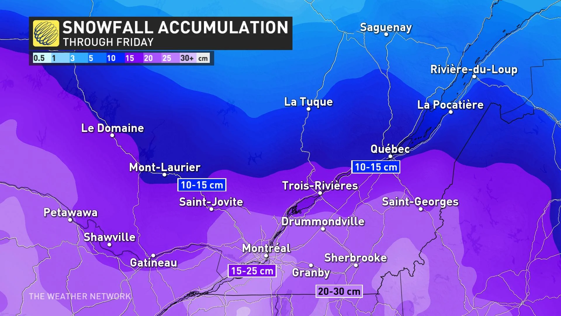
Between 15-25 cm of snow is possible for Montreal and the Eastern Townships through Friday morning, while Quebec City will see closer to 10 cm this time around. Meanwhile, areas south-southeast of Montreal could see up to 30 cm.
"As the snow is falling, temperatures will be sitting well below freezing, so the snow can be very fluffy in nature and can accumulate quickly," says Rachel Modestino, a meteorologist at The Weather Network. "This kind of snow can easily be blown around, as well, so even just a slight breeze can limit visibility."
The storm will also generate strong winds and local blowing snow, so drivers will need to prepare for hazardous travel through its duration.
The major freezing rain event that is targeting much of southern Ontario will stay well south of the border.
Temperatures will remain frigid behind this system, bottoming out Friday night in the -20s across the province, which is about 15°C to 20°C below normal.
WATCH: Worried about a power outage? How to prep ahead of time
Stay tuned to The Weather Network for more forecast updates for Quebec.


