
Growing storm chance with flooding risk in parts of Central Canada

More widespread active weather is in store for southern Ontario and Quebec. A developing low-pressure system will trigger rainfall and thunderstorms in central Canada, but some regions will miss out on significant rainfall. The storm threat should remain non-severe in nature. Any storms that do pop up may produce heavy rain and strong wind gusts. For details on the heat, humidity and thunderstorm risks for Monday, read below.
MUST READ: What to take on a day trip to the sunflower fields
Monday: Stormy pattern lingers, but risk diminishes
Beyond the weekend, the active weather pattern will continue Monday.
A developing low-pressure system early Monday will allow for more widespread rainfall and thunderstorms across southern Ontario and Quebec, but some regions will miss out on significant rainfall.
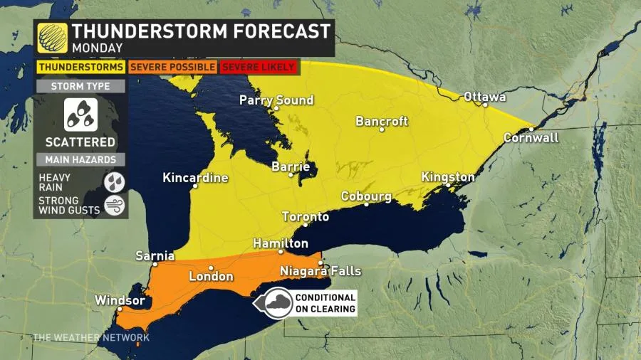
The storm threat will remain confined to southern Ontario and should remain non-severe in nature. Any storms that do pop up may produce heavy rain and strong wind gusts.
By Tuesday, the active weather wanes and temperatures will fall substantially compared to Monday and what was seen on the weekend.
As well, the extreme heat and humidity will ease by the middle and end of this week.
MUST READ: Your mid-summer guide to lawn maintenance products
WATCH: How a single Ontario storm can skew your perception of summer
Stay tuned to The Weather Network for the latest forecast details for southern Ontario and Quebec.
Thumbnail courtesy of Louise, taken in Meaford, Ont.


