Florida snowbirds face multi-day severe storm, tornado threat this week
The same major storm affecting Ontario and Quebec this week will spawn a second round of severe thunderstorms in the southern U.S., including Florida, Georgia and the Carolinas
A far-reaching storm sweeping across North America this week will bring foul weather to Canadians from Montreal to Miami.
The significant delegation of Canadians enjoying warmer weather in the Sunshine State will have to endure a second round of severe thunderstorms, with a similar setup once again this weekend.
Anyone in Florida this week should keep an eye on the radar and ensure they have a way to receive severe weather warnings the moment they’re issued. It’s also worth giving any family or friends in the region a heads-up that severe thunderstorms are possible over the next couple of days.
DON’T MISS: Snowbirds face a stormy winter as El Niño influences U.S. patterns

This is a classic severe weather setup for the southern United States during the heart of winter.
Winter is sometimes called the ‘second’ tornado season in the south. Powerful systems that blast Ontario and Quebec often spark dangerous thunderstorms on the warmer side of the storm. We already saw one damaging tornado tear through Fort Lauderdale, Florida, on Saturday.
WATCH: Wild footage of Saturday's tornado in Fort Lauderdale, Florida
Dangerous thunderstorms likely Tuesday
That’s pretty much the setup as an impressive Texas low gears up to begin the week. Our system continues to be quite strong through Monday overnight, and will stay that way through Tuesday.
A cold front sweeping along the Gulf Coast on Tuesday will spark thunderstorms that could easily turn severe. Conditions are favourable for any thunderstorms from the Florida Panhandle to the Carolinas to produce damaging winds and tornadoes through the afternoon and into the overnight hours.

Any individual thunderstorms that form ahead of the cold front could tap into enough wind shear to produce an enhanced risk for strong or long-lived tornadoes, according to the U.S. Storm Prediction Center (SPC).
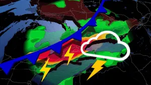
Tuesday’s severe weather risk is greatest across the Florida Panhandle, Georgia and both Carolina states. This includes the cities Tallahassee, Augusta, Columbia and Savannah.
MUST SEE: ‘This is a tornado emergency’: How forecasters warn of grave danger
Tuesday’s severe weather will be a continuation of Monday’s storms as they roll across the northern Gulf Coast overnight into the early morning hours. One or more lines of severe thunderstorms will follow the cold front east through the day Tuesday, packing a risk for damaging winds and embedded tornadoes.
The SPC expects a risk for severe thunderstorms covering most of Florida—including the Miami metro, the Tampa Bay area, and metro Orlando—and extending all the way up the coast toward Virginia Beach.

Any tornadoes that form on Tuesday could also be strong or long-lived, especially around the Florida Panhandle.
Prepare for dangerous weather in advance
Make sure you’re prepared for severe weather before the skies have a chance to darken.
Check your smartphone and ensure that emergency alerts are activated for tornado warnings. This simple feature, which is very similar to Canada's Alert Ready system, can provide critical minutes of heads-up to get to a safe place ahead of danger.
STAY SAFE: Stuck in your car during a tornado? Here’s what you should do
Take a look at The Weather Network app on your phone and set the app to provide weather forecasts and updates for your current location. The app can also provide severe weather alerts for locations in the United States.
Much of the severe weather threat on Monday will take place after sunset. The danger grows with nighttime severe storms as folks tune out and head to bed, making it harder to hear any warnings coming across your phone, radio, or television.
Take cover in an interior room on the lowest part of your home or building the moment a tornado warning is issued. Homes and businesses in Florida largely don’t have basements due to the region’s high water table.
If you’re in a condo building or a hotel, ask the front desk for advice or take a mental note of the safest place in the building to ride out the storm. For some, this may be an interior stairwell or an interior bathroom or closet within the unit. Remember, the ultimate goal of tornado safety is to put as many sturdy walls between you and the outdoors as possible.

A comparable multi-day severe weather setup is anticipated over the weekend for the Gulf States and Florida. Humidity levels are on the rise in Florida, contributing to an increased potential for severe weather on Friday.
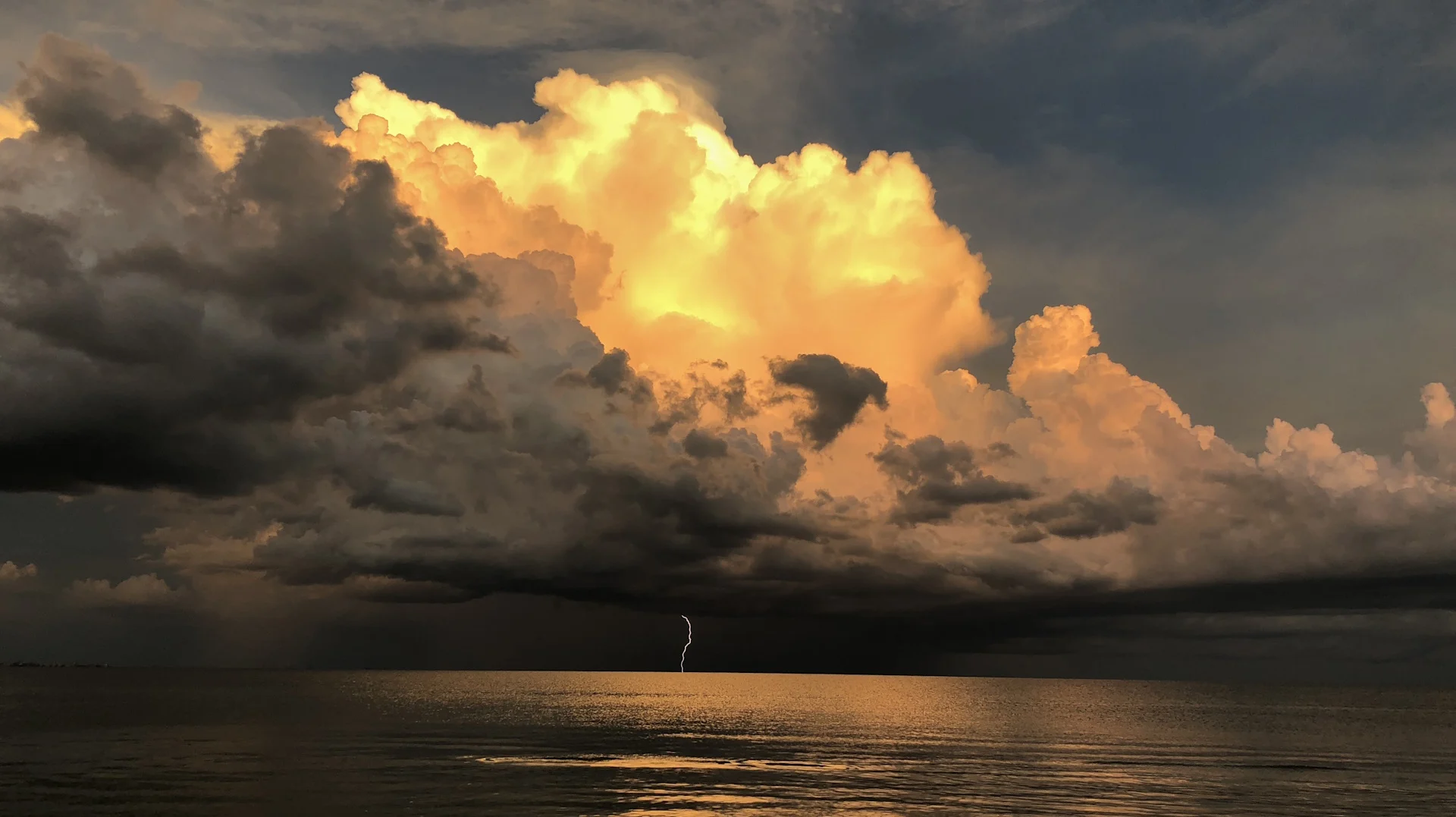
Header image courtesy of Jennifer Roe, taken at Sanibel Island, Florida, in 2018.
Stay with The Weather Network for the latest on this major winter storm's progress across the U.S. and Canada.