First look at potential Atlantic Canada impacts from Nicole remnants

With Nicole set to make landfall in Florida soon, a tropical cyclone information statement has been issued for parts of Quebec, as well as New Brunswick, Nova Scotia and P.E.I. for impacts this weekend.
Tropical storms and the associated remnants are far from unusual across Atlantic Canada during the summer and early Fall. Just not in November.
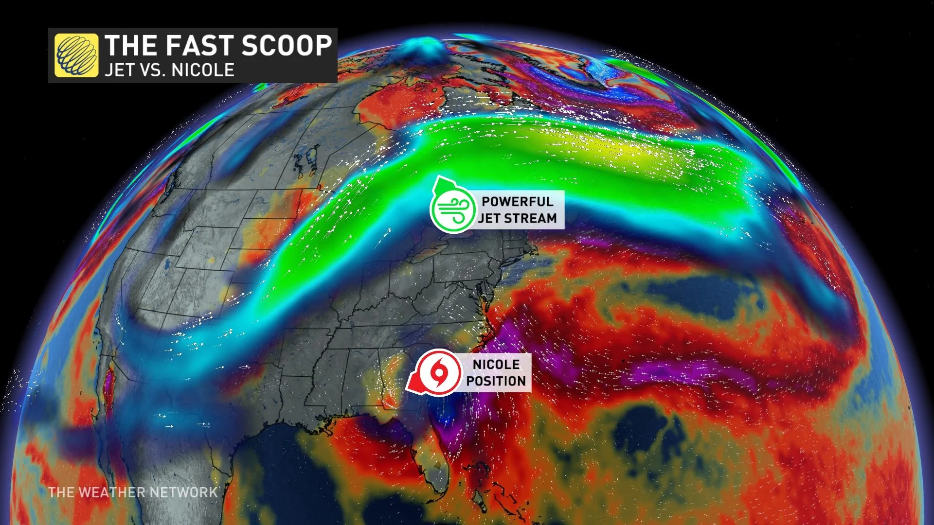
On Friday morning, Nicole's remnant low is in Georgia. By Saturday afternoon, the remnants of Nicole will be absorbed into a fast-moving jet stream, triggering a gradual intensification of the low.
RELATED: A snowstorm and tropical system set to collide over Eastern Canada
For the early looks at the potential impacts from Nicole, read on.
What we know so far
Environment and Climate Change Canada (ECCC) has already issued a tropical cyclone information statement for parts of Quebec, as well as New Brunswick, Nova Scotia and P.E.I.
"Since the storm is expected to transition to 'post-tropical' well to our south, it will essentially be an autumn-type storm while impacting Eastern Canada. Heavy rain will likely spread well north of the low's track into southern Quebec and perhaps even eastern Lake Ontario," said ECCC in the statement.

Nicole track. (Canadian Hurricane Centre)
The Canadian Hurricane Centre (CHC) will track this for a few days and issue additional bulletins this week.
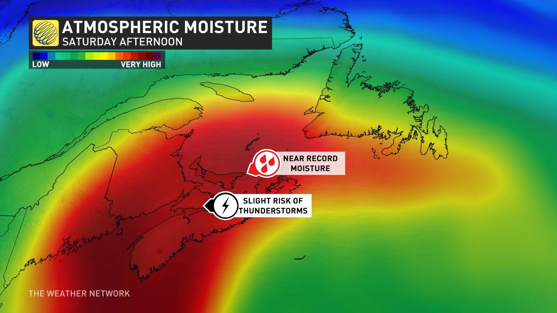
The greatest threat will undoubtedly be heavy rainfall, as the moisture in the atmosphere will be near the highest November levels on record. If you wrung out the entire column of the atmosphere, you would end up with about 50 mm of moisture.
The trough hangs back, allowing the tropical moisture to become the dominant story. If the energy from Nicole effortlessly phased with the Prairie trough, we'd be looking at a much deeper low-pressure system. Hurricane Fiona was an excellent, but a terrifying example of what happens when a tropical system perfectly merges with an upper trough.
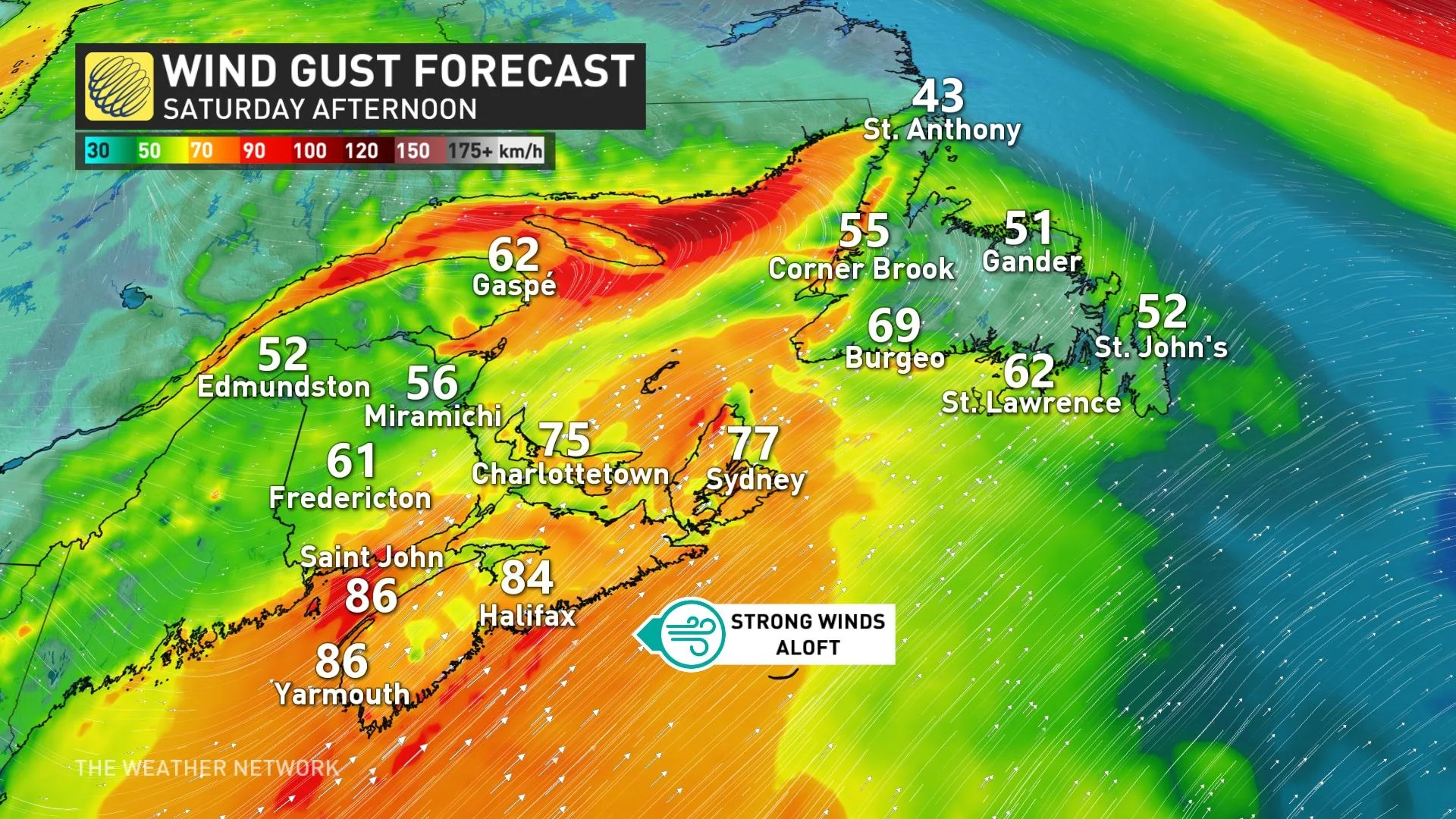
Wind gusts along coastal sections of the Maritimes can exceed 90 km/h, and even higher if the screaming winds aloft mix down. By the time the low slides across Newfoundland, there's enough cold air to promote a nasty winter-like storm across northern sections of the province.
The rapid speed of the low will suppress the threat of significant and widespread flooding, but portions of New Brunswick and Newfoundland are looking at 50-80 mm of rainfall through early Sunday.

Rainfall rates will be locally intense, and up to 30 mm could fall in as little as six hours. Needless to say, there will be the risk of localized flooding and power outages.
With files from Tyler Hamilton, a meteorologist at The Weather Network.
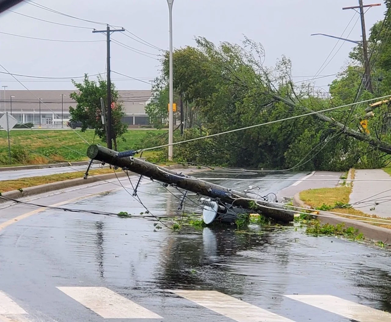
Thumbnail courtesy of Jessica Mills, taken in Charlottetown, P.E.I.
Check back as this Eastern Canada forecast continues to develop.