Fast-moving severe storms leave trail of damage in southern Ontario

Severe thunderstorms raced through southern Ontario Sunday night bringing damaging wind gusts and large quarter-sized hail.
Despite inching closer to the official start to the fall season, late-summer storms continue to take a toll across southern Ontario.
The latest round of severe thunderstorms moved into southwestern Ontario Sunday evening from Michigan and formed into a line of severe storms known as a 'bow echo' - shaped like a bow of a bow and arrow. This storm system raced across southwestern Ontario and through the Niagara region at over 100 km/h.
Warnings lined the region as the powerful winds and the fast forward motion brought damaging gusts of 100+ km/h. Torrential rain and quarter-sized hail were also reported at times.
MUST SEE: Ontario's Tuesday tornado outbreak was an 'airborne octopus’
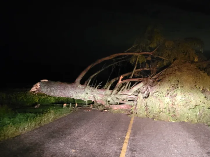
Many reports started pouring in of power outages, as the storm brought down branches and large trees. About 25,000 hydro customers lost power as the storm rolled through.
The storm then moved into New York state where the National Weather Service in Buffalo warned of severe, damaging wind gusts as well. The threat for severe storms has diminished over southern Ontario, though a couple rounds of rain showers and weaker thunderstorms are possible Monday. That's ahead of another severe threat that will develop on Tuesday.
Here's a look at Sunday's damaging storms as they flooded in on social media.
Thumbnail image courtesy: NZP Chasers