
Eyes on the skies in Ontario Tuesday for severe storm, tornado threat

Stormy skies have rocked Ontario multiple times already in September, and yet another menacing atmospheric setup is developing for Tuesday.
Tuesday will want to be a day to pay close attention to the forecast and weather alerts, with a heightened threat for severe thunderstorms across parts of southern Ontario. The setup will include the potential for supercells and one or two tornadoes near the Lake Huron shores in the afternoon and evening. More on the storm risk and potential impacts, below.
TUESDAY: WIDESPREAD SEVERE RISK INCLUDES TORNADO THREAT
A warm front lifting into southern Ontario will bring the risk of elevated showers and thunderstorms overnight Monday and pre-dawn hours Tuesday. There will be an initial round of showers and thunderstorms in the Nickel Belt region Tuesday morning, north of a low-pressure system.
The warm front will continue to allow instability to build during the day Tuesday, especially near Lake Huron shores, as a low-pressure system cuts across the Great Lakes.
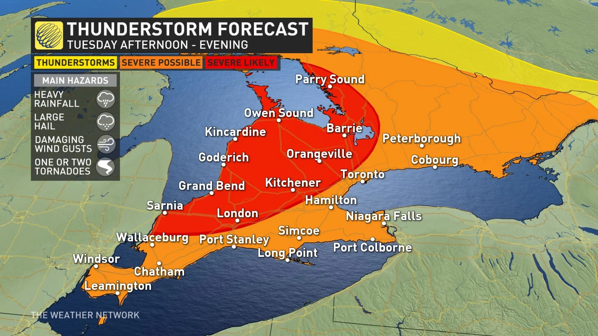
This will bring a widespread threat for severe thunderstorms across southern Ontario in the afternoon and evening. Because directional wind shear will be favourable near the Lake Huron and Georgian Bay shores, rotating storms will be possible along the warm front as it lifts in the afternoon.
This means there will be the potential for one or two tornadoes in the early afternoon and evening before it diminishes. The other main hazards with the severe storms will be damaging wind gusts, large hail and heavy rainfall.
However, similar to the severe weather event on Tuesday, Sept. 7, timing will be critical. The window for surface-based storms to develop is quite narrow in September because of the loss of daylight.
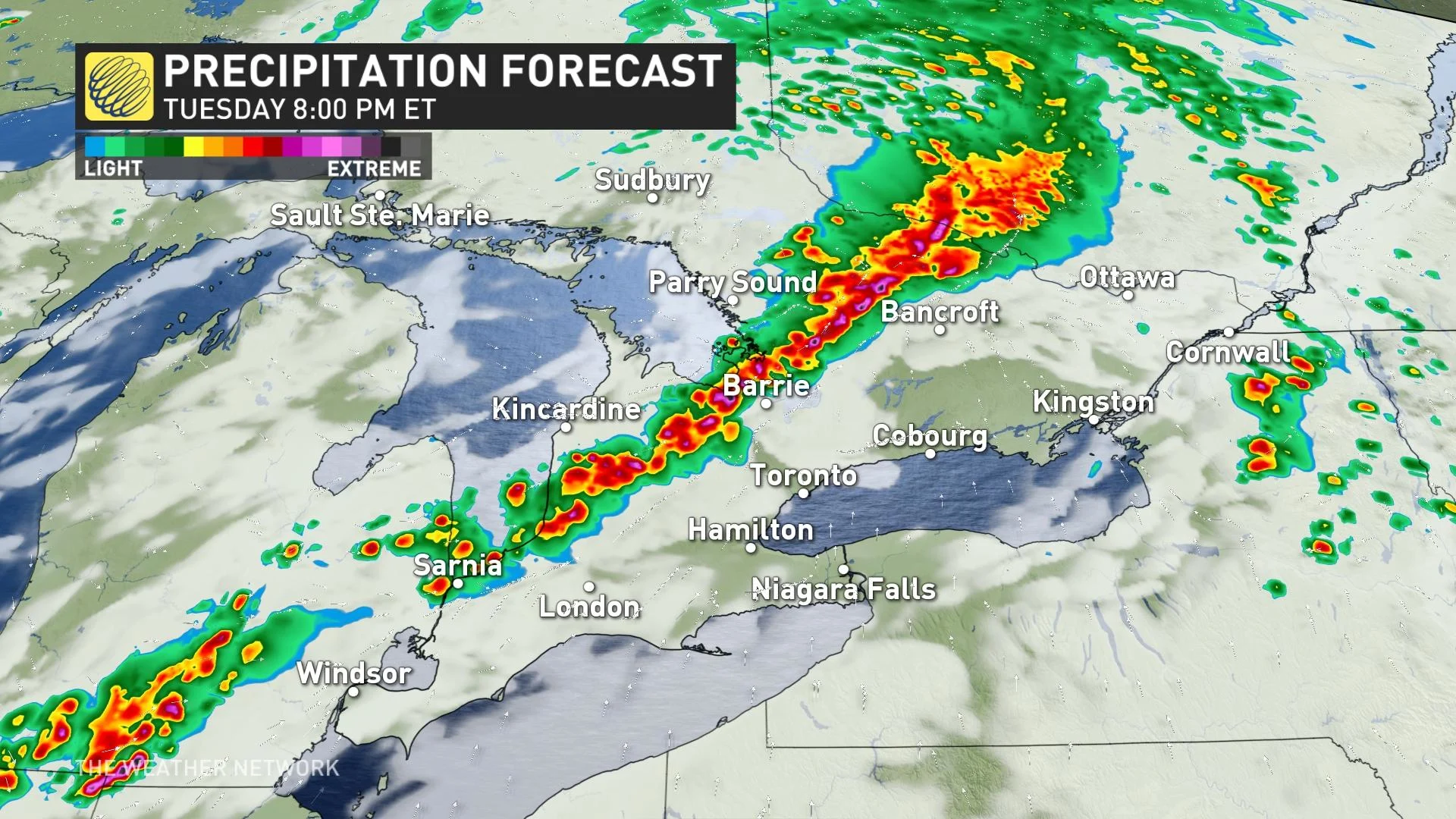
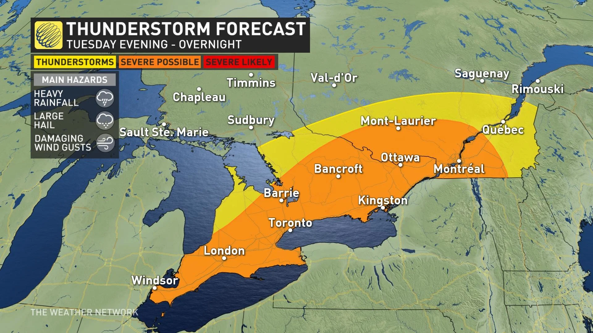
The severe storm risk will linger through the evening and overnight period, further inland from the Lake Huron shores. A quasi-linear convective system (QLCS), or a squall line, is likely to develop in the evening, continuing overnight.
The storms will track into eastern Ontario early overnight and reach southern Quebec during the overnight period.
RELATED: Ontario's Tuesday tornado outbreak was an 'airborne octopus’
BEYOND: A LATE-WEEK WARMING TREND AHEAD
Conditions will settle down once the low-pressure system moves away from the region by the middle of the week. Southern Ontario will see more sunshine and less active weather for the second half of the week.

Temperatures will grow warmer by the end of the week, accompanied by a noticeable uptick in humidity. Friday could see feels-like values in the 30s for most. Mostly fair and warm on the weekend, but there will be a risk for showers and thunderstorms.
Warmer than normal temperatures are expected to dominate the latter half of September, with the potential for a few days of very warm and possibly hot weather.
Thumbnail courtesy of Meagan Baumhour, taken in Kindcardine, Ont.
Stay tuned to The Weather Network for the latest forecast across southern Ontario