Extreme temperature anomaly scrambles North America's weather pattern

Southern regions in the United States will see temperatures dip by mid-week while parts of northern Canada will see temperatures in the teens.
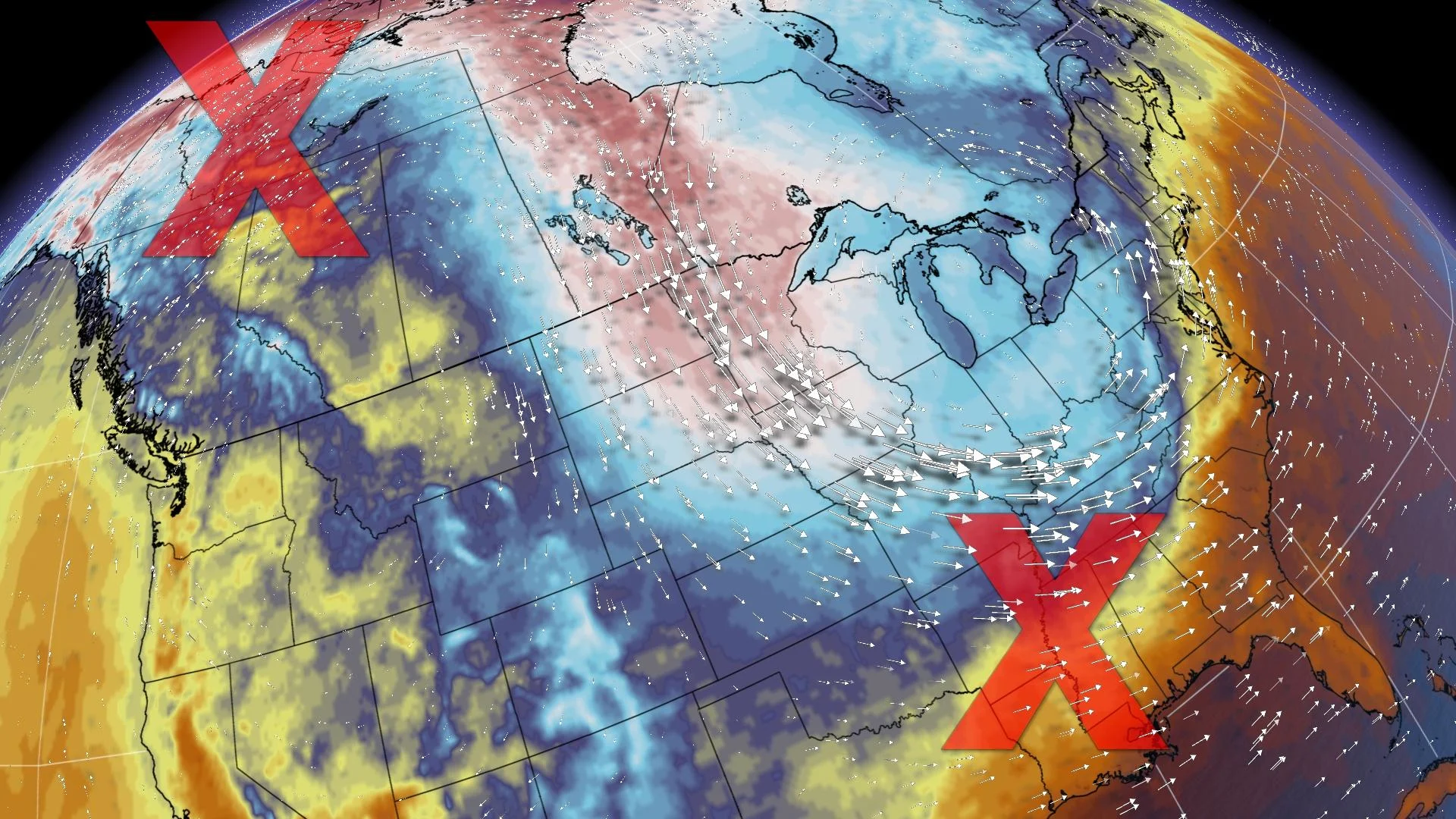
It's as amplified as a weather pattern as you'll ever see. Ridges and troughs divide the cold and warm air masses across North America, and this week, that divide will be taken to the extreme.
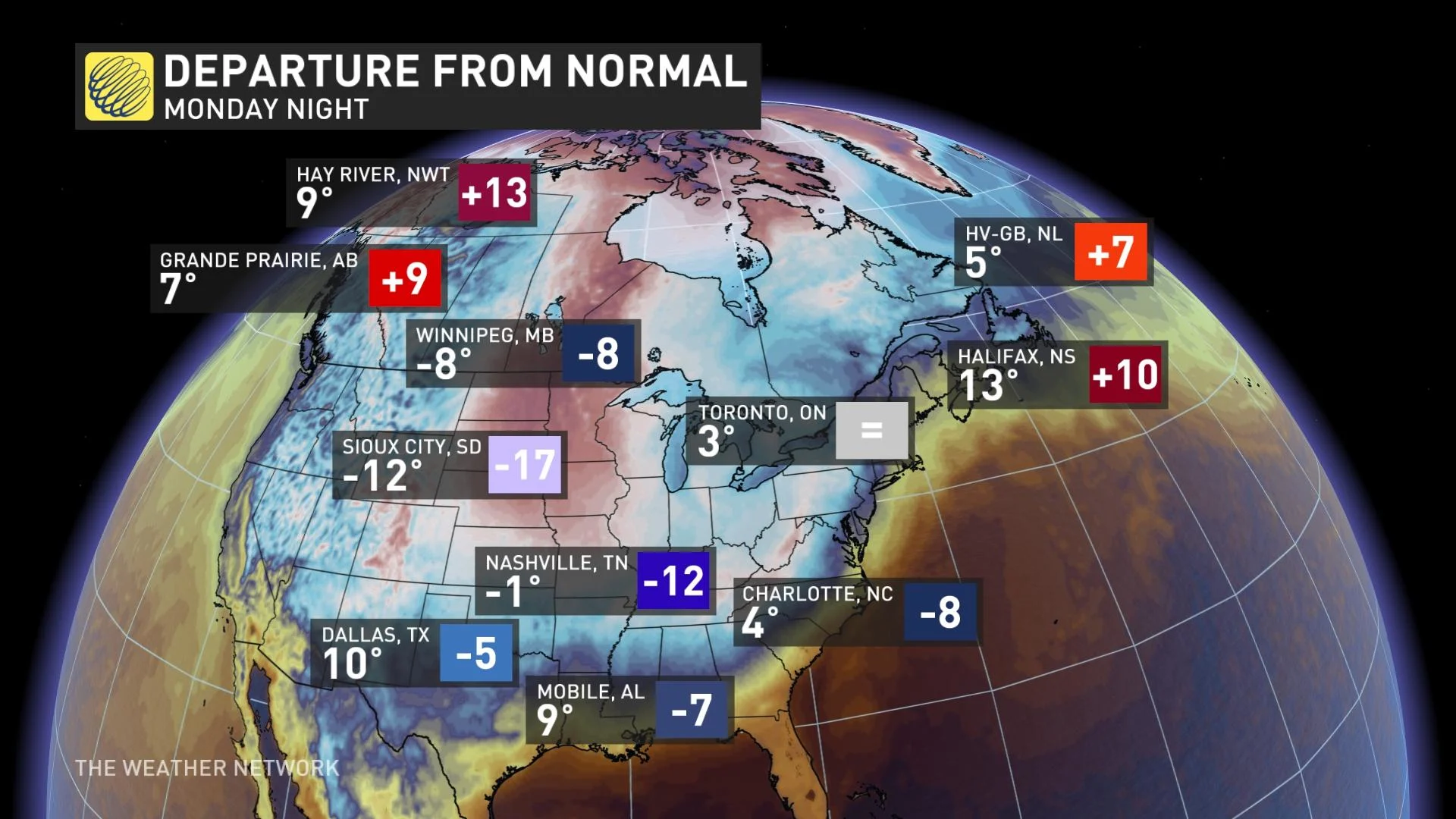
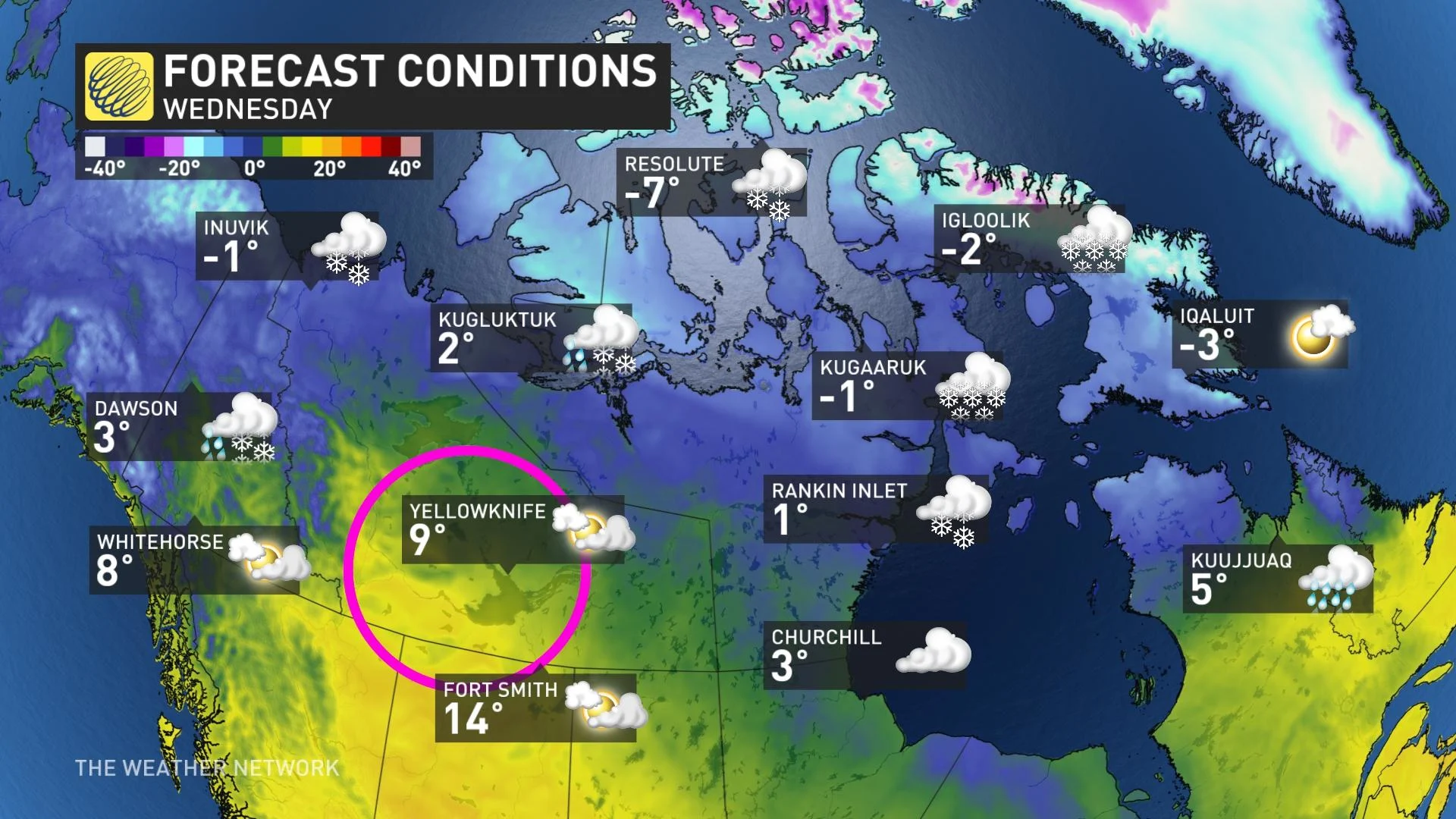
Last weekend regions in the Northwest Territory saw temperatures leap into the mid-to-upper teens, which is unusual since temperatures in the part of the Arctic typically hover around 0°C during this time of year.
What’s even more peculiar is that unseasonably colder temperatures will soon plunge thousands of kilometres south towards the Gulf of Mexico.
See also: A 'Ring of Fire' solar eclipse happens one year from today. Start planning now!
Take a look at Monday night, where the temperature in Hay River, N.W.T., is expected to be near 10°C, while Sioux City, South Dakota could plunge to -12°C.
These unusually frigid temperatures in central regions of Canada and the U.S. is due to the wavy jetstream that is tapping into high-latitude Arctic air, which will eventually make its way to Alabama, Louisana, and the Gulf States by Wednesday.
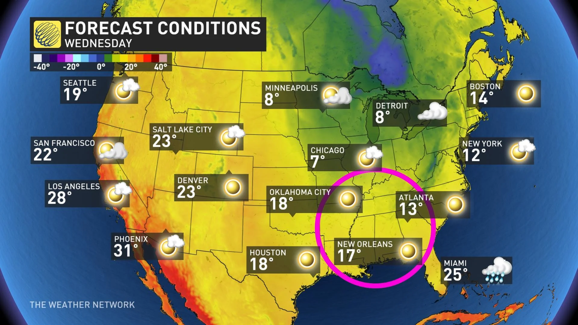
Daytime highs are comparable across the Northwest Territories mid-week to regions nearly 5,000 kilometres further south, compliments of the wavy jetstream.
A zonal flow will develop by the end of the week, which means the extreme temperature anomalies that have been steadfast in the west will be tamed. This will result in some much-needed relief from the drought and wildfire conditions in the Pacific Northwest.