Every major Canadian city is below seasonal on Tuesday, more cold in sight

Spring continues to take a backseat with this pattern, one that was influenced by major weather events.
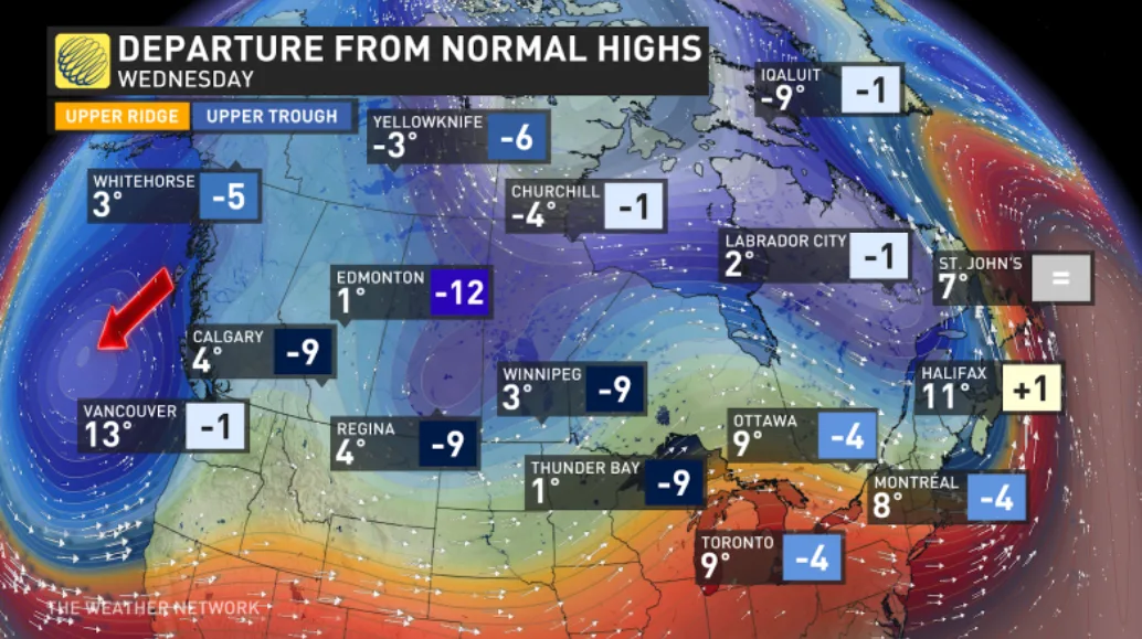
Tuesday’s temperatures are forecast to be 5 to 15 degrees colder than normal across Canada. That's as spring continues to take a backseat as the whole of Canada dives into a trough pattern, one that was influenced by major weather events.
Eastern Canada’s temperature dive can be traced back to the Prairie’s April blizzard on April 12 through the 14th.
PHOTOS: Spring on pause in southern Ontario as snow stuns residents
Although the storm has moved on, it left behind a primed atmosphere of chilly, unstable air. Following shortly after, a Montana low took full advantage as it swept the Great Lakes with a chilly April snowfall, blanketing the Greater Toronto Area on April 18. The cold and snowfall continues to impact Quebec and Atlantic Canada through Wednesday.
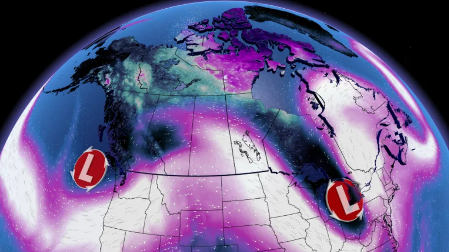
Eastern Canada can expect more cold shots later this April thanks to a weather system that was half a world away. It’s the same weather system that has a chill forecast in Western Canada this work week.
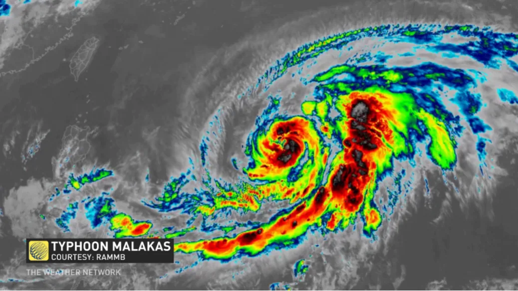
Remnant energy from Typhoon Malakas has traversed the Pacific Ocean and is now on the doorstep of Canada’s West Coast. B.C. joins the April chill in the short term, adding the Prairies later this week.
This energy will ultimately help tug the atmospheric trough south into the United States, allowing cold temperatures from Canada’s North to funnel south into the Prairies. Western Canada continues to be stuck in this below seasonal pattern, which will press into the Great Lakes later this week.