Canada: 'Remarkable' clash of the seasons could mean snow versus heat

Snow versus heat. Find out where you land in this remarkable clash of the seasons setting up across Canada.
Autumn is famous for wild temperature swings and sharp contrasts in weather across Canada and that is exactly what we are going to see at the end of this week and into the start of October.
Visit our Complete Guide to Fall 2019 for an in depth look at the Fall Forecast, tips to plan for it and a sneak peek at the winter ahead
Before we look ahead at the upcoming pattern change, here is a quick recap of what we have seen so far during September.
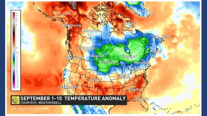
Fall got off to a quick start with cooler than normal temperatures across most of Canada east of the Rockies for the first half of the month. The various shades of blue and green on the map highlight regions that were cooler than normal.
However, since that time, summer has made a curtain call appearance across many areas that were rather cool to start the month. The map below shows that with the exception of parts of Atlantic Canada and southern B.C, most of Canada has been warmer than normal during the past week.

Another pattern change is in the works, starting at the end of this week and continuing through the middle of next week (the first couple days of October).
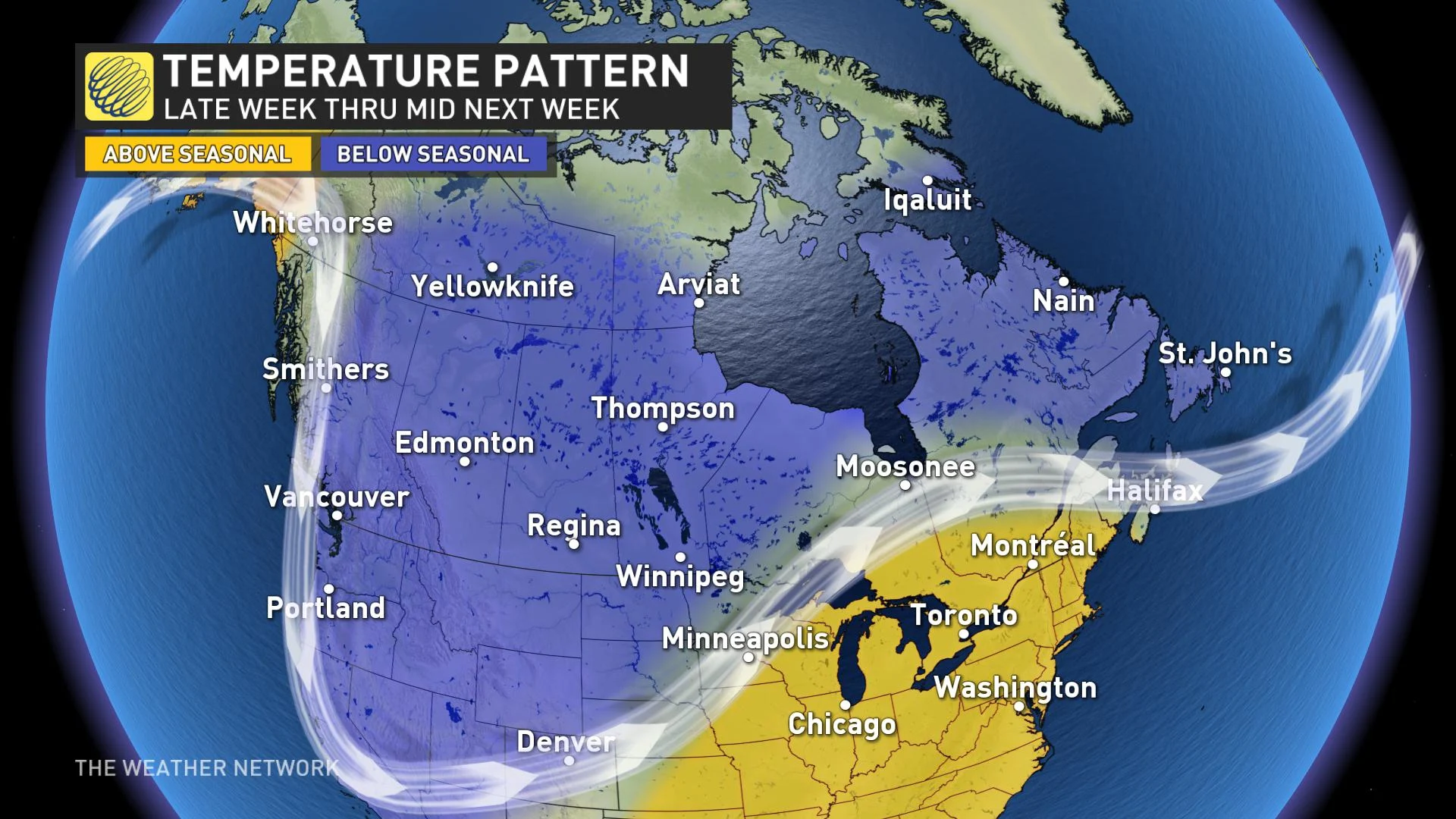
This pattern change will feature a a blast of very chilly weather late this week and weekend across western Canada with temperatures more typical of November.
Meanwhile, above seasonal temperature will dominate from the Great Lakes to southern Quebec where we will still see one or two more days of mid-summer heat and humidity next week. Temperatures will be near normal across the Maritimes and cooler than normal across Newfoundland.
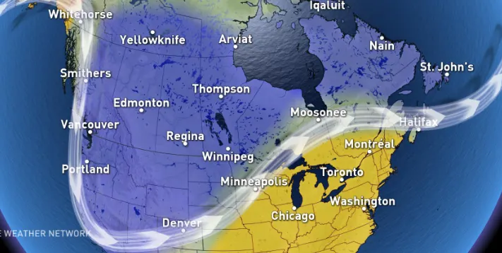
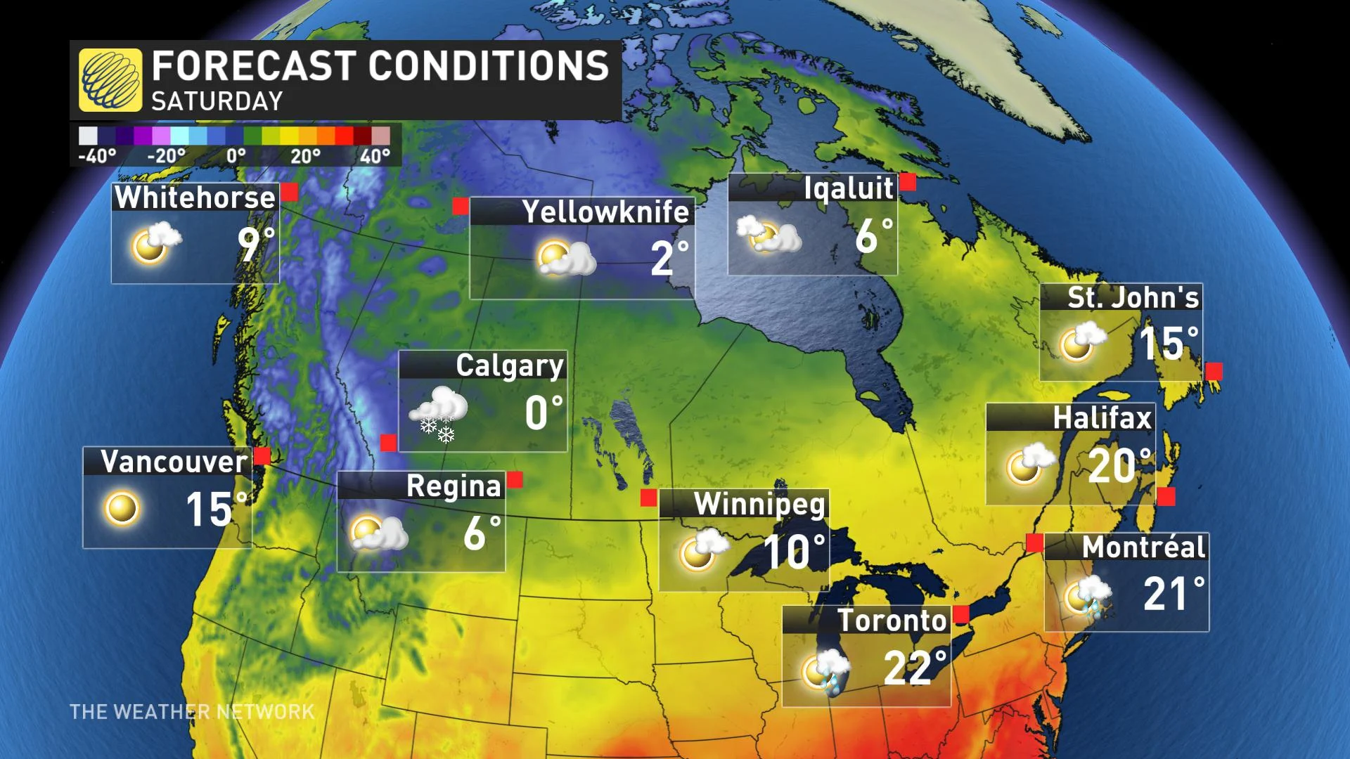
The temperature contrast across Canada will be especially remarkable on Saturday when Calgary will struggle to reach a high of 0 ºC while southern Ontario and southern Quebec will reach the lower 20s.
In addition to the chilly weather across the west, we will also see a snow storm with significant snow across parts of the region.
Heavy snow is likely in the mountains of B.C. and in the Rockies of B.C. and Alberta late in the week and weekend. During the weekend, heavy wet snow will also spread across southern Alberta and into parts of southern Saskatchewan.
There is still some uncertainty regarding the exact track of a potent system that will track south of the border during the weekend, and that will be the key to where we see the heaviest snow. At this point it looks like just a few centimetres of snow in the Calgary area.
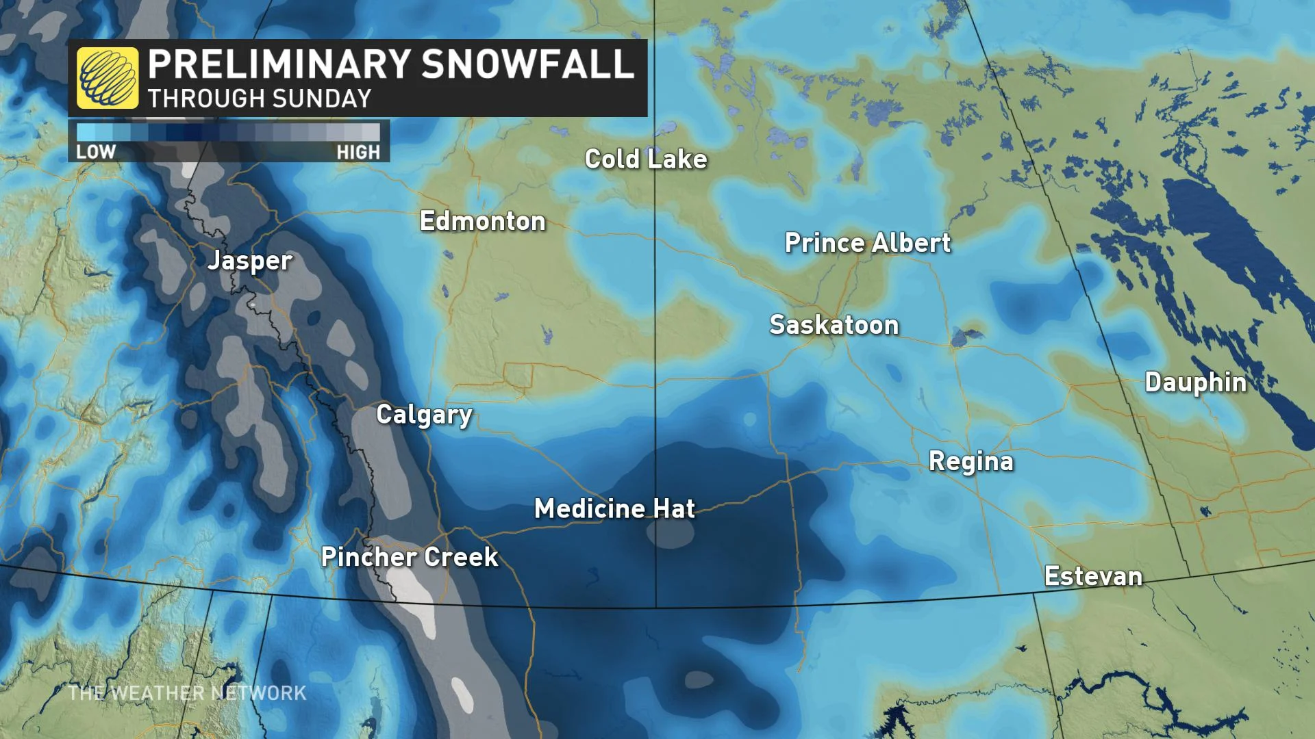
Currently, it looks the Pincher Creek area has the highest threat to reach or even exceed 30 cm of snow by the end of the weekend. Widespread totals of 10 to 20 cm are expected across parts of southern Alberta and into southern Saskatchewan.
With the foliage still on the trees, we are concerned about damage to trees and power outages from the heavy wet snow. Of course this will also have a major impact on the fall harvest. Temperatures will remain well below seasonal for first week of October.
Meanwhile, we are also watching the potential for summer’s grand finale across southern Ontario and southern Quebec during Tuesday and Wednesday of next week (October 1-2) with temperatures reaching into the mid to upper 20s. Parts of southwestern Ontario will reach at least 30ºC with a humidex in the upper 30s and even approaching 40.

More typical autumnal weather is expected by the end of the week.