Persistent sea-effect snow brings 40+ cm to parts of Atlantic Canada

Persistent sea-effect brings snow bands carrying 40+ cm of snow to parts of Atlantic Canada ahead of Christmas.
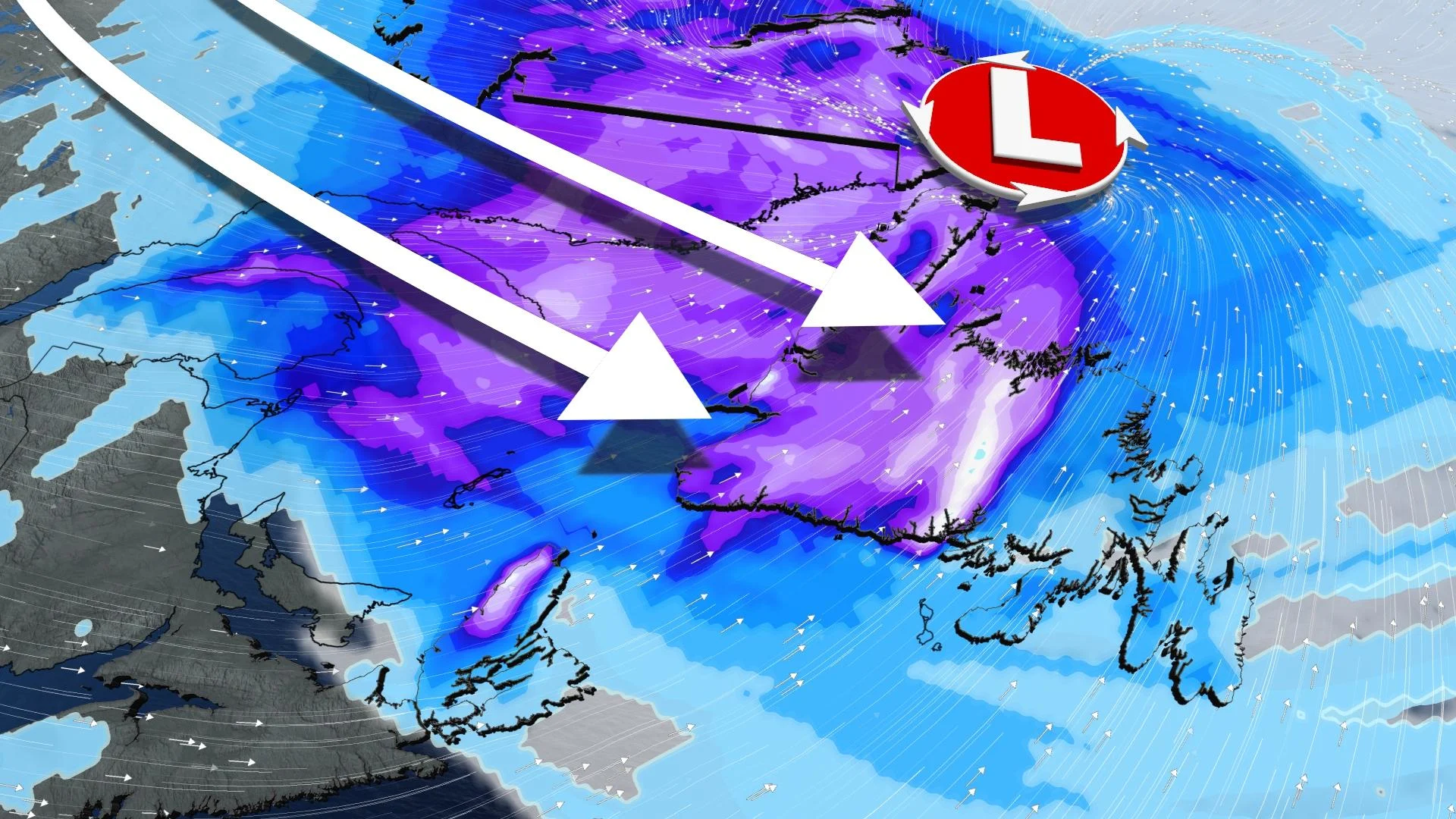
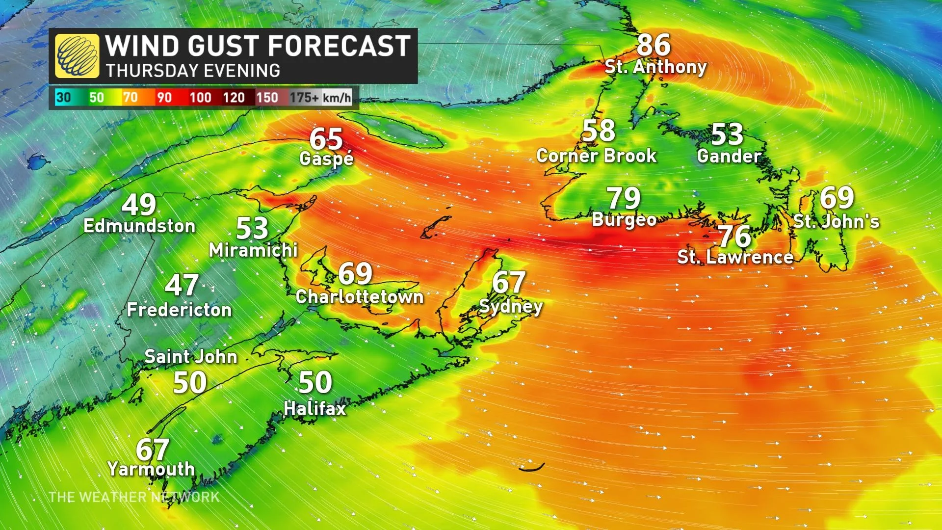
A windy and wintry system will continue to bring impacts to parts of Atlantic Canada through Friday, as the upper atmospheric pattern stalls out and keeps the unsettled conditions locked in place. Persistent sea-effect snow squalls will persist for many coastal areas in the northern Maritimes and Newfoundland, with 40+ cm possible amid the heaviest snow bands. Coastal areas will also see powerful winds with gusts upwards of 100 km/h linger through early Saturday. More on the impacts and timing as we head into the holidays, below.
Visit our Complete Guide to Winter 2022 for an in-depth look at the Winter Forecast, tips to plan for it, and much more!
THURSDAY INTO SATURDAY: PERSISTENT SEA-EFFECT SNOW THREATENS 40+ CM OF SNOW
A low-pressure system that moved up the Atlantic coast joined forces with a clipper pushing through Eastern Canada to bring widespread wintry weather across much of the Atlantic provinces, guaranteeing a white Christmas for some.
MUST SEE: Dreaming of a White Christmas? Region-by-region breakdown, here
That wintry system will continue to impact parts of the region as we head into the Christmas weekend, as the upper atmospheric pattern stalls out and cold air settles in across the region.
"Gusty winds will continue to swirl around the surface low well into Saturday, setting the stage for persistent sea-effect snow for many coastal areas in the northern Maritimes and Newfoundland," says Michael Carter, a meteorologist at The Weather Network.
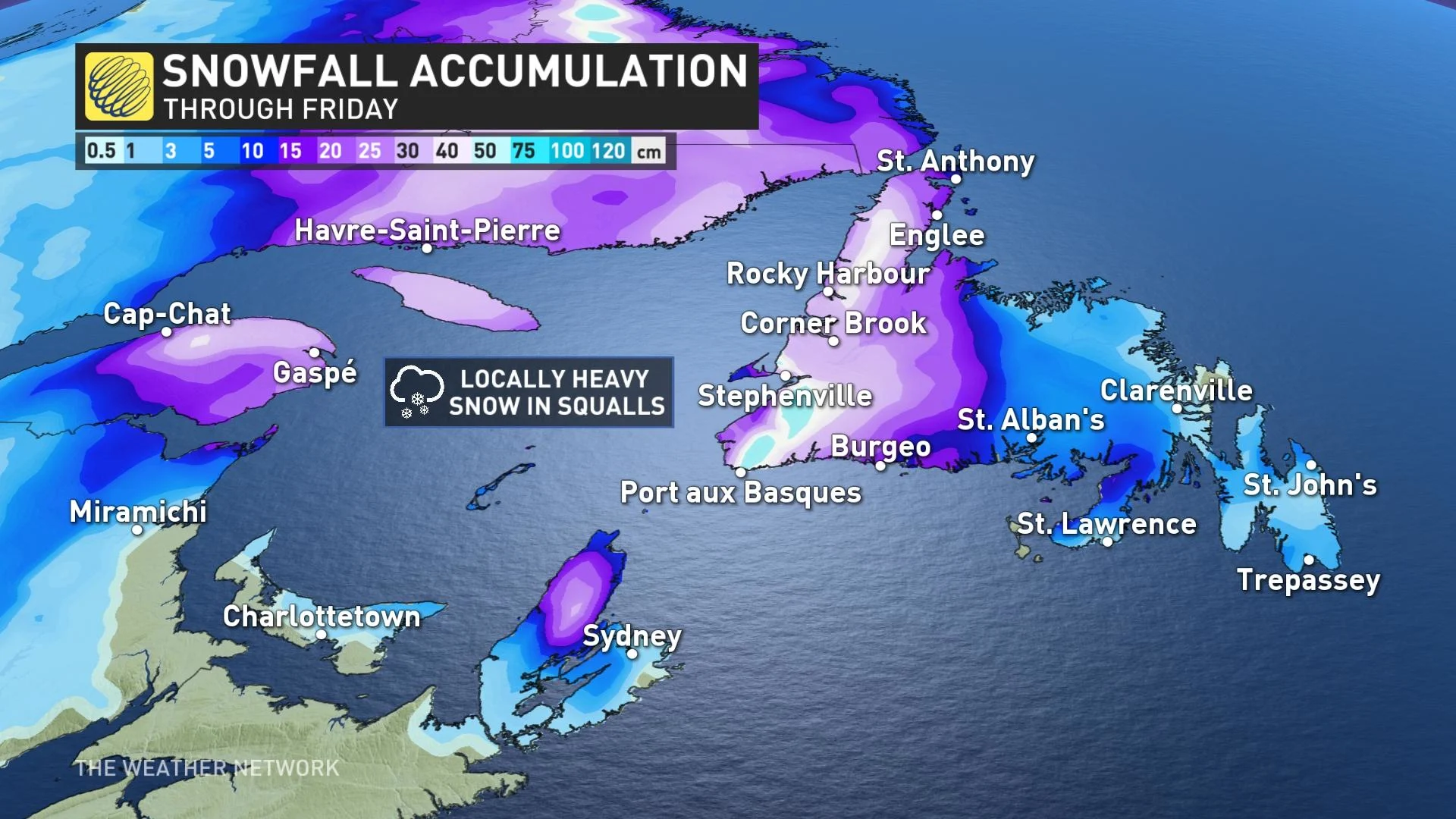
Widespread winter warnings cover the region -- including winter storm, snowfall, snow squall and wind -- with as much as 40+ cm of snow possible over the western coast of Newfoundland and Cape Breton, where the more persistent sea-effect bands lock in.
"Surfaces such as highways, roads, walkways and parking lots may become difficult to navigate due to accumulating snow," warns Environment and Climate Change Canada. "Visibility will be suddenly reduced to near zero at times in heavy snow and blowing snow."
Coastal areas will see wind gusts between 90-110 km/h linger through Thursday and Friday, before gradually easing during Christmas day on Saturday.
Mostly fair and cold conditions are expected for Christmas across the Maritimes, with snow flurries persisting across Newfoundland. A quieter pattern is forecast for early and mid next week, with no major systems in sight and slightly above seasonal temperatures set to dominate.
Stay with The Weather Network as we track the holiday weather in Atlantic Canada.