B.C. saw less rain in 3 months than Hurricane Ian dumped in 1 minute

Parts of British Columbia have seen less rain in the past couple of months than Hurricane Ian dropped in just one minute when it hit Florida.
Studying the weather on North America’s coasts is a study of extremes. One only needs to look at British Columbia and Florida to see how extreme these extremes have grown.
Parts of southern B.C. have seen less rain since the beginning of July than some communities in Florida saw in just one minute as Hurricane Ian lashed the state.
Really.
CANADA’S OCTOBER OUTLOOK: A slow slide or a freefall into colder weather?
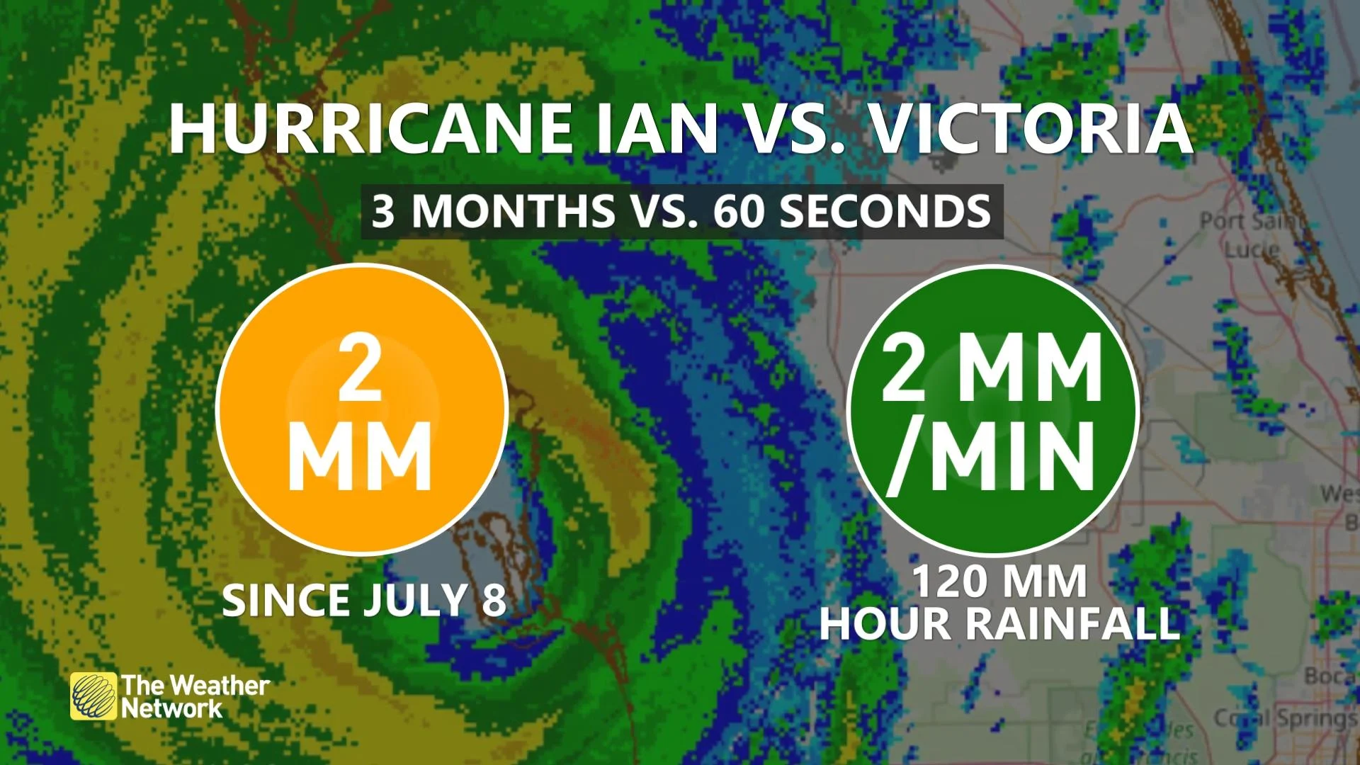
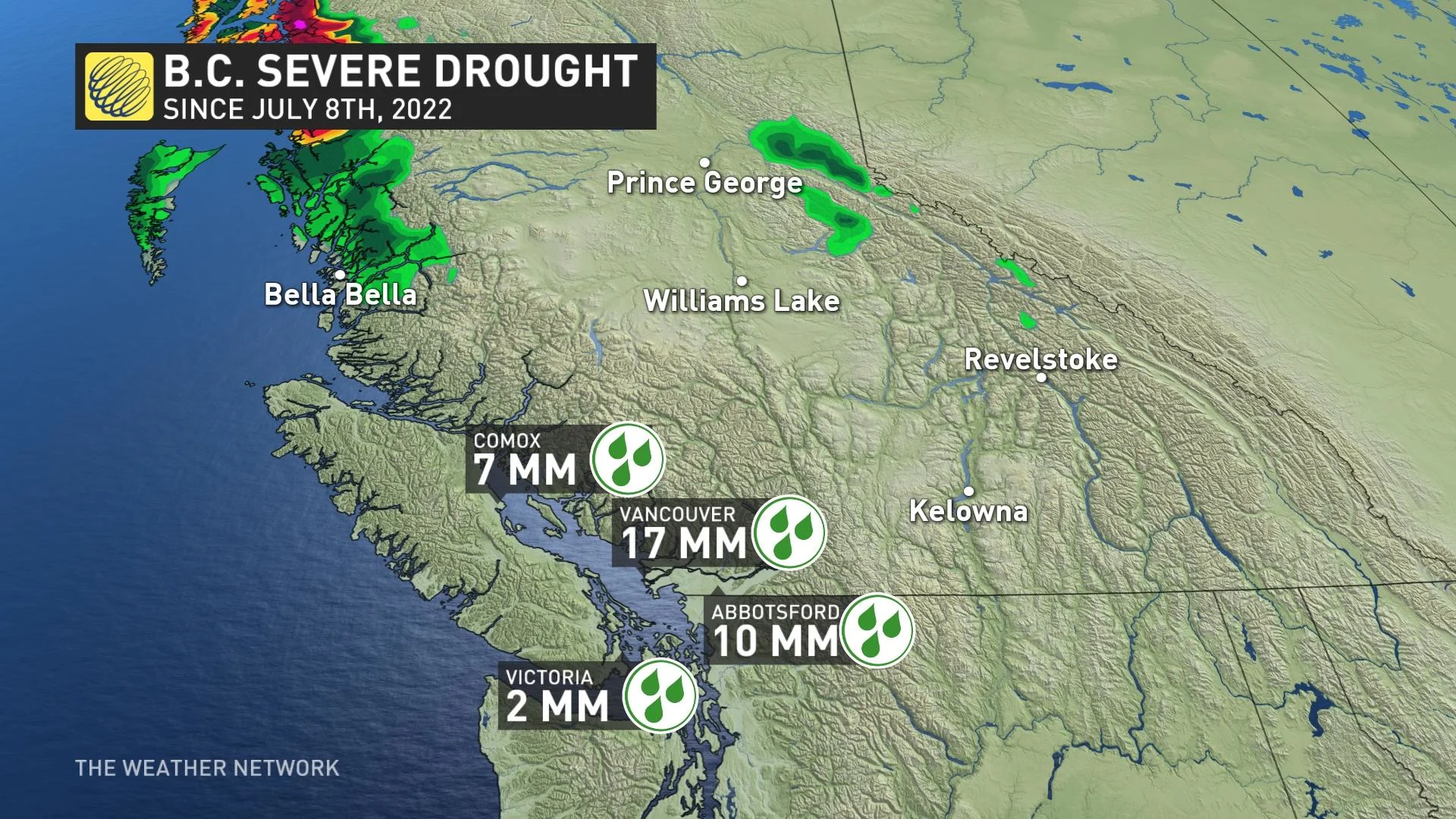
Victoria has only measured about 2 mm of rain since July 8th. A few thousand kilometres to the southeast, some towns in central Florida measured 2 mm of rain in one minute as Hurricane Ian smashed into the state as a high-end Category 4 storm.
Persistent ridges of high pressure over the western coast of North America have kept this part of B.C. exceptionally dry for the past couple of months.
This is one severe drought—Comox has only seen 7 mm of rain since July 8th, and Vancouver has only measured 17 mm of rain since the same date.
Compare that extreme level of parching to what unfolded in Florida as Hurricane Ian made landfall on September 28th. The storm hit north of Ft. Myers with maximum winds of 240 km/h.
One of the most powerful hurricanes to ever hit the United States, Ian caused extreme wind damage and pushed a devastating storm surge into coastal communities.
PHOTOS: Widespread destruction after Hurricane Ian batters Florida
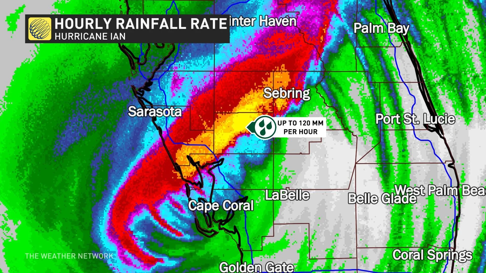
Its effects didn’t stop with wind and waves. The hurricane’s extreme rains led to extensive freshwater flooding for communities well inland across the Florida Peninsula.
Radar estimates showed rainfall rates as high as 120 mm per hour just northeast of where The Weather Network’s Jaclyn Whittal and Mark Robinson rode out the storm in Punta Gorda.
WATCH: Survivors describe riding out Hurricane Ian’s wrath
Will B.C.’s fortunes reverse anytime soon?
It’s not likely.
Another upper-level ridge building over Western Canada will keep the province sunny and unseasonably warm through at least the first week of October.
DON’T MISS: B.C.’s nice weekend may break this unusual weather record
In fact, communities like Vancouver and Abbotsford could come close to recording all-time record high temperatures for the month of October with the mid-20-degree temperatures coming their way in the next few days.
This pattern isn’t very conducive for precipitation, either. In addition to the warmer-than-normal temperatures, “we will also see a delay in the start of the rainy season for B.C.'s South Coast,” according to Dr. Doug Gillham in The Weather Network’s monthly outlook for October.
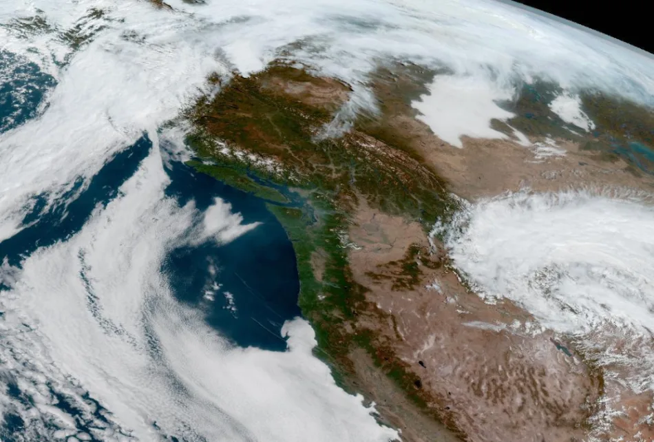
Thumbnail courtesy of NOAA
Stay with The Weather Network for the latest on conditions across British Columbia.