Australian wildfire smoke tracked wrapping around the entire world

A satellite view from space reveals the far-reaching impact of Australia's wildfires
NASA satellites have been keeping a close eye on the smoke billowing into the air from wildfires in Australia. They have now traced it around the entire globe.
The latest bushfire season in Australia is already one of the worst on record, with over 18.6 million hectares burned so far. There are almost daily reports of the increasing toll, not only on the environment and wildlife but also on communities impacted by the fires.
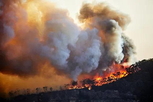
Credit: Getty
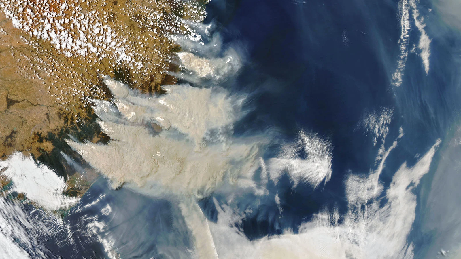
Since the beginning of January, scientists have been tracking a new, global impact. As the wildfires have intensified, immense plumes of smoke have been billowing into the air, drawn out over the Tasman Sea and the South Pacific Ocean, carried by prevailing winds.
RELATED: How climate change is worsening Australia's deadly wildfires
NASA satellites, such as the Cloud-Aerosol Lidar and Infrared Pathfinder Satellite Observation (CALIPSO) spacecraft, as well as the Aqua, Terra and Suomi NPP satellites, have been scanning and imaging the smoke as it has spread farther to the east. Passing over the plumes once every 90 minutes or so, the instruments on these satellites have swept them with lasers, and imaged them with visible and infrared cameras.
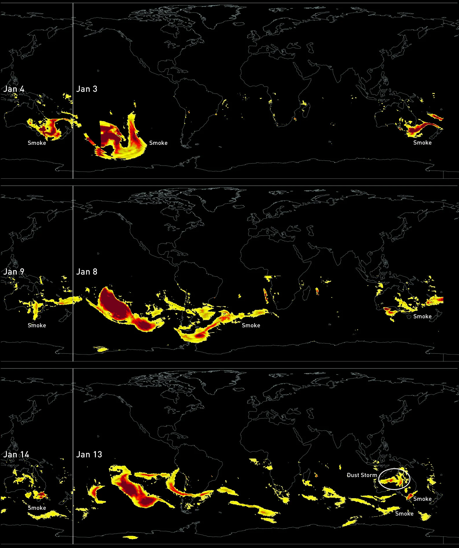
Three panels of aerosol (smoke) data from NASA's Suomi NPP satellite are shown. As the satellite scans from east to west, the data presents the entire southern hemisphere, as well as when the satellite passes the International Date Line to scan Australia the following day. The top panel is comprised of all scans by Suomi NPP from January 3rd through the 4th. The center panel is from January 8th through 9th. The bottom panel is from the 13th through the 14th. Note that the strong aerosol signal over central Australia on Jan 13 is from a dust storm. Credits: NASA Worldview/Scott Sutherland
Between December 31st and January 14th, daily collections of these scans have revealed the smoke slowly tracking around the entire southern hemisphere. From January 13th to 14th, as shown in the image above, even while more smoke billows off the southeast coast of Australia, the leading edge of the plumes emitted earlier in the month has come full circle to reach southeastern Australia once again.
RELATED: How a spark can become a disastrous wildfire in a matter of minutes
According to NASA: "NASA's satellite instruments are often the first to detect wildfires burning in remote regions, and the locations of new fires are sent directly to land managers worldwide within hours of the satellite overpass. Together, NASA instruments detect actively burning fires, track the transport of smoke from fires, provide information for fire management, and map the extent of changes to ecosystems, based on the extent and severity of burn scars. NASA has a fleet of Earth-observing instruments, many of which contribute to our understanding of fire in the Earth system. Satellites in orbit around the poles provide observations of the entire planet several times per day, whereas satellites in a geostationary orbit provide coarse-resolution imagery of fires, smoke and clouds every five to 15 minutes."
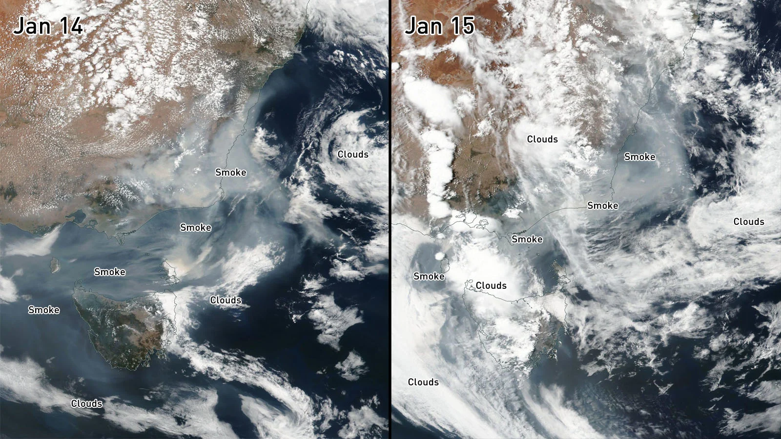
Visible-light camera views of New South Wales and the Tasman Sea from Suomi NPP on January 14 and 15, 2020, show smoke continuing to billow out to sea from bushfires. Credits: NASA Worldview/Scott Sutherland
Even as the wildfire smoke loops back on itself, new satellite images reveal that smoke continues to stream off fires along the coast. According to the latest forecasts from the Australian Bureau of Meteorology, heavy rains are expected across New South Wales for the rest of this week, which will hopefully bring some relief from the spreading fires.
Sources: NASA | NASA | Australian BOM