Impactful winter storm wallops Atlantic Canada, sets 30+ cm sights on St. John's

A wintry system is in the works to wallop parts of Atlantic Canada over the weekend.
The Colorado low that left a messy swath of rain, snow, and ice across Ontario and Quebec is slipping south of the Atlantic region Friday and Saturday, bringing a substantial blanket of snow to parts of Nova Scotia and Newfoundland.
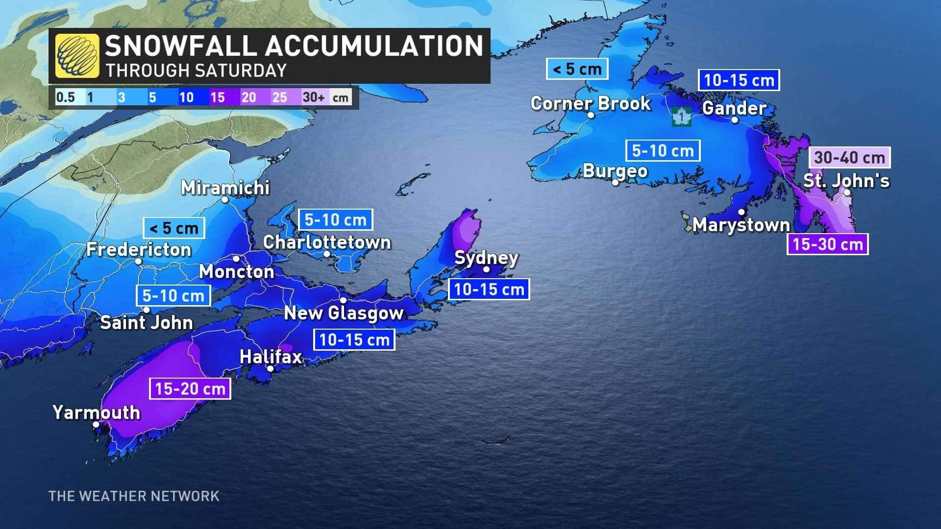
Snowfall on the northern extent of this low will scrape a swath of snow across the southern Maritimes and eastern Newfoundland. Communities near the coast should see higher totals than those further inland.
Halifax has been on track to receive about 10-15 cm throughout Friday. Heavier totals are expected closer to the southern coasts close to Yarmouth, where a potential 15-20 cm may fall by the end of the system.
This system could be the largest snowfall of the season in Halifax, potentially doubling or even tripling the snowfall the region has received so far this season. Observers at the Halifax Airport had only recorded 6 cm of snow so far before this system, whereas Halifax would have typically measured about 90 cm of snow at this point in a normal winter.
READ MORE: Simple tips for checking the safety of your winter tires
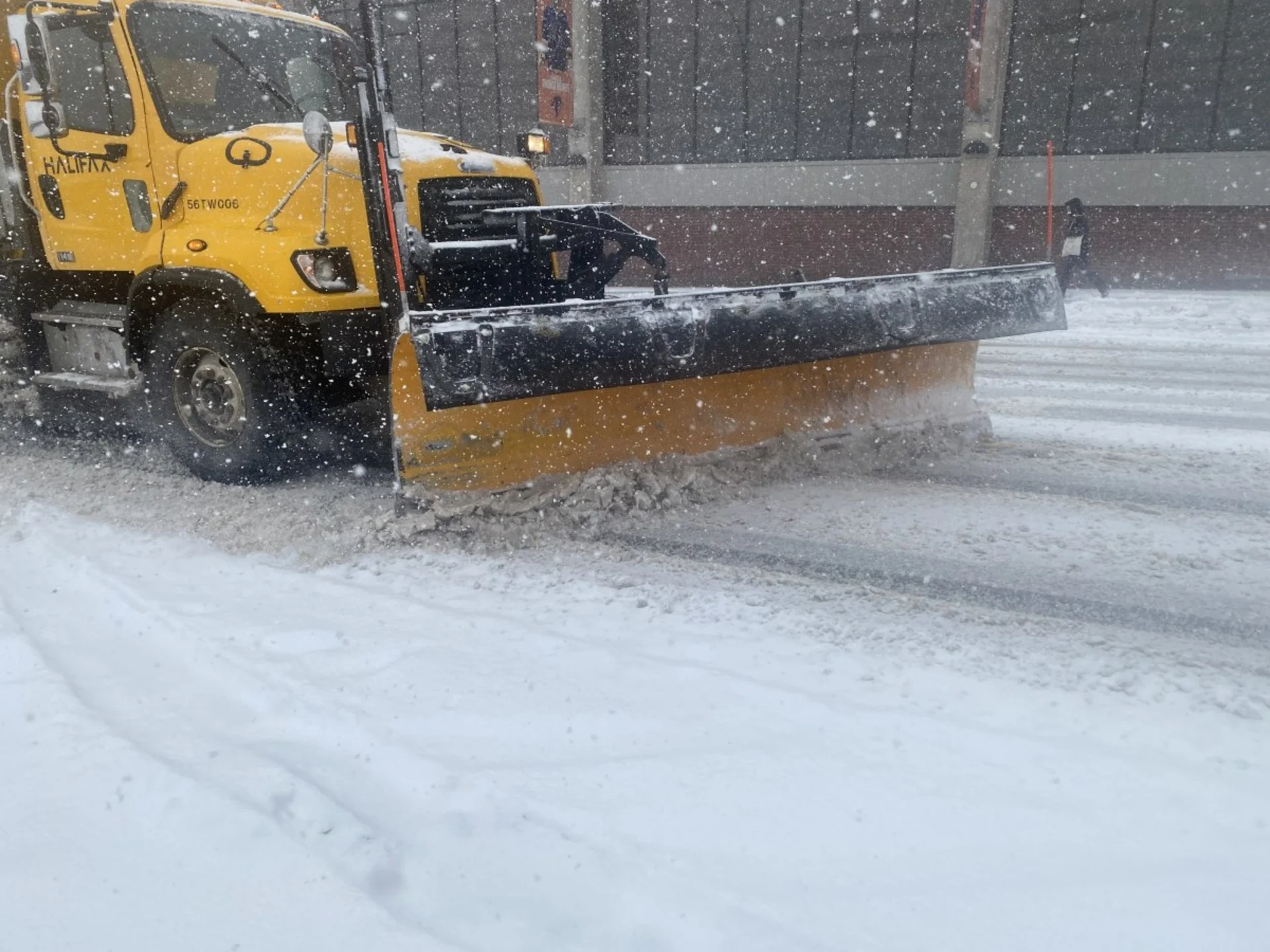
The snow event prompted many school and business closures in Nova Scotia going into Friday. All of Nova Scotia Community College campuses were closed due to the storm. Public libraries in Halifax had also closed for the day.
Halifax Stanfield International Airport cautioned travellers to confirm their flight details before heading to the airport as the storm could prompt flight delays and cancellations.
Environment and Climate Change Canada (ECCC) has issued a snowfall warning for all of the province and Cape Breton.
ECCC urges residents to, “prepare for quickly changing and deteriorating travel conditions. Surfaces such as highways, roads, walkways, and parking lots may become difficult to navigate due to accumulating snow.”
As the low tracks towards the east, it will slightly intensify as it approaches Newfoundland, with even higher snowfall totals projected for the Avalon Peninsula.
Snowfall will arrive in the Avalon Peninsula and St. John’s Friday evening. The heaviest snowfall rates could crash into the region in two bursts - one on Friday night and the other, on Saturday afternoon.
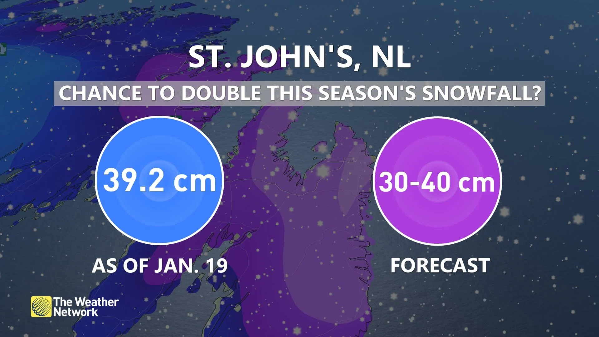
Models have shown a significant range in snowfall totals for the Avalon, but it is not out of the question to see 30-40 cm in the city of St. John’s. It is worth noting that some forecast models have slightly higher snow totals, so check back in with the forecast as we continue to update this upcoming storm.
SEE ALSO: Winter 'vacation' will end soon with return of classic Canadian cold
Like Halifax, St. John’s is also facing the prospect of possibly doubling this season’s snowfall with this storm. The city has recorded approximately 39 cm of snow so far this season.
ECCC has issued a winter storm warning for St. John’s and the Avalon and advises residents of those regions to consider postponing non-essential travel until conditions improve.
This system will head out of the region on Sunday, but it will not be long before the next one arrives in Atlantic Canada.
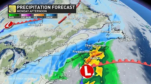
The next system will approach the region Monday and Tuesday. Currently, the system is expected to track further north, leading to a sloppy mess of rain and snow with the heavier snow focused towards New Brunswick and western Newfoundland.
WATCH NOW: Halifax jumps back into winter with more snow than entire season so far
Thumbnail courtesy of Nathan Coleman.
Check back for the latest as this wintry system approaches Atlantic Canada.


