Travel alerts in southern Ontario as snow squalls threaten whiteouts

Localized whiteouts are possible in areas that deal with snow squalls over the next couple of days.
Dangerous travel is likely across parts of southern Ontario over the next couple of days as snow squalls blow over the region. Use extreme caution while traveling through Monday, as conditions can change rapidly over short distances beneath a snow squall. Frigid air will also descend on the province overnight Sunday into Monday. More on the timing and what you need to know, below.
Visit our Complete Guide to Spring 2022 for an in-depth look at the Spring Forecast, tips to plan for it and much more!
THIS WEEKEND: MULTI-DAY LAKE-EFFECT SNOW SETS UP AMID GUSTY WINDS
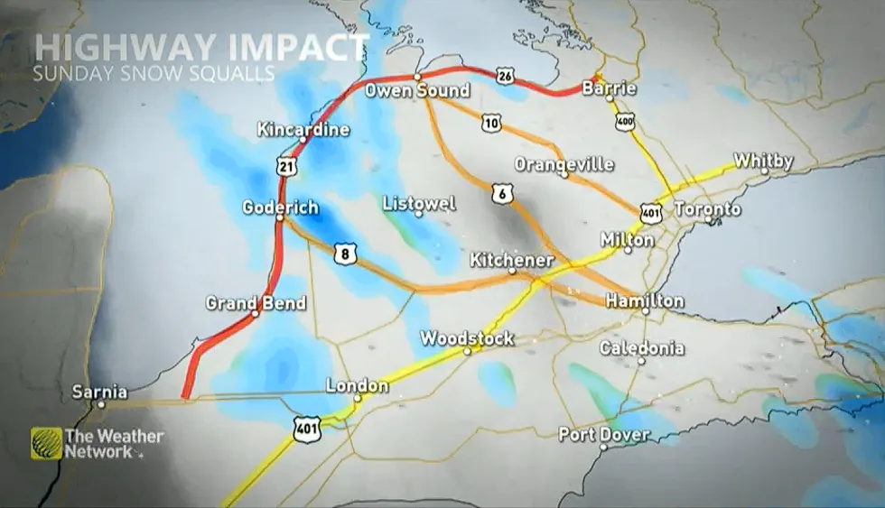
Cold, northwesterly winds blowing over the Great Lakes will trigger occasional bands of lake-effect snow off of Lake Huron and Georgian Bay between Saturday night and Monday. Winter weather travel advisories are in effect for a large portion of southern Ontario ahead of the threat for snow squalls.
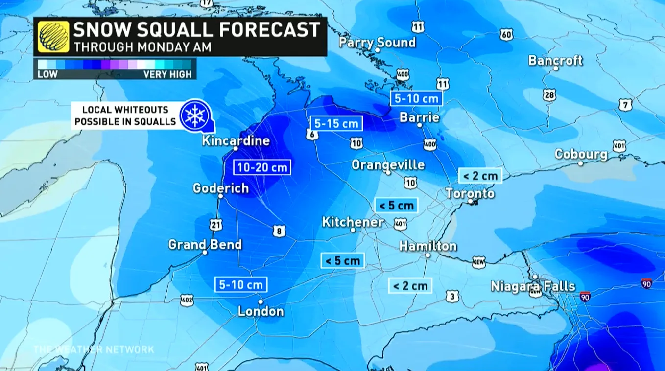
The greatest impacts are expected along and near the Huron shores, where we’ll likely deal with treacherous driving conditions at times starting Saturday evening.
MUST SEE: Toronto will be colder than the Arctic Circle this week
5-15 cm of snow is anticipated in the hardest-hit bands. Travel impacts could extend into parts of the GTA at times. The snow squalls will be more organized during the overnight and early-morning hours.
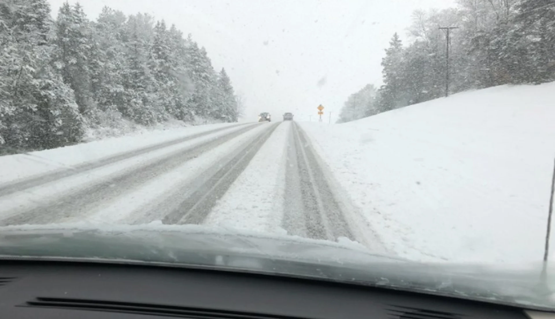
"Prepare for quickly changing and deteriorating travel conditions. Surfaces such as highways, roads, walkways and parking lots may become difficult to navigate due to accumulating snow. Visibility will be suddenly reduced to near zero at times in heavy snow and blowing snow," says Environment and Climate Change Canada (ECCC) in the advisory.
Consider delaying travel plans across the affected areas. Conditions can change rapidly over short distances.
Folks across southern Ontario will have to deal with these snow squalls on Sunday, too, before temperatures plunge to near-record levels in the overnight period into early Monday morning.
IS THE POLAR VORTEX BACK FOR SPRING?
A small lobe of the polar vortex will dip into the Great Lakes region by Monday.
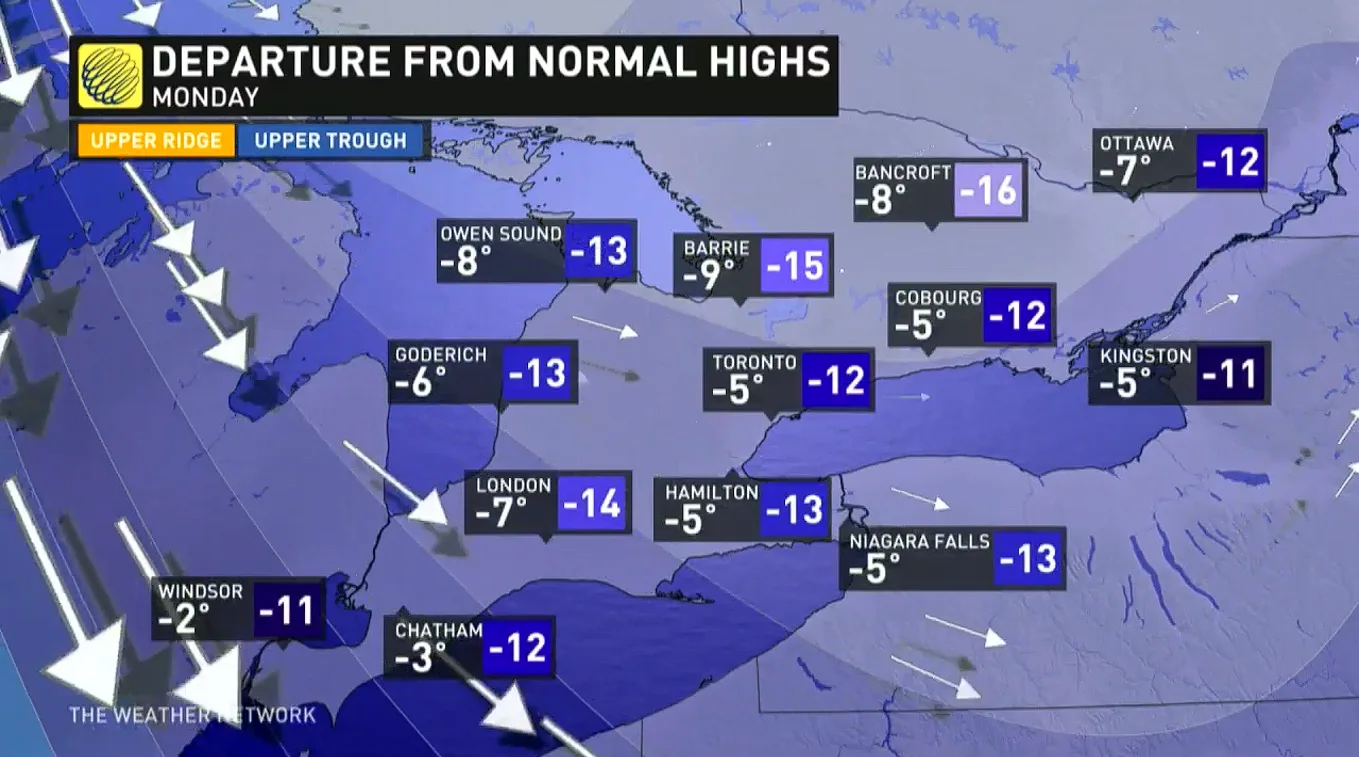
This surge of chilly Arctic air will push temperatures at least 10°C below normal for the end of March and will likely set new record low temperatures.
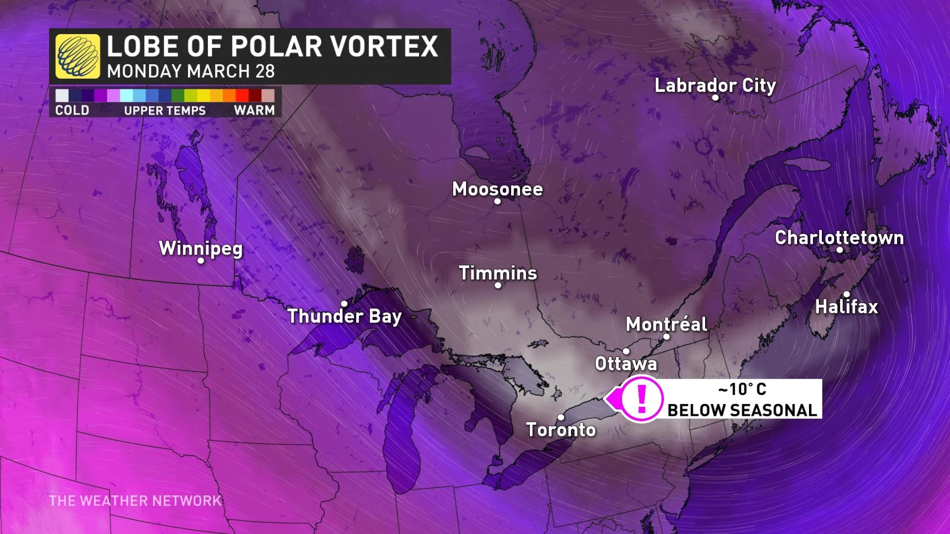
The lobe of frigid air aloft will modify slightly on its trip south this weekend, but it is what's to blame for temperatures being significantly cooler for Monday.
Monday morning’s low temperatures across northern Ontario will dip into the -20s, while parts of southern Ontario will be into the minus double digits and teens.
With some lingering gusty northwest winds, wind chills will make temperatures feel even colder, approaching -20 by early Monday morning. These temperatures will likely be a bit of a shock to the system, as it has been a couple weeks since temperatures have been this cold.
While this sudden temperature dive will prove to be short-lived, chilly temperatures will persist into the beginning of April, with no sustained warm weather in sight.
As well, for next week, another system will track later on Wednesday, as March goes out like a lion. The storm track favours rainfall and a brief warm-up across southern Ontario, but at this point it looks like freezing rain will be possible in some of the same regions that saw the ice on Wednesday.
If this storm takes a track as far to the north and west as the models currently show, then we would see a brief warm-up into the teens in southern Ontario on Thursday.
Be sure to check back for the latest updates on the changing conditions across Ontario.
Subscribe to 'This Day in Weather History': Apple Podcasts | Amazon Alexa | Google Assistant | Spotify | Google Podcasts | iHeartRadio | Overcast