
Bomb cyclone eyes Atlantic Canada with ripping winds, heavy snow

Conditions are ripe for the explosive development of a powerful storm over Atlantic Canada this weekend.
A powerful jet stream streaking over the North Atlantic will set the stage for a storm system that could bring intense winds, heavy precipitation, and maybe even a headache from the sudden pressure drop, to the East Coast as we conclude the weekend and start next week.
DON'T MISS: ‘Weather bombs’: Explosive storms that create ferocious conditions
How a screaming jet stream leads to trouble on the ground
We’ll see this fantastic ribbon of upper-level winds cruise from the southeastern United States straight through the heart of the northern Atlantic -— a jet flying from Atlanta to London would have no trouble arriving on time with a stream this robust.
Such intense winds ripping through the jet stream creates diverging winds aloft. These winds leave a void when they spread out, forcing air to rapidly rise from the surface to take its place.
That much air pulling upward creates a centre of low air pressure at the surface, which gathers strength the longer this setup remains in place.
This is the process we’ll see unfold this weekend, and the end result will be a rollicking couple of days of active weather for Atlantic Canada, with Newfoundland finding itself in line for the worst conditions through early next week.
WATCH: What, exactly, is a weather bomb?
Impacts include blustery winds, heavy rainfall and snow
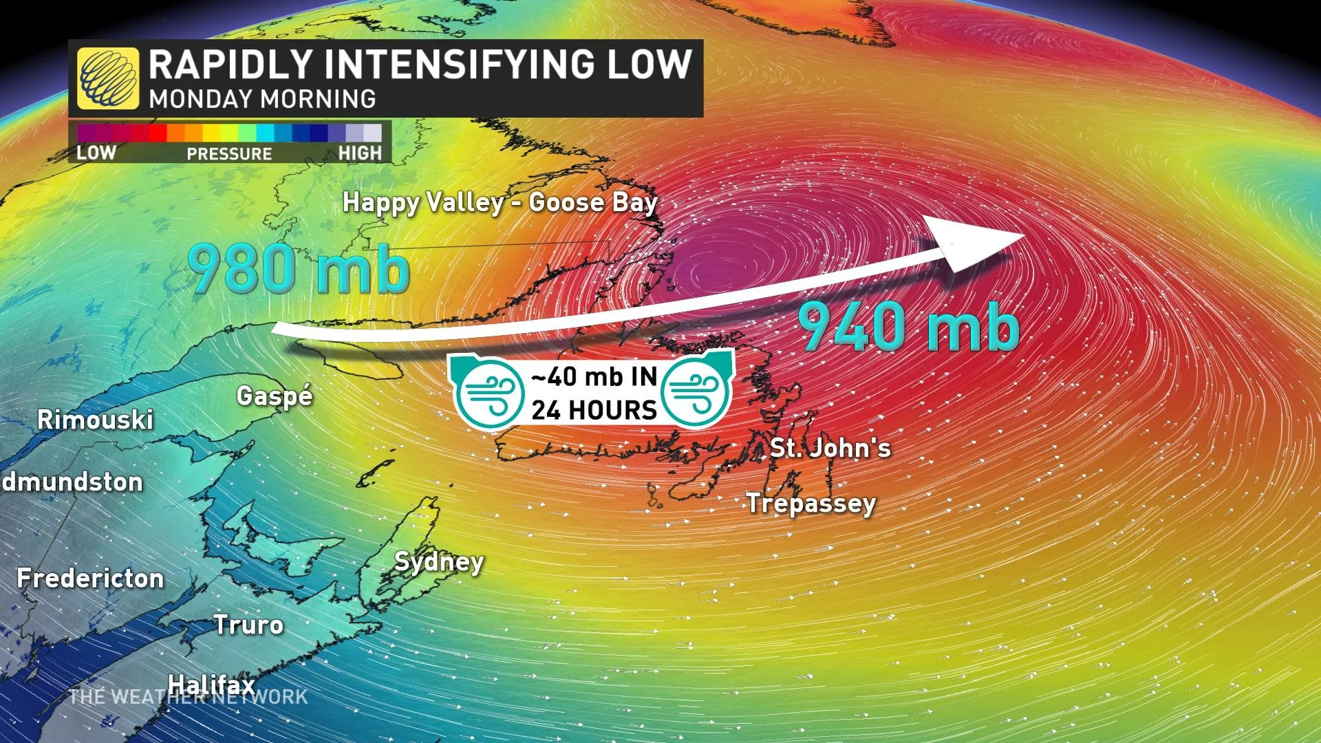
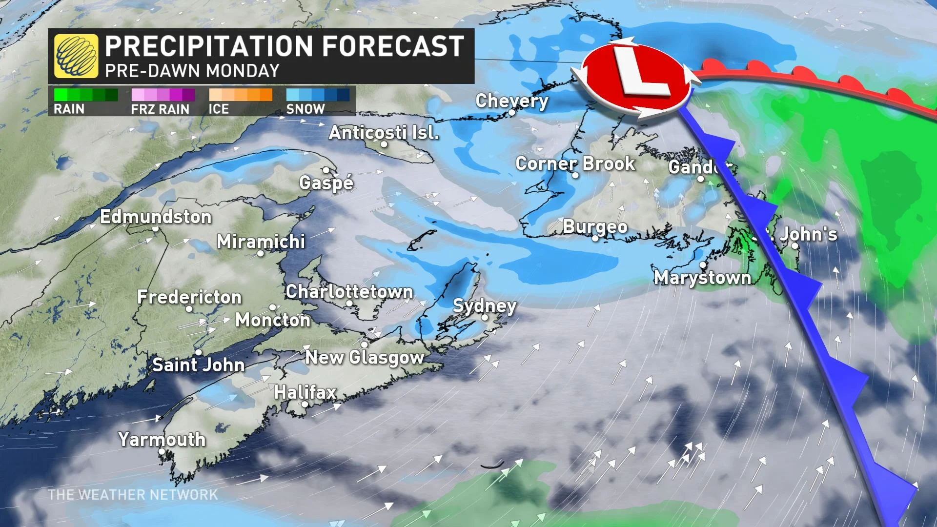
Rainy conditions will start our Sunday across the Maritimes as the low-pressure system begins to develop. The low will begin rapidly deepening through the day Sunday as it crosses the Gulf of St. Lawrence and approaches Newfoundland.
The system will reach peak strength on Monday as the centre of the low pulls north of the island with a minimum pressure equivalent to that of a formidable hurricane.
A pressure drop of 40 mb in 24 hours will easily meet the definition of bombogenesis, or the term meteorologists use to describe a low-pressure system that strengthens very quickly in a short period of time.
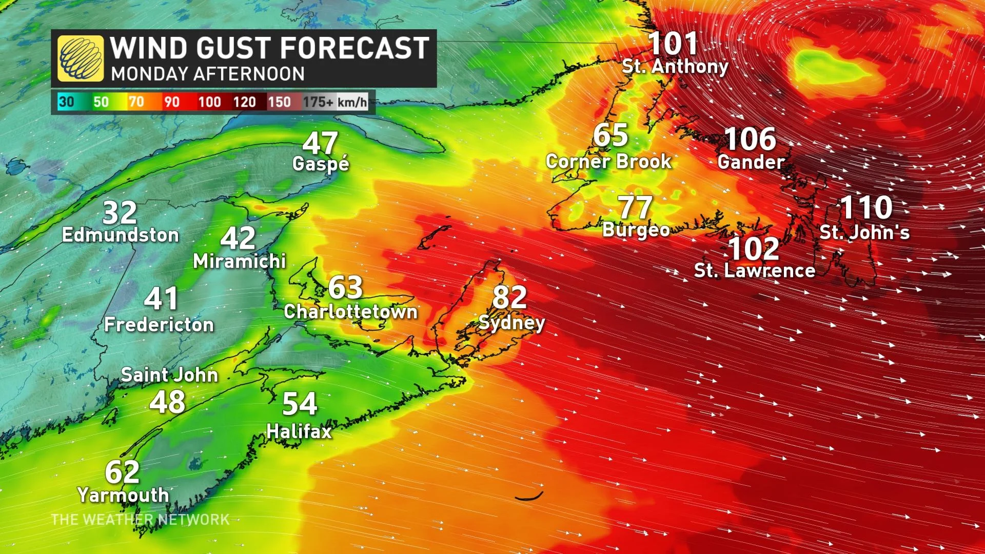
The resulting pressure gradient will lead to ripping winds across Newfoundland, which could easily exceed 100 km/h at times. Residents across the island, especially along coastal areas, should prepare for localized power outages, and secure loose objects that could blow around during high winds.
Cold air blowing in winds behind the low-pressure system will also lead to sea-effect snow across the Atlantic provinces.
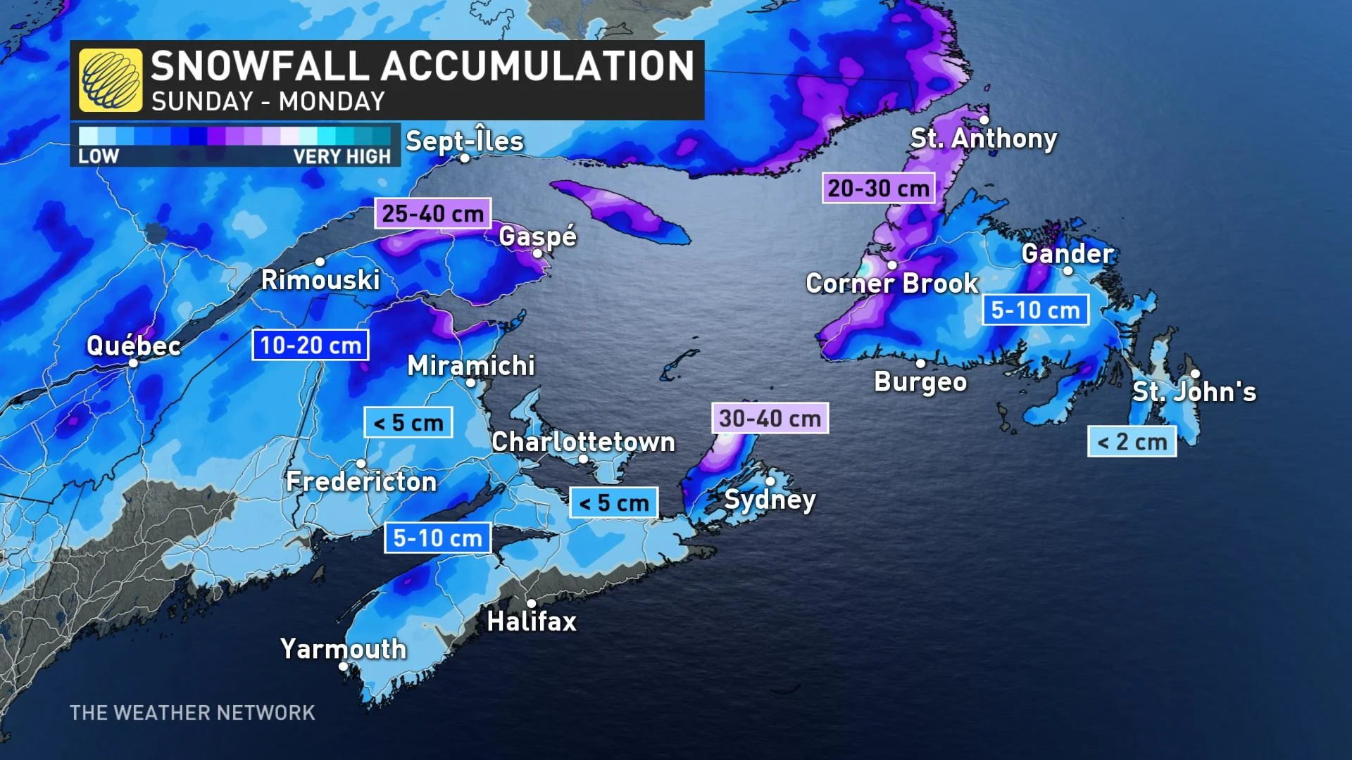
Bands of snow are possible in the westerly and northwesterly winds that set up throughout the region on Sunday into Monday. Wind-driven snow could reduce visibility in spots and lead to difficult travel at times.
Eastern Nova Scotia is in line for a hefty amount of snow, potentially 40-50 cm by the time it ends. Western and northern Newfoundland will also be on the hook for significant snowfall, with 20-30 cm possible.
Stay tuned to The Weather Network for the latest on conditions across Atlantic Canada.