30-degree temperature swing ahead for this part of Canada, here's why

A big temperature drop is in the forecast, due to this impressive setup.
A Chinook setup nudged temperatures into double digits in several southern communities in western Canada on Friday. In Calgary, it was 12°C at noon, dropping by about 10 degrees just a couple of hours later. The wind direction shifted from gusting southwest at 60 km/h at noon to North at 60 km/h by 2 p.m., causing the temperature drop.
This was a small-scale representation of what will happen across western Canada over this week, with parts of Canada set to experience a 30-degree temperature plunge as we head toward the start of December.
RELATED: Never scrape our windows again with this sandwich bag hack
Let's look at Calgary again. By mid-week, the city can expect daytime highs around the -20-degree mark as Arctic air funnels into the area.
Big chill in Alberta
Significantly colder weather is also in the forecast for Edmonton, which can expect 35-degree drop.
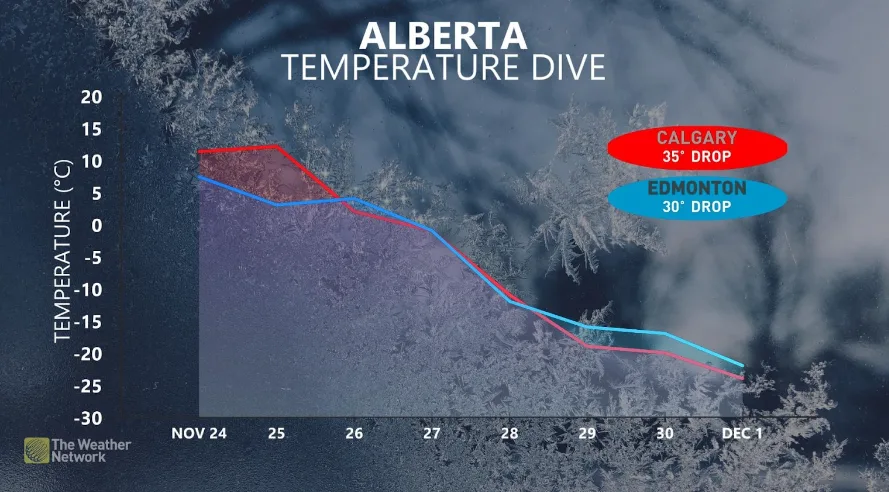
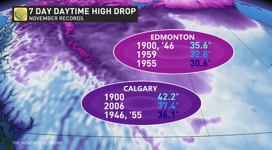
Both Calgary and Edmonton saw their biggest November weekly temperature drop in 1900, and that record will stand. But this week's cold still could be historic, potentially becoming the second or third coldest November drops on record.
How unusual is this temperature roller coaster?
Historically, this type of temperature roller coaster isn't unheard of, especially in parts of Alberta, due to its proximity to the Rockies and northern Canada.
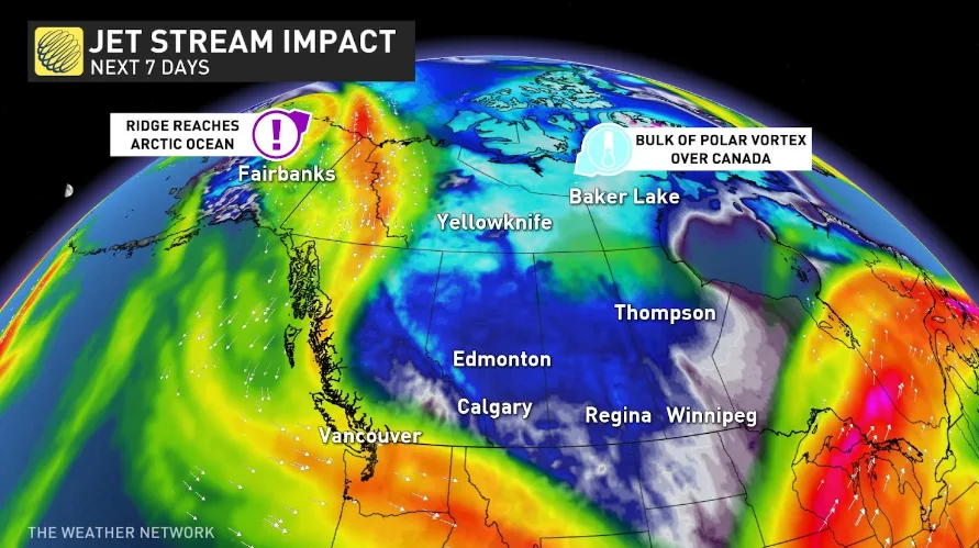
The jet stream that provided the Chinook setup has now given way to a trough. As the trough sinks over western Canada, the ridge will continue to build, almost reaching the North Pole - and here's where things become a bit out of the ordinary.

While transitioning to a ridge over the Pacific and a trough over the Prairies isn't rare, it is rare for that ridge to get a second boost that reaches the Arctic Ocean, while the trough remains over the Prairies, explains Weather Network meteorologist Kevin Mackay.
"That is the makings of a historic event," he says.
"The portion of the polar vortex over Canada will be significantly stronger than the remainder of the polar vortex in Siberia."
The only comparable event was in 2006, when a similar setup allowed abnormally cold air to pour out of the Yukon and into the western Prairies following a similar Chinook event.
This dropped Calgary’s daytime temperature from 17.8°C to -24.4°C in one week.