Heavy snow will impact travel to B.C. ski destinations this weekend

A cold front will cut this weekend in two, bringing heavy snow to the mountain passes and dropping temperatures for next week
Two fronts sliding down the coast will bring a fresh coating of snow to the alpine level through the weekend. While this will be welcomed by ski resorts officially kicking off their winter season, with the freezing levels starting to tumble below 1000 metres ahead of the Arctic air mass for next week, travel this weekend through the passes could get dicey at times.
MUST SEE: Don't call it a comeback, Canada: Winter hasn't even started
"The most challenging drives this weekend will be focused to anyone travelling from the interior to the coast," says Kelly Sonnenburg, a meteorologist at The Weather Network. "The Coquihalla Highway is expected to receive between 20-40 cm of snow with some icy precipitation mixed in as well."
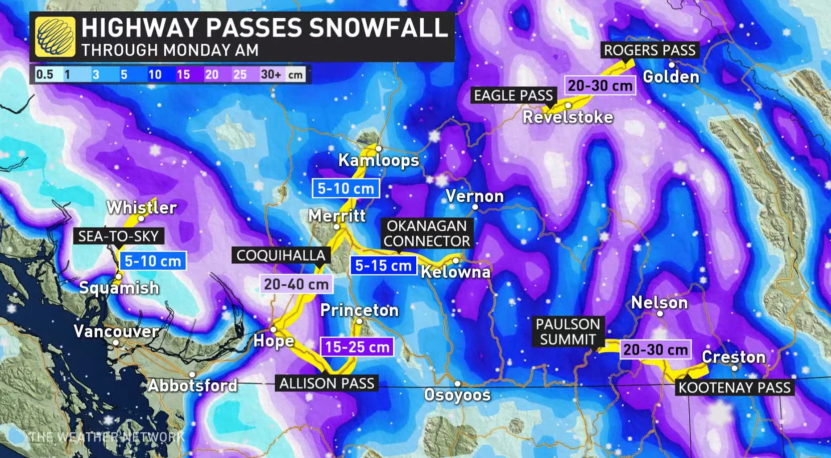
As a result, drivers may want to think about postponing any non-essential travel, especially since weather and visibility in the mountains can change very suddenly.
WATCH: Why this ski season could be the best in three years
Freezing levels will bottom out through the interior, which means cities and communities in the Okanagan will receive anywhere from a couple centimetres up to 10 cm of snow. Further east towards the Rockies, snow will be plentiful, with 15-30 cm expected for the mountain peaks and the Eagle, Rogers and Kootenay passes.
Behind the second front on Sunday, Arctic air will migrate south leading to a frigid air mass settling in by mid to late week next week. Daytime highs to start next week will be in the minus double digits for many in central and northern B.C. and in the minus single digits to start out in the south.
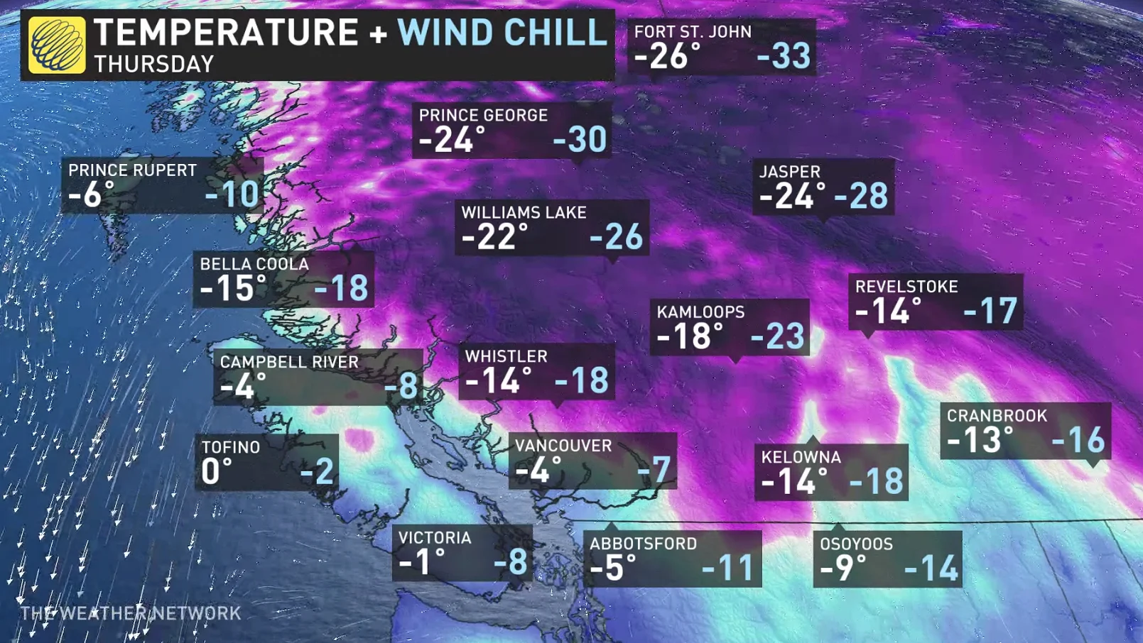
By mid to late week, temperatures in the central and northern interior will plunge into the -20s for daytime highs. Overnight lows in the north will creep towards the -30s, with wind chills making things feel even colder.
Look ahead: Widespread snow threat across the South Coast next week
As the cold air settles in next week, a system from Alaska is forecast to dive towards the South Coast bringing widespread snow.

"With temperatures well below the freezing mark most, if not all, precipitation will fall as snow," says Sonnenburg. "It will have been over three weeks since Vancouver and the lower elevations had received snow, and this event could be much more significant than the last."
PHOTOS: Vancouver's early-season snowfall catches city by surprise
Be sure to check back for the lates updates on the pattern change across B.C.