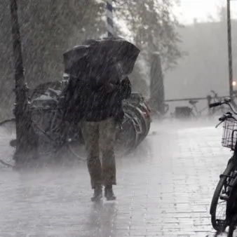
B.C. may endure a month’s worth of rain by early next week

July is typically the driest month of the year across B.C., but a backed-up atmospheric pattern will drench the region through the first full week of the month.
--
A stretch of wet weather is on the way for many communities across southern British Columbia as we head into early next week. July is typically the driest month of the year in B.C. This year, however, we could see a whole month’s worth of rain in a few days. More on the timing and what you can expect, below.
CANADA’S JULY FORECAST: Summer sizzle or does the heat fizzle? Your monthly outlook, here
SUNDAY THROUGH TUESDAY: UNUSUALLY RAINY FOR JULY, FLOODING POSSIBLE
A jammed-up upper-level pattern is to blame for the upcoming stretch of rainy conditions.
We’re seeing a rex block across Western Canada this weekend. This upper-level blocking pattern occurs when an upper-level low gets caught beneath an upper-level ridge, essentially jamming up the jet stream and forcing a stagnant pattern to remain in place for days—and even weeks in extreme cases.
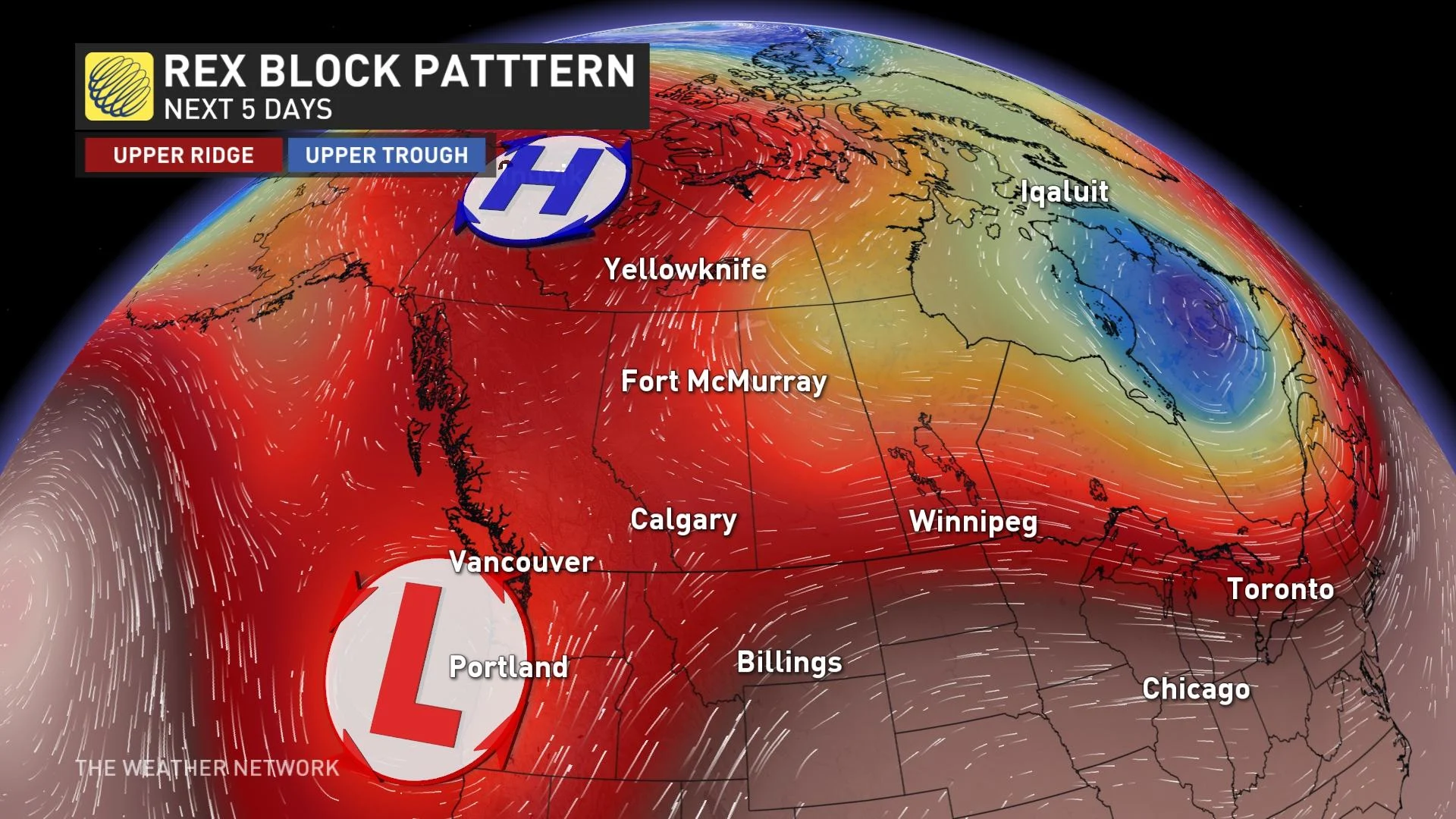
While communities in the Arctic Circle endure an impressive stretch of abnormal heat as a result of that stubborn ridge, B.C. will fall on the unsettled side of the blocking pattern with that upper-level low stuck over the region.
This pattern is responsible for the impending stretch of rain that’ll start to wash over the South Coast and Lower Mainland beginning Sunday and lasting into Tuesday. B.C. should expect heavy showers and thunderstorms to parade across the province through the first half of the week.
DON'T MISS: Here’s what to stock your vehicle emergency kit with, BEFORE you hit the road
A steady, gloomy rain will begin to build over the region through the day on Sunday, which will likely be the heaviest rainfall day as we head into the beginning of the new work week.
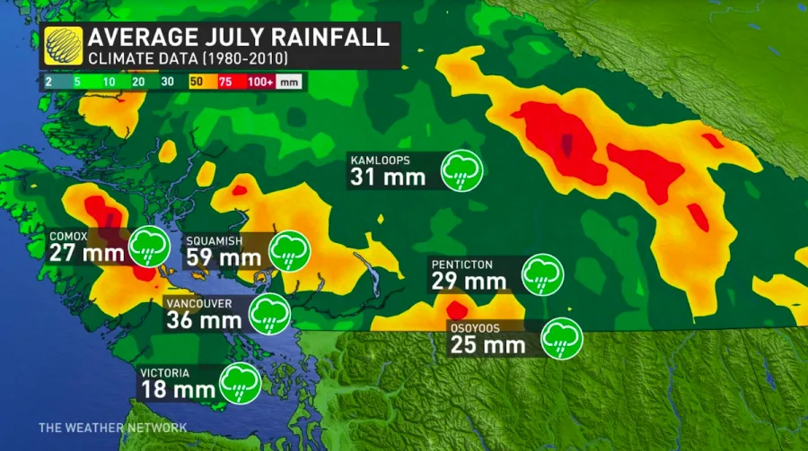
All told, the precipitation will amount to 30-50 mm for much of the region, with isolated pockets of 50+ mm possible. This may not sound like much, but given that July is typically pretty dry, that’s nearly a month’s worth of rainfall for some locations by July 4.
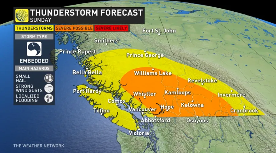
On Sunday, there will be the risk of non-severe, scattered thunderstorms in the Interior and the coastal regions. However, there is the risk for stronger storm dynamics across the Lower Mainland. Several watersheds are seeing elevated flow rates from ample runoff from snowmelt, and the heavy bursts of rains are poised to cause additional flood risks during the first week of July.
LOOKING AHEAD: SCATTERED RAIN AT TIMES, AROUND SEASONAL
Rain will start to clear out of southern B.C. on Tuesday, leaving behind a chance for scattered showers and thunderstorms through the remainder of the week.
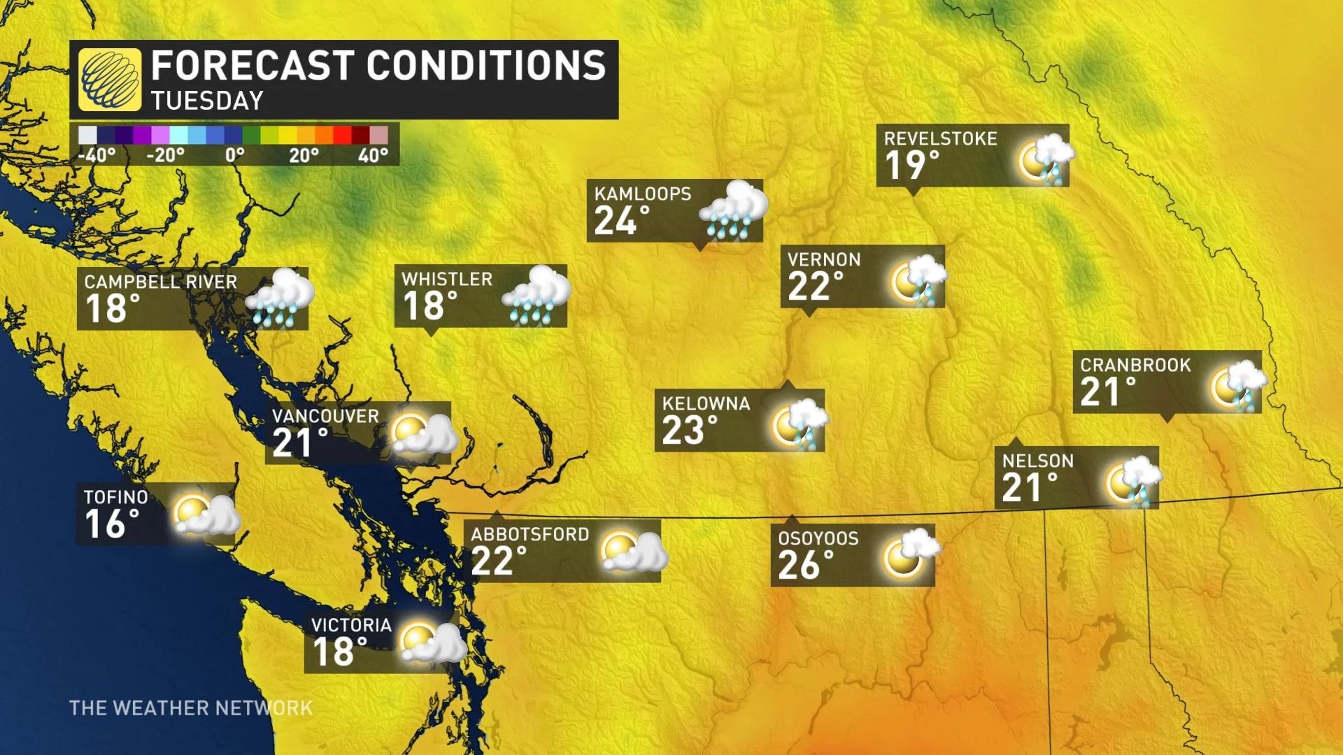
We’ll escape any summer-like heat across B.C. as we make our way through the first week of the month. Temperatures should come in around or slightly below seasonal over the next seven days, with highs hovering around 20°C for the duration in Vancouver.
Check back for the latest details on the rain heading for British Columbia.