What is La Niña? And why is it disrupting our winter
Visit this Fall Forecast Guide to the Season for the Fall Forecast, Winter Weather Preview and more.
Meteorologist/Science Writer
Friday, November 18, 2016, 3:13 PM - La Niña - the cold phase of the El Niño Southern Oscillation (ENSO) - has a strong influence on the world's weather, just like its "warm phase" counterpart.
![]() Will a strong La Niña follow near-record El Niño 2015? | What is El Niño?
Will a strong La Niña follow near-record El Niño 2015? | What is El Niño?
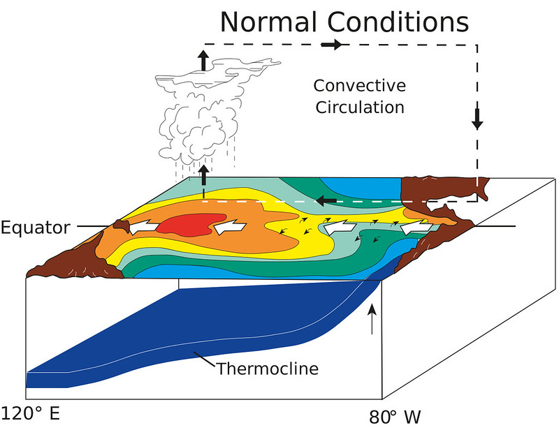
As influential as El Niño can be on the world's weather, one can only last so long, due to a built-in limiting factor.
When equatorial Kelvin waves, which support the growth of and sustain an El Niño, deliver their payload of heat eastward across the Pacific Ocean, they hit the South American coast and are reflected back towards the west. These waves, known as Rossby waves, travel along the thermocline and at the surface to the north and south of the equator. Taking roughly six months to traverse the ocean, these Rossby waves reach the coastlines of southeast Asia and are reflected again, back towards the east.
This cycle continues with each successive Kelvin wave, and when the eastward-reflected Rossby waves from Asia encounter the westward-reflected Rossby waves from South America, their interaction erodes the entire El Niño pattern.
Eventually everything settles back into the normal state again.
|
|
|
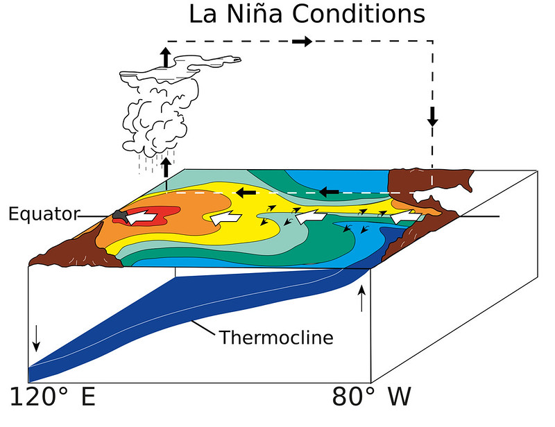
Once in awhile - especially when you have a particularly strong El Niño - as the pattern finally breaks down, Rossby waves can continue to propagate back and forth across the ocean well after the El Niño is done. This keeps pushing the system in the direction of "normal" which results in a kind of "hyper-normal" state.
This situation, with stronger than normal westerly winds pushing warm surface waters even farther to the west than usual, thus causing an even stronger and wider upwelling of cold water in the east, is known as a La Niña.
Watch all of this happen in the video above, which shows the decay of the 2009-2010 El Niño and the development of the 2010-2011 La Niña.
When La Niña conditions develop, it usually means a colder winter for the western half of Canada, which even impinges on Ontario as well at times, and there's typically wetter conditions along the west coast and near the Great Lakes.
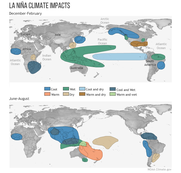
Typical impacts of La Niña on the world during Northern Hemisphere winter and summer. Credit: Climate.gov
Along with that, the eastern Pacific hurricane season tends to be quiet, while the Atlantic season ramps up - with more tropical storms and hurricanes, and more major hurricanes as well.
For example, during the El Niño of 2009, the Atlantic saw only 6 tropical storms and 3 hurricanes, 2 of which became major hurricanes (category 3 or higher). The following year, under strong La Niña conditions, there were 7 tropical storms and 12 hurricanes, 5 of which were major hurricanes. When the La Niña persisted, albeit weaker, in 2011, there was a similar number of storms (although the details were reversed - 12 tropical storms, 7 hurricanes, 4 of which were major hurricanes).
Back to: What is El Niño?
Sources: NOAA | Climate.gov


