Four map forecast: Severe weather watch continues
Digital Reporter
Thursday, April 28, 2016, 11:27 AM - The severe weather threat continues for the U.S. Meanwhile, hope continues to fade for warmer temperatures heading into the first week of May in Atlantic Canada. Here's your weather overview for Thursday, April 28.
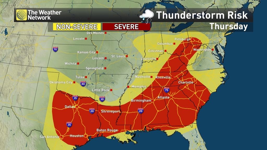
We'll start with the U.S., where a severe weather threat continues to impact the country. "On Thursday, the low will continue its track through the Upper Midwest into the northeast with a frontal boundary extending back west southwestward across the Upper Midwest, the Tennessee River Valley, through the central and southern plains, and then back up through the northern High Plains, and then off into the west," writes Weather Network meteorologist Brad Rousseau.
"Across the severe risk area will be the potential yet again for strong winds, large hail, and heavy rain with the slight risk for some flash flooding mainly across the southeast."
High pressure sinking in from the north will bring mainly sunny skies to the eastern Prairies, keeping conditions dry through the weekend. Temperatures will be near or just a touch below seasonal through the weekend, warming even further into next week with a building ridge. According to Weather Network meteorologist Michael Carter, May is looking much more consistent in the west.

Computer models are now in better agreement for a system set to impact southern Ontario this weekend. "Showers will start spreading into southwestern Ontario Saturday evening, spreading through the Greater Toronto Area during the pre-dawn hours on Sunday," says Weather Network meteorologist Kelly Sonnenburg. "Some models are keeping the bulk of the moisture stateside while others bring it straight through southern Ontario."

The same system set to bring rain to parts of Ontario on Sunday will continue to track into the Martitimes as a rather potent system early next week. Strong winds, rain and even some snow is likely for the first week of May with below seasonal temperatures expected as well.


