B.C.'s spring snowpack is the lowest on record, increased wildfire risk
Relatively dry conditions continued across most of the province through March, report says
British Columbia's snowpack is the lowest it's been at this time of year since records started being kept in 1970, and those conditions could exacerbate a province-wide drought, according to the latest bulletin from the B.C. River Forecast Centre (BCRFC).
As of April 1, the provincial snowpack was 63 per cent of normal, with warming seasonal temperatures slowing snow accumulation. At this time last year, the snowpack measured 88 per cent of normal.
"Low snowpack and seasonal runoff forecasts, combined with warm seasonal weather forecasts and lingering impacts from ongoing drought, are creating significantly elevated drought hazards for this upcoming spring and summer," the snow and water supply report said.
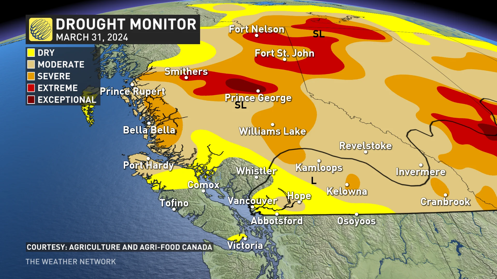
B.C. Drought Monitor as of March 31, 2024. "SL" represents short-term drought, typically less than 6 months (e.g., agriculture, grasslands). "L" represents the region of a long-term drought over 6 months (e.g., hydrology, ecology). (Source: Agriculture and Agri-Food Canada)
DON'T MISS: Encore skiing as some Western Canada resorts extend the season
The areas of biggest concern are the Chilcotin, Skeena-Nass, Upper Fraser East and Quesnel regions.
Approximately 95 per cent of the annual snowpack is typically already on the ground at this time of year.
The report said dry conditions continued across most of the province through March, including several locations in the northern and Interior regions of the province that measured near-record low precipitation.
Vancouver Island was the only area that saw a normal amount of precipitation in March, it said.

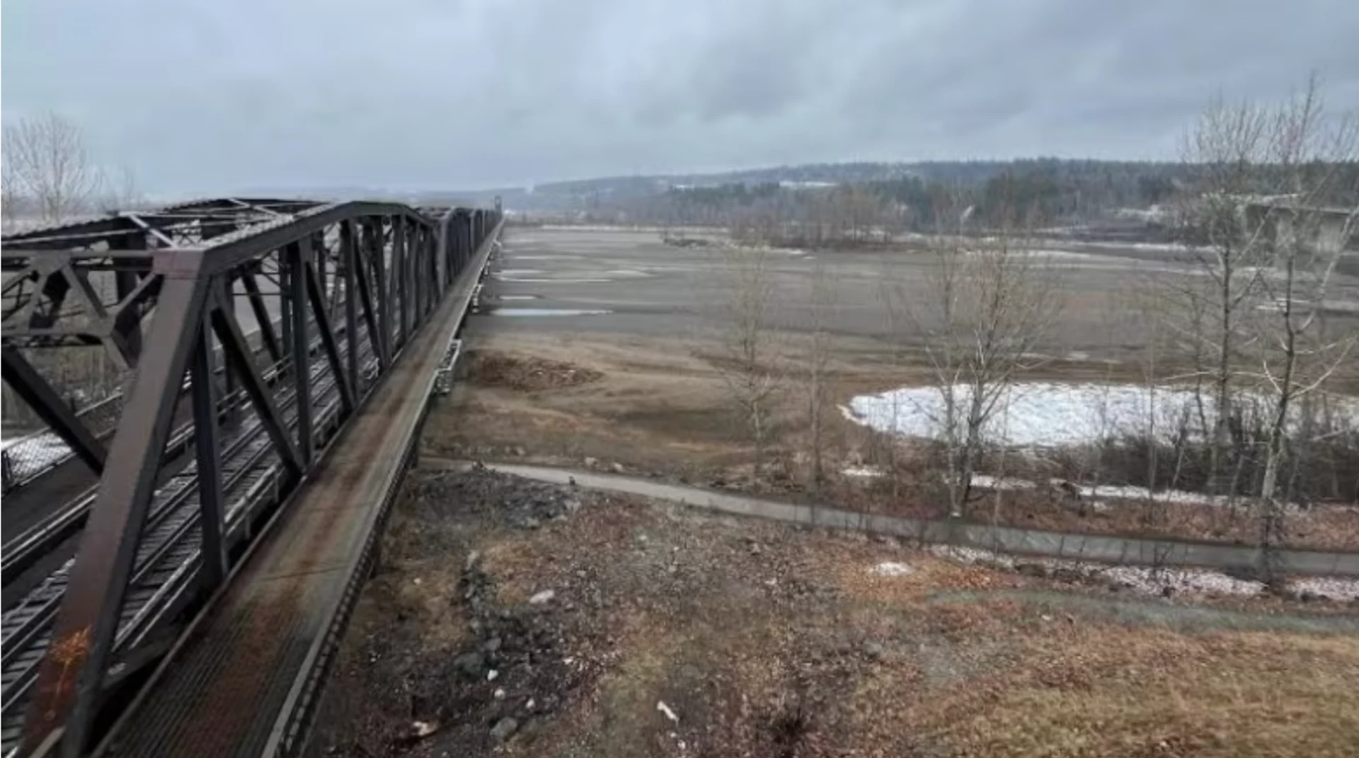
Extended drought has resulted in extremely low water levels at the confluence of the Fraser and Nechako Rivers near Prince George, B.C. (Andrew Kurjata/CBC)
RELATED: Flood risk in B.C.'s Lower Mainland will intensify by 2100: report
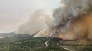
Increased risk of wildfire
Lori Daniels, a University of B.C. forestry professor and chair of the Centre for Wildfire Coexistence, said the report is pointing to a long, dry fire season ahead.
"We know that we're in a multi-year drought so these are places that already had low precipitation last summer, where we had big fires as a result," said Daniels.
"We went right through the fall with low rainfall, not enough snow through the winter, which means that our forests are already dry and are going to be vulnerable to fire this summer."
RELATED: Officials already preparing for potentially active 2024 wildfire season in B.C.
BCRFC hydrologist Jonathon Boyd said it is possible the snowpack could increase into May if it is a cold or wet spring, adding that the "silver lining" is that flooding risk is lower for areas that consistently flood.
However, he says it is still possible for sudden or extreme rainfall or persistent heavy rain to cause flooding "especially in smaller- or medium-sized rivers in the Interior."
"We'll see what happens over the next maybe three to four weeks in terms of temperatures," he said during a news conference Wednesday. "Ideally, what we'd like ... is seasonal temperatures with a little bit of precipitation."
WATCH: B.C.'s 2023 wildfire season was the most destructive and costly yet
This article, written by Karin Larsen, was originally published for CBC News.