A looming December chill could boost Canada’s white Christmas odds

A deep chill is lurking on the horizon that could boost your odds of waking up to snow on the ground come Christmas morning.
If you’re aching to see a white Christmas, Canada, our upcoming pattern might be the kind of setup you’ll want to root for.
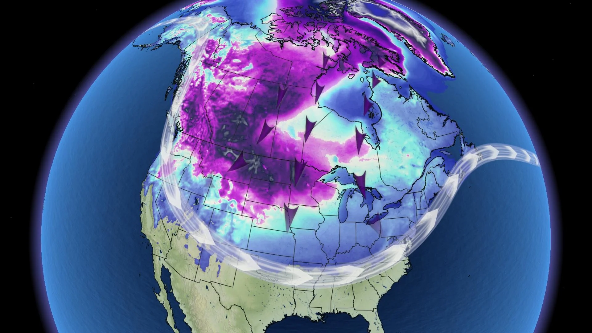
We’re staring down the potential for a widespread chill to blanket a large portion of the country for the last half of December, courtesy of a significant ridge that forecasters expect to build over Alaska just before the holidays.
If this potential plays out as models suggest, it’ll open up the floodgates for Arctic air to spill across the western half of the country and continue pouring south into the States.
DON'T MISS: Triple-dip La Niña and polar vortex to deliver a frigid start to winter
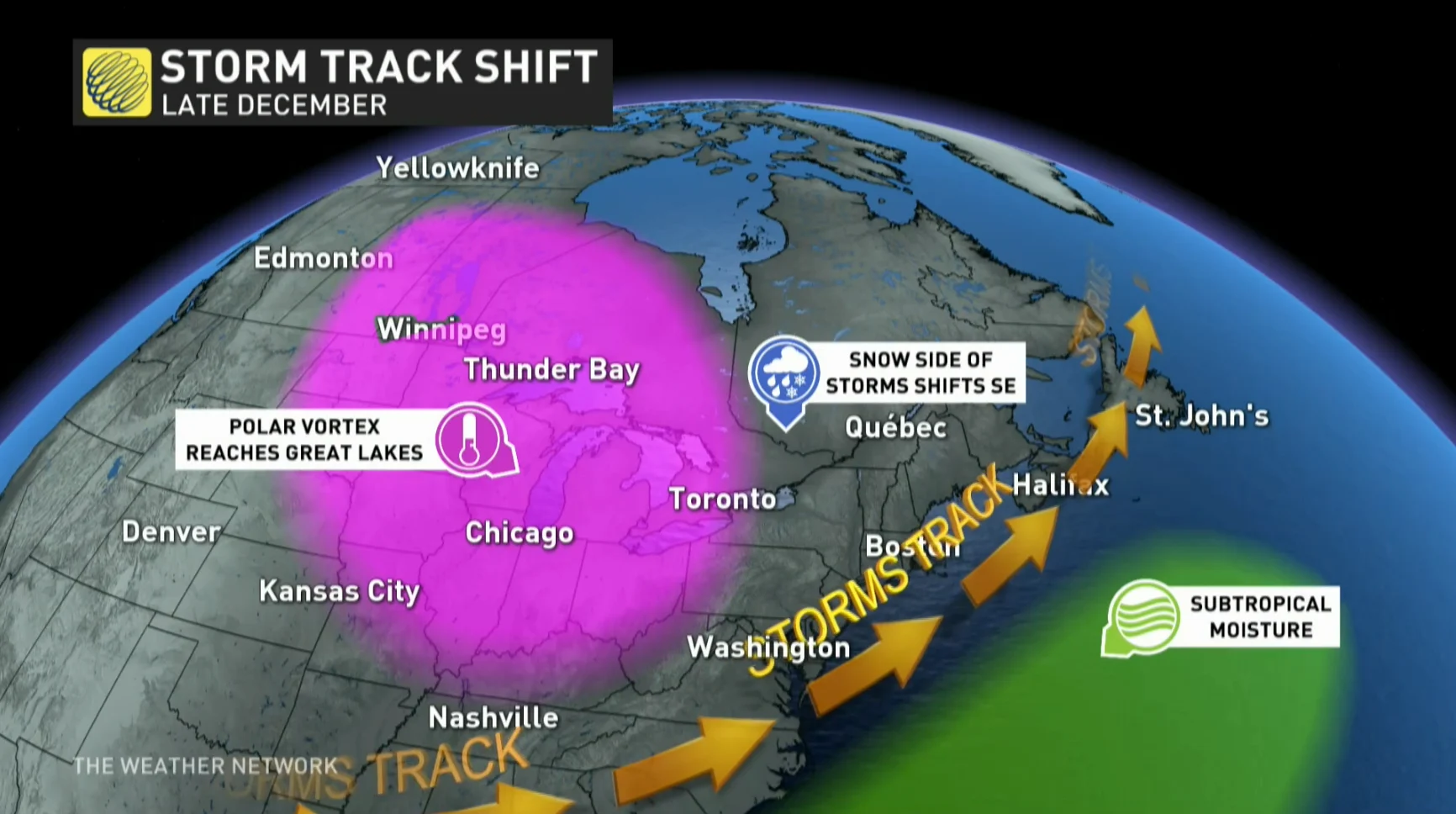
The combination of cold air in place over Canada and an active storm track bubbling south of the border could create multiple opportunities for snow that may stick around long enough to lend some seasonal ambiance to your holiday mood.
We’re currently under the influence of a huge upper-level ridge over Greenland, a blocking pattern that’s gummed up the storm track this week.
That pattern will start to break down a bit heading into next week, allowing an amplified jet stream—one that’s wavy, creating big ridges and troughs—to bring some active weather to North America next week.
Behind that, though, forecasters are keeping an eye on the potential that a significant ridge will build over Alaska in the week leading up to Christmas.
While a steep Alaskan ridge will keep the 49th state unusually warm for this time of year, it leads to cross-polar flow for Canada, creating what amounts to a conveyor belt of Arctic air spilling south.
WATCH: Why winter makes your cold symptoms worse
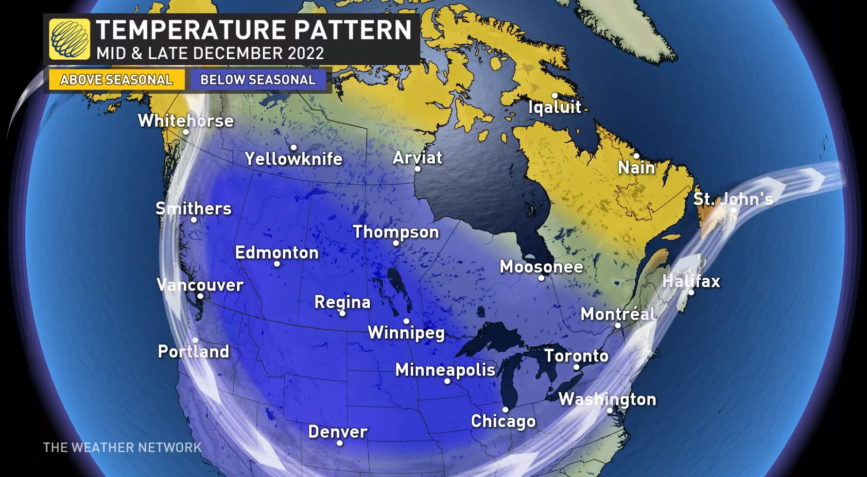
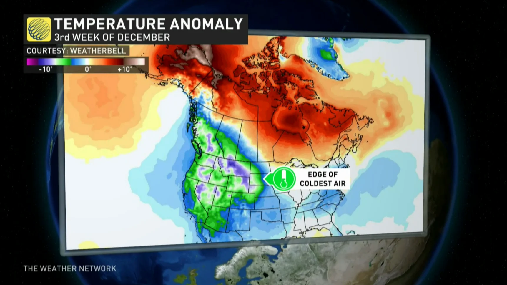
The western Prairies stand to take the brunt of this pre-holiday chill, with an extended period of very cold weather arriving after next week. There are signs that the chill will begin to poke east toward the Great Lakes by the fourth week of the month.
MUST SEE: 14 gift ideas to make your vehicle a useful and welcoming place
While the general pattern is becoming clearer, it’s still far too early to sniff out specifics like precisely where and how much snow may fall with a pattern like this.
The two remaining questions are how far east the cold will slide, and how many storms will slide far enough north to take advantage of this setup?
Those two factors won’t just determine how many folks across the country experience a firm helping of winter weather, but it may also determine your odds of seeing a white Christmas. A stormier and colder pattern will beef up the odds of having snow on the ground come Christmas morning.
Stay tuned to The Weather Network for the latest on conditions across Canada this month.