Active AlertsRenfrow, OK
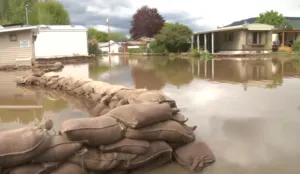
You should monitor later forecasts and be alert for possible FloodWarnings. Those living in areas prone to flooding should be preparedto take action should flooding develop.
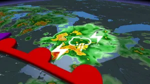
* WHAT...Flooding caused by excessive rainfall is possible.* WHERE...Portions of central, east central, northern, and southeastOklahoma, including the following counties, in central Oklahoma,Canadian, Cleveland, Kingfisher, Lincoln, Logan, McClain,Oklahoma, Payne and Pottawatomie. In east central Oklahoma,Pontotoc and Seminole. In northern Oklahoma, Garfield, Grant, Kayand Noble. In southeast Oklahoma, Coal and Hughes.* WHEN...From 7 PM CDT this evening through Tuesday morning.* IMPACTS...Excessive runoff may result in flooding of rivers,creeks, streams, and other low-lying and flood-prone locations.* ADDITIONAL DETAILS...- Heavy rainfall this evening and overnight has the potentialto produce flash flooding.- http://www.weather.gov/safety/flood
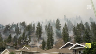
Remain alert for a possible tornado! Tornadoes can develop quicklyfrom severe thunderstorms.This storm is producing large hail. SEEK SHELTER NOW inside a sturdystructure and stay away from windows.
At 658 PM CDT, a severe thunderstorm was located near Jefferson,moving east at 35 mph.HAZARD...Golf ball size hail and 60 mph wind gusts.SOURCE...Radar indicated.IMPACT...People and animals outdoors will be injured. Expect haildamage to roofs, siding, windows, and vehicles. Expect winddamage to roofs, siding, and trees.Locations impacted include...Jefferson.