Fred weakens as it crosses the Dominican Republic, could hit Florida by Sunday

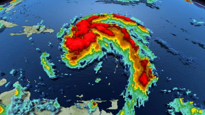
Tropical Storm Fred came to life on Tuesday night, becoming the Atlantic's sixth named storm of the season south of Puerto Rico, though it lost its tropical status as it crossed the Dominican Republic Wednesday night.
After something of a lull, the 2021 Atlantic hurricane season rumbled back to life earlier this week with the formation of Tropical Storm Fred Tuesday night.
The storm gradually trekked toward the island of Hispaniola, making landfall in the Dominican Republic later Wednesday.
Based on the latest update from the U.S. National Hurricane Center, Fred rapidly lost strength as it traversed the island, and as of 8 p.m. EDT Wednesday the storm was a tropical depression, with maximum sustained winds of 55 km/h.
On the forecast track, the centre of Fred is to exit Hispaniola in the early morning hours of Thursday, on a track parallel to Cuba, and presently looks to regain tropical storm status by Friday.

The storm is expected to bring some 75-125 mm of rain to the Dominican Republic, with isolated local extremes around 200 mm. 25-75 mm of rain is expected over Haiti, the Turks and Caicos, eastern Bahamas and eastern Cuba, with isolated maximum totals of 125 mm possible.
"Heavy rainfall through Thursday morning could lead to flash, urban, and small stream flooding, along with possible rapid river rises and the potential for mudslides," the NHC said in a message related to the Dominican Republic.

FORECASTERS CLOSELY WATCHING HOW THIS SYSTEM INTERACTS WITH PUERTO RICO AND HISPANIOLA
According to Dr. Doug Gillham, a meteorologist at The Weather Network, how this system interacts with Puerto Rico and Hispaniola will be critical to the threat to Florida and the Gulf of Mexico this weekend and early next week.
"After tracking across Hispaniola and likely being downgraded to a depression, Fred should regain tropical storm status once back over the open ocean as it tracks just north of Cuba through Friday, near the southern tip of Florida Friday night, and then into the eastern Gulf of Mexico for the weekend," Gillham says. "There's the potential for landfall on the Florida Panhandle Sunday night."
While the intensity is still highly uncertain, the overall pattern will become conducive for significant intensification to a hurricane, but intensification will likely be hindered by its close proximity to Cuba.
Forecasters warn that this is likely the beginning of an active period, with the potential for another significant system next week as the eastern Pacific continues to be very active as well.
Stay tuned to The Weather Network for the latest updates on Tropical Storm Fred.