Quick shot of snow precedes threatening cold on the Prairies

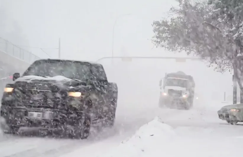
Bursts of heavy, blowing snow are possible on parts of the Prairies Friday, ahead of some wickedly dangerous cold temperatures and wind chills this weekend.
After a shot of snow to round out the week in Alberta, the Prairie region is staring down the tightening grip of the polar vortex, which has descended to cover the entire region with Arctic air that will drive temperatures down to -30°C in some areas this weekend, feeling closer and possibly even colder than -40 Sunday and Monday, with only a scant warmup beyond. For a deeper look, see below
WEATHER HIGHLIGHTS
Arctic air settles in after descending Friday for the entire Prairie region
Daytime highs may struggle to reach -30°C for the coldest communities, feeling like -40 with the wind chill
Extreme cold relaxes somewhat late next week, but still below seasonal
THE WEEKEND AND BEYOND: POLAR VORTEX SINKS SOUTH, DANGEROUSLY COLD TEMPERATURES TO COME
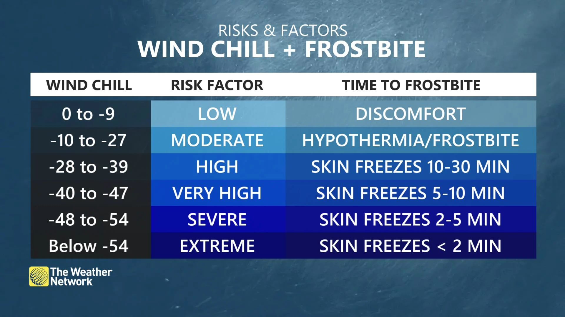
Dangerous cold will persist through the weekend and next week. Temperatures will plunge to -35°C to -45°C, with hazardous wind chills in the -40s and even below -50.
Daytime high temperatures on Sunday will remain below -30°C for Saskatoon, Prince Albert and surrounding areas. So overnight lows will be much colder than that.
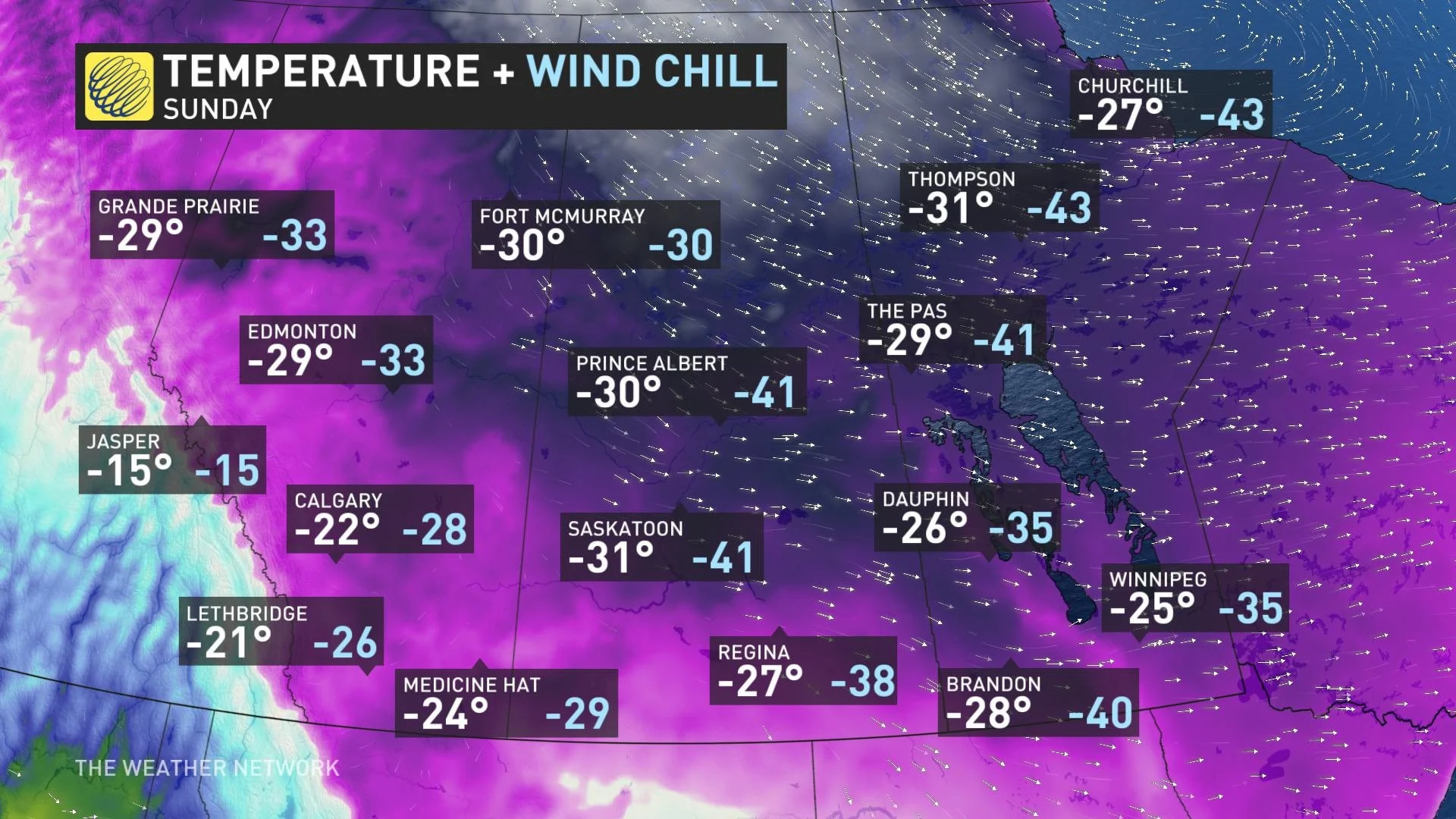
That's before factoring in the wind chill, which will make it feel at or slightly above -40 even at the peak of the day in parts of Saskatchewan and Manitoba Sunday. Even parts of Alberta, whose daytime highs will "only" fall as low as the low minus-20s, like Calgary, Medicine Hat and Lethbridge, will shiver in wind chills bringing them closer to -30.
That's some serious cold, even exceeding parts of the actual Canadian Arctic. Winnipeg's Sunday high will be below Whitehorse's -- and with a forecast high of -3°C that day, Iqaluit will be warmer than anywhere on the Prairies due to comparatively warmer easterly flow.
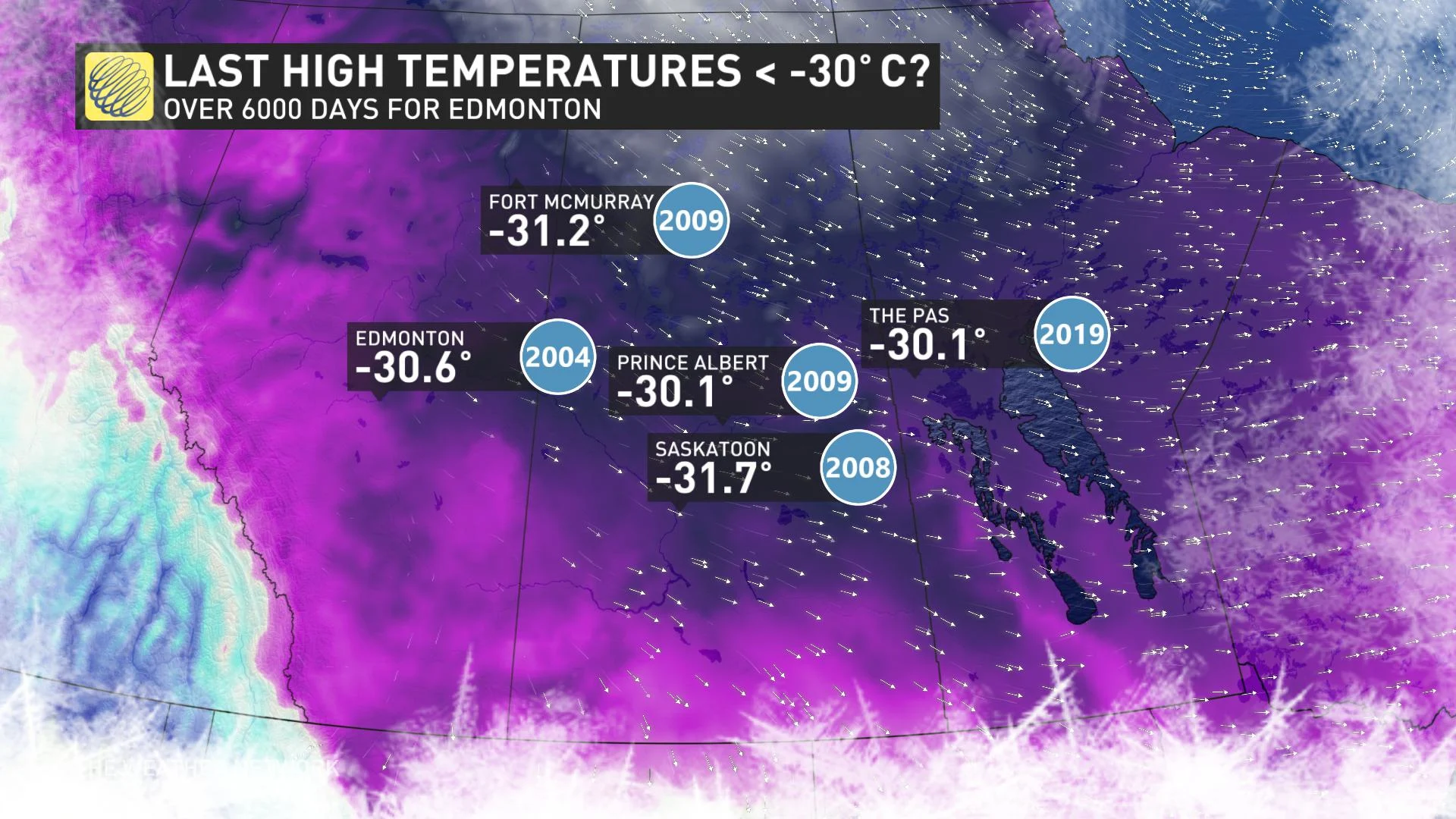
And depending on how it plays out, some cities may see daytime highs fall below -30°C for the first time in more than a decade – in Edmonton's case, 17 years.
While Sunday will be the worst of the cold for many people, bitterly cold temperatures will be sticking around until the middle of next week. The severity of the cold will relax by late-week or the weekend, but temperatures will still remain well below seasonal.
Check back as we continue to monitor these bitterly cold conditions.