
Canada's first fall blizzard is impacting this Canadian province

This part of Canada woke up to a blizzard on the first day of October.
Folks in northern Labrador are experiencing the first fall blizzard of 2020 on Thursday.
The official blizzard criteria across Canada is at least 4 hours of snow or blowing snow, sustained winds of 40 km/h or greater, and visibility reduced to 400 metres or less.
These conditions were met as an intense low-pressure system tracked into the region throughout the pre-dawn hours on Thursday with powerful wind gusts up to 100 km/h and heavy snow. Wind warnings are in place. The highest snowfall totals in the areas impacted by the blizzard could reach 20-30 cm.
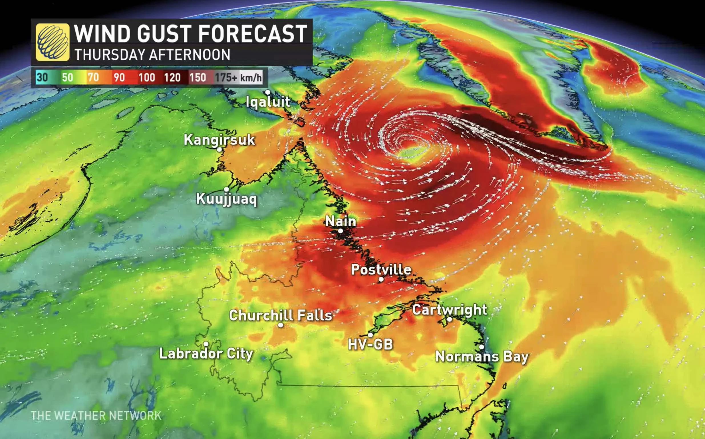
The Weather Network meteorologist Tyler Hamilton notes that the depth of this low pressure system is particularly impressive.
“The strong wind gusts in Labrador are driven by an unusually deep low pressure system developing over the area, driving the barometric pressure below 960 hPa, which is quite deep for the 1st of October,” Hamilton explains.
While many across Canada will be startled by this region’s snowy start to October, temperatures are normally around 3-4°C during this time of year and heavy snow during the early part of fall isn’t uncommon.
However, not all parts of Labrador will be frigid on Thursday. Mary’s Habour, which is located in southern Labrador, will likely reach a balmy 20°C; that extreme temperature contrast is ultimately fuelling the low pressure system.
This potent low-pressure system will continue its eastward track into the Atlantic throughout Thursday, with wind and snow impacts diminishing in the afternoon.
Thumbnail Credit: Getty Images


