Extreme heat returns to Ontario, warnings in place
theweathernetwork.com
Wednesday, July 13, 2016, 12:27 PM - Dangerous heat has returned to Ontario with warnings covering most of the province. As the heat rises and conditions become unstable, there's the potential for some severe thunderstorms as well.
![]() SUMMER 2016: Visit the Summer Forecast Guide to the Season for the 2016 Summer Forecast, Fall Weather Preview and much more
SUMMER 2016: Visit the Summer Forecast Guide to the Season for the 2016 Summer Forecast, Fall Weather Preview and much more
"A widespread thunderstorm threat exists on Wednesday and Thursday as a front approaches southern Ontario," says Weather Network meteorologist Matt Grinter.

Heat warnings
Environment Canada issued a heat warning for much of southern Ontario on Monday, which then extended into northern regions as well.
"Humidex values reaching near 40 are expected," EC warns. "Frequently visit neighbours, friends and older family members, especially those who are chronically ill, to make sure that they are cool and hydrated. Never leave people or pets in your care inside a parked vehicle or in direct sunlight."

Monday brought more seasonal conditions to the province, but daytime highs into the mid 30s arrived once again on Tuesday.
A strong ridge in the jet stream is what will allow temperatures to easily attain or even surpass the 30˚C mark for the majority of the work week.
"Under this ridge in the jet stream, an area of high pressure at the surface will help funnel in warm air from the United States," says Brett Soderholm, another meteorologist at The Weather Network. "The nights will be warm and muggy with overnight lows of 20 to 23. A somewhat cooler airmass is forecast to move in Thursday night."

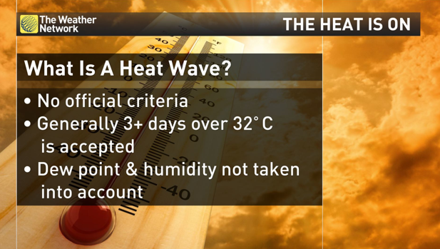
Will it be a heat wave?
"Perhaps contrary to popular belief, there is no definite or officially-accepted criteria for a heat wave in Canada, although this term is loosely used to describe when three or more days exceed 32˚C," Soderholm says.
Summer 2015 vs summer 2016
While the statistics from one single location are not necessarily an accurate representation of a whole region, they do provide an opportunity to compare temperature trends between this summer so far and the last.
Since May 27th of this year, Toronto Pearson has hit 30.0˚C or above thirteen times already, with many cities in the surrounding area and southern Ontario following suit.
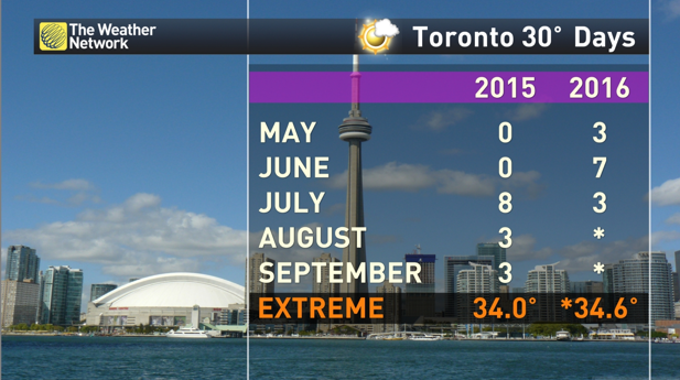
Compare this to last year, when Toronto didn’t attain or exceed 30.0˚C until July 18th, 2015, and only had a grand total of fourteen days going past this (admittedly arbitrary) threshold in the whole year.
Moreover, this year Toronto Pearson has already recorded its hottest maximum daytime high temperature in almost three years, when the mercury rose to a toasty 34.6˚C on the first day of astronomical summer (June 20th, 2016). The last time it was that hot was on July 19th, 2013, when a temperature of 34.9˚C was recorded.
So if you live in the GTA and have had a sneaking suspicion that this year’s meteorological summer has been hotter than last years, you’d be absolutely right.


