Photos of Fort McMurray before and after the fire
Digital Reporter
Sunday, May 8, 2016, 7:21 PM - Firefighters continue to battle the flames of a massive wildfire that has burned part of Fort McMurray, Alta., and sent its 80,000 inhabitants fleeing to safety.
The fire advanced quickly, and at last report had burned some 1,600 structures in parts of the city. In some neighbourhoods, as many as 90 per cent of homes burned.
![]() FORT MCMURRAY FIRE COVERAGE:
FORT MCMURRAY FIRE COVERAGE:
- Latest fire updates
- 19 terrifying videos from the initial evacuation.
- New hope for pets stranded in Fort McMurray
We took images of the Fort McMurray fire posted to social media and then used Google Maps Street View to try and get as close a view as possible of what those neighbourhoods looked like before the fire.
The images aren't an exact comparison, but they do provide some perspective.
Waterways, Fort McMurray


Before photo: Google street view. After photo: Twitter.
Fire exploding near Fort McMurray. Top pic 11am, bottom 1240pm. View is looking northwest from #YMM airport. pic.twitter.com/hjSAY4igoj
— Kyle Cleary (@Wx_Ninja) May 4, 2016
Highway 63 at Anzac turn

Before photo: Google street view. After photo: Deb Matejicka/Twitter.
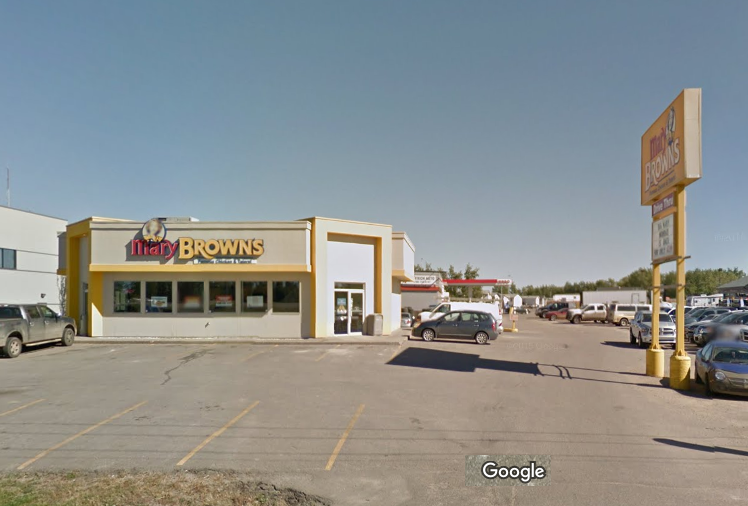
BEFORE: Fort McMurray Super 8 Hotel:

This area was completely gutted by the fire, as shown in this tweet by Global Calgary photographer Loren Andreae:
#YMMfire: Super 8 & surrounding area gone. Photos by @GlobalCalgary's Loren Andreae.https://t.co/uUz3Qgz1UZ #YMM pic.twitter.com/kM8Q8n5h4V
— Tiffany Lizée (@TiffanyGlobal) May 4, 2016
VIDEO: FIRE 'RAINS' DOWN AS EVACUEES FLEE:


