Heat to ease in B.C. with temperature, some rain relief for wildfires

B.C. will begin to see some relief from the heat Sunday, with widespread cooler temperatures filtering in Sunday, along with some much-needed rainfall for parts of the province. Wildfires and smoke remain a major issue for the region.
Finally some much-needed relief is en route for British Columbia as a jet stream moves south, signalling an end to the latest stretch of extreme heat that has plagued the province in recent days. While Sunday will see the heat continue in communities across the Interior, as the South Coast cools down, an inbound system will filter in in seasonal temperatures by Monday. The cool temperatures won't do anything for the ngoing wildfires, but the aforementioned system will bring in some helpful rain for parts of the Interior, as little as it will be. More on the temperature relief and hazardous air quality from the wildfire smoke, below.
SUNDAY: TEMPERATURES COOL DOWN, HELPFUL RAIN MOVES IN
B.C. has been suffering under an intense heat wave for several days. Tje culprit was another heat dome resulting from a resilient ridge of high pressure aloft. This has trapped the heat, as the name suggests, leading to daytime temperatures in the mid- to upper-30s for parts of the Interior.
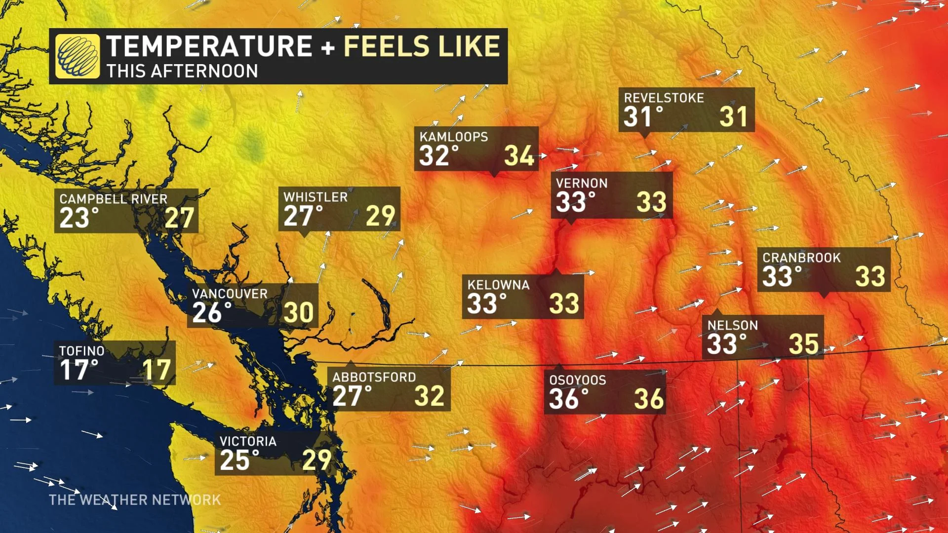
The high temperatures, while not nearly as intense or of long-lasting duration as the late-June event, yielded a few new August all-time records.
The Interior will continue to cook under the sweltering heat Sunday, with daytime highs potentially reaching the mid-30s in the Okanagan Valley, extending south toward the international border. For the South Coast, some relief has already arrived -- bringing temperatures down below the 30-degree mark.
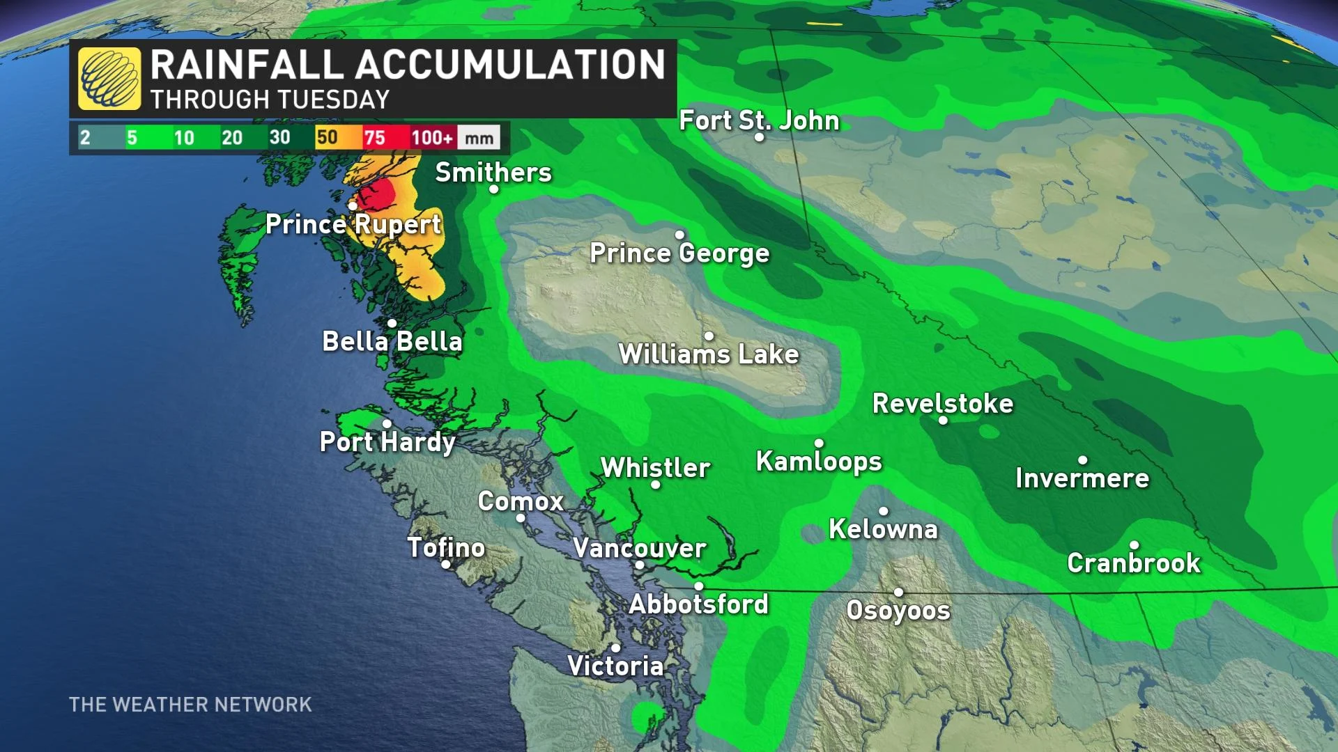
As well, some sought-after moisture has finally moved into northern B.C. Sunday with the low-pressure system. The heaviest amounts, though, will remain in central and northern sections. The rain will spread southward on Monday.
Winds will also ramp up somewhat Sunday, gusting as high as 30 km/h while the higher terrain areas may see 50+ km/h.
POOR AIR QUALITY FROM ONGOING WILDFIRES
Ongoing wildfires across the B.C. Interior means the hazardous air quality, especially for communities near large wildfires, will continue. Special air quality statements remain in place.
"Outflow winds are bringing smoke from wildfires burning in B.C. and Washington into and over the region, contributing to elevated fine particulate matter concentrations and hazy skies," says Environment Canada in the air quality advisory. "Smoke concentrations may vary widely across the region as winds and temperatures change, and as wildfire behaviour changes."
As of Sunday morning, there are more than 270 fires active across the province, mostly in the Interior. The fire danger is at "high" or "extreme" levels across southern Vancouver Island and most of the central Interior once again. The extreme heat will dry out what little moisture there is in the environment, allowing for new fires easier to quickly start and spread.
MONDAY AND BEYOND: HIGH HEAT EASES, CLOSELY WATCHING THE RAIN CHANCES
As the ridge of high pressure moves eastward, the jet stream is able to move southward providing B.C, with much cooler temperatures Monday.
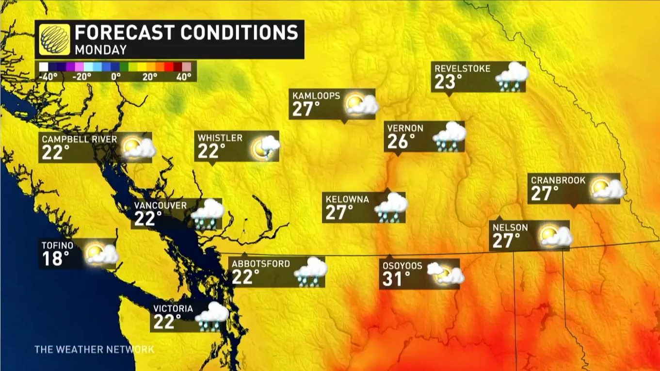
Kelowna, for example, will drop an above-seasonal high of 32°C on Sunday to a comparatively chilly 16°C on Tuesday afternoon.
Meanwhile, the low will push southward Monday afternoon, bringing the rain onto the South Coast and parts of the Interior region. While not excessive, The Lower Mainland and Okanagan will see 5-10 mm, while the eastern Interoir will see slightly higher amounts of 10-20 mm.
While temperatures will come down significantly, the southern Interior, which is where the majority of B.C.'s more virulent wildfires are burning, is not expected to get any significant rain, with the only unsettled weather in central and northern B.C.
The rain on the South Coast will be short-lived and dry weather will move back in Tuesday, lingering through late week.
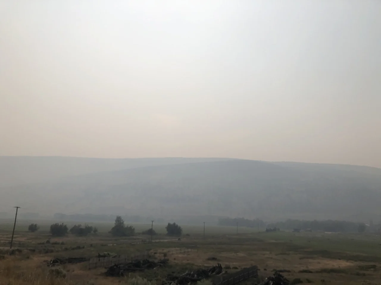
Thumbnail courtesy of Jennifer Gould, taken in Lillooet, B.C.
Stay tuned to The Weather Network for the latest on conditions across British Columbia.


