Ontario: Storm moves out, keeping an eye on the next one

Freezing rain, ice pellets, snow, and strong winds made for a treacherous start to the work week, with more on the way Thursday into Friday for southern Ontario.
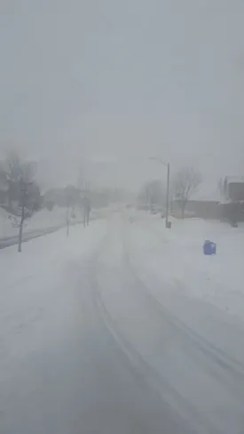
Many across southern Ontario are still clearing their driveways and sidewalks as strong winds and lake-effect squalls continue to make for messy roads.
The mid-week snow and strong winds followed on the heels of a potent winter storm that delivered freezing rain, ice pellets, and heavy snow before departing the province early Wednesday.
More on the the NEXT system that approaches the region as early as Thursday, below.
WEATHER HIGHLIGHTS:
Widespread light snow tapers off by Thursday morning
Strong, persistent winds diminish overnight
Next system approaches on Thursday with more snow and freezing rain threatening the region as temperatures fall by Friday
Latest warnings HERE
WATCH BELOW: EYES ON THE NEXT APPROACHING STORMS
As the snow eases completely during the overnight hours, we're watching the next system approaching southern Ontario Thursday.
THE DEBATE: Snow days - A challenge for some, getting 'easier' for others. What's YOUR take?
"Thursday will be mostly cloudy with rain showers developing across the southern Golden Horseshoe, possibly starting as freezing rain, during the mid to late afternoon," Gillham says. "Snow is likely for the northern half of the Golden Horseshoe, roughly north of the 401."
The rain will continue through Thursday night south of the 401/407 with between 4-8 cm of snow expected across northern parts of the Golden Horseshoe.
"The precipitation will end early on Friday with temperatures then falling through the day," Gillham says. "The high temperatures will occur during the morning hours with temperatures falling below freezing for the afternoon throughout the region."
Colder weather will return to the region for the weekend with high temperatures a few degrees colder than normal. We are also closely watching the track of yet another Colorado Low that will track well south of the border during the day on Sunday.
"If this system tracks just a bit further north than currently expected, then we will see snow develop across southern parts of our region, especially for Niagara and into southern parts of the GTA," Gillham says.
Please be sure to check back for updates as we continue to monitor this weekend system.
LOCKING INTO A COLDER PATTERN FOR LATE FEBRUARY
After a temperature roller coaster for the first half of February, the second half of the month will feature a more consistently cold pattern.
"We know that there will be an abundance of frigid weather in Canada - the question is whether that will remain focused across western Canada or will the Arctic air return to the Great Lakes region during the second half of the month?," Gillham says. "At this point we expect that colder than normal temperatures will dominate during the second half of February and this pattern is expected to persist through the first half of March."