Pacific typhoon upends April pattern across Canada

A major pattern reversal marks the second half of April in Canada, along with the influence of a distant typhoon.
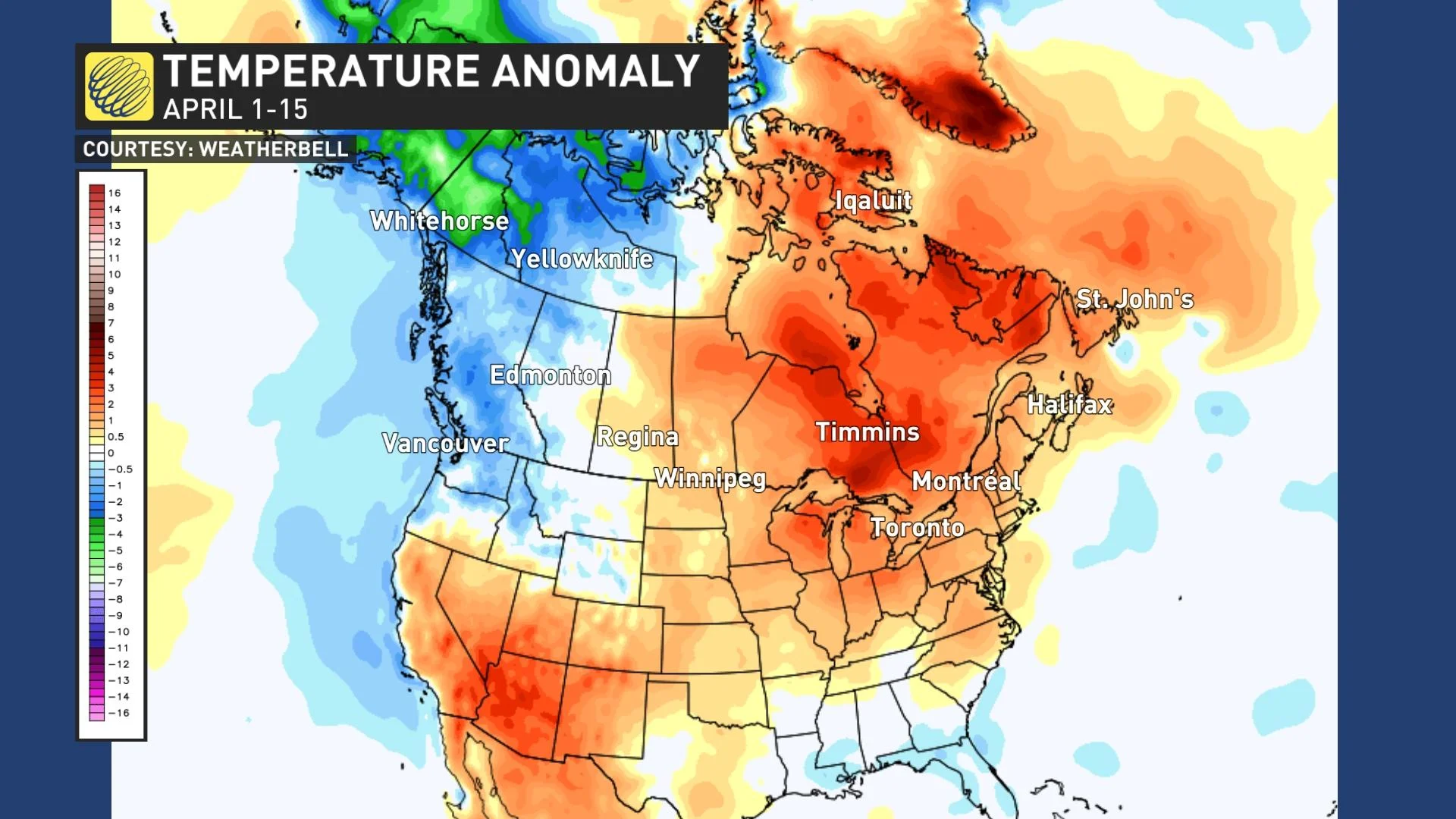
A major pattern reversal is underway across Canada. During early April, warmer than normal temperatures dominated from the central Prairies to Atlantic Canada, while cooler than seasonal temperatures dominated across western and much of northern Canada.
The map below shows the temperature anomalies that we saw during the first two weeks of April with the various shades of orange and red highlighting the warmer-than-normal temperatures.
However, a major pattern reversal began to unfold mid-month. This brought an abrupt transition to much warmer weather for B.C. and Yukon, with a taste of early summer for parts of southern B.C.
Meanwhile, parts of Saskatchewan and Manitoba saw their worst snowstorm of the year as much colder weather shifted east into the region.
PHOTOS: April Prairie snowstorm delivers a wallop, road chaos ensues
The pattern reversal has been slower to develop across Ontario and Quebec, where the past week has brought temperatures closer to seasonal. We will take another step down to below seasonal temperatures for several days this week with widespread snow.
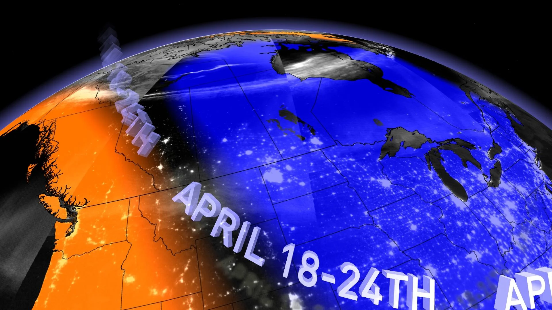
Here is a look at the national pattern that we expect for the week:
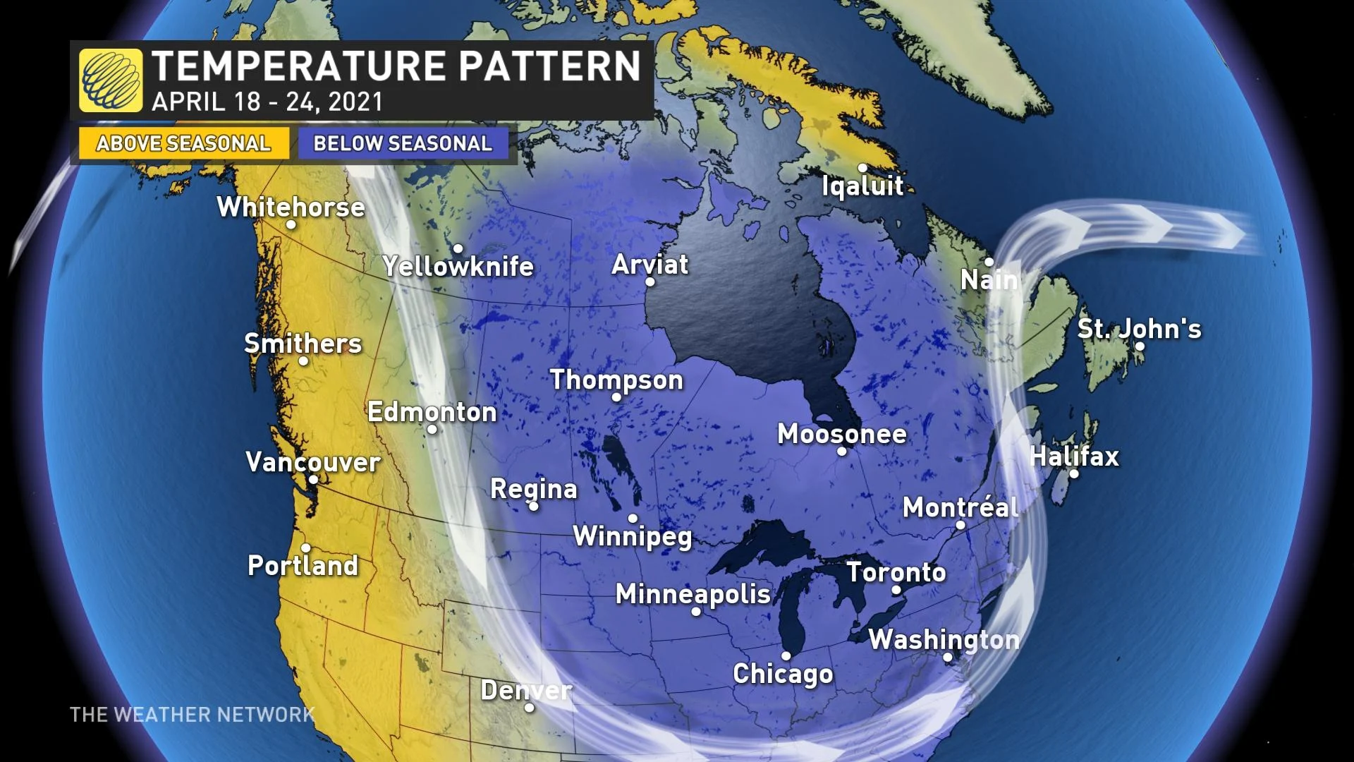
Above-seasonal temperatures will continue this week across B.C. and Yukon. However, this pattern will begin to break down late in the week and weekend, with temperatures trending back to near seasonal, along with an increasing threat for unsettled weather.
Across the Prairies, chilly weather will be found across the region early this week. Milder weather will briefly spread east across the region during the middle of the week, but another blast of arctic air is likely for the end of the week.
Colder weather will spread east across Ontario and Quebec early this week. From the Great Lakes to southern Quebec the coldest weather is expected from Tuesday through Thursday with a threat for significant snow for parts of the region.
Much warmer weather is expected for Atlantic Canada during the first half of this week. Cooler weather will briefly spread into the region for the end of the week, but overall this region will miss out on the blast of cold weather
PACIFIC TYPHOON COMPLICATES FORECAST FOR FINAL WEEK OF APRIL
The final week of April will bring a more changeable pattern to Canada. Initially we will see cooler weather across western Canada while much warmer weather should briefly return to Ontario and Quebec.
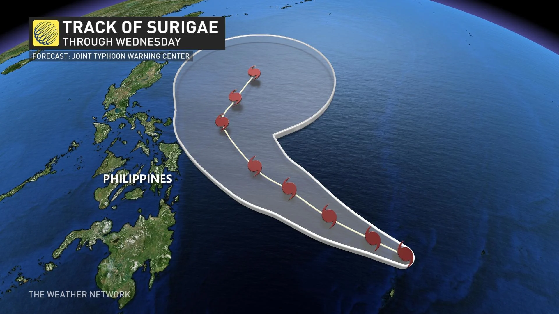
However, this pattern will not be able to lock into place and one of the reasons for this volatile pattern is Typhoon Surigae, a powerful storm over the southwest Pacific Ocean which is recurving out to sea to the east of the Philippines.
During the late summer and fall we often talk about the impact of recurving typhoons on the jet stream pattern across North America. It is hard to believe, but a typhoon thousands of kilometres away can actually have an impact on the type of weather pattern that we see across Canada one to two weeks later by amplifying the jet stream. The exact track of the typhoon is the key to whether that results in a period of warmer or colder weather for a particular region.
Surigae is turning out to sea to the east of the Philippines and well southeast of Japan. Based on this track we expect a dip or trough in the jet stream (meaning a colder pattern) near the Great Lakes region six to 10 days after the typhoon makes its turn north. That would correlate to the final few days of April and possibly into early May.
At this point there isn't much model support for this to occur. However, that is not surprising, as the models are usually unable to correctly forecast the impact that a typhoon will have on the jet stream until those impacts start to happen.
However, the impact of the typhoon on our jet stream and weather pattern should be less than what we often see during the late summer and fall. Typhoon Surigae will quickly weaken as tracks north and leaves the tropics. It is still April, after all, and conditions outside of the tropics are not nearly as favourable for sustaining a powerful storm as we typically find during the summer and fall.
Therefore, the impact on the jet stream should be considerably less, but we still expect a cooler conclusion to April across Ontario and Quebec and that could linger into the beginning of May.
So, this leaves us with more than the typical amount of uncertainty as to what our weather pattern will look across Canada like during the final days of April. While there are indications that we will quickly return to the pattern that has dominated much of the spring, a typhoon in the Pacific Ocean could play a key role in just how quickly that transition actually happens.