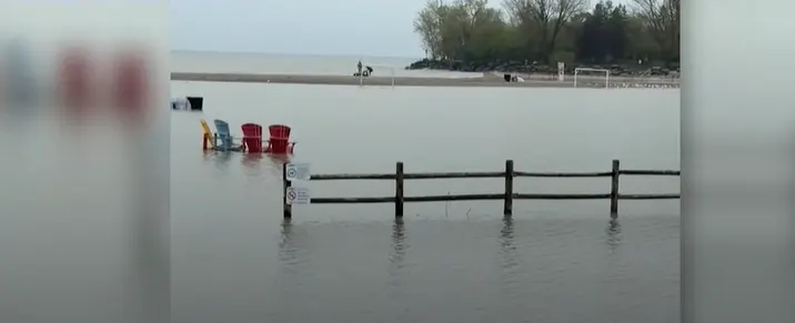
What caused parts of Toronto’s waterfront to flood this spring?

Woodbine beach appears normal, but spring flooding shows impact of changing lake levels on Toronto's waterfront
Visitors to Woodbine Beach today would see little evidence that much of the area was submerged just a few months ago. This spring, Lake Ontario's water levels rose significantly, driven not only by rain and snowmelt, but also by controlled outflows to protect downstream communities like Ottawa and Montreal.
"Outflows into the St. Lawrence River were reduced to manage high flows in those areas," explains David Kellershohn, Associate Director of Engineering Services at the Toronto and Region Conservation Authority. "This left Lake Ontario about 35 to 40 cm higher than normal for this time of year."
DON'T MISS: From drips to disasters: How to flood-proof your home
Maintaining water levels is a delicate balancing act, considering flood risks, shipping, hydropower, and environmental concerns.
"It’s a difficult decision—choosing which areas might flood," Kellershohn says.
While water levels have since receded, this year’s inundation highlights the vulnerability of Toronto's shoreline to fluctuating lake levels.
"Climate change has already caused Lake Ontario's average water levels to rise," Kellershohn adds. "Designing infrastructure for higher levels now is essential."
Although Woodbine Beach naturally adjusts over time, experts emphasize proactive planning to safeguard against future flooding risks along Toronto's waterfront.
WATCH: Three tips to protect against flooded basement damage
Thumbnail image courtesy: @Loucheryl - TikTok