Waterfront residents in Cumberland brace for flooding
Residents near Boisé and Leo lanes in Ottawa's east end are busy filling sandbags and operating sump pumps for the third time in seven years as the Ottawa River once again floods the area.
One of the snowiest winters on record in Ottawa contributed to flooding along that river that started last month. Water levels are surging again during a very rainy week.
In Cumberland, located about 30 kilometres east of downtown Ottawa, longtime resident Glen Roberts is no stranger to flooding.
"It's been tough to stay centred. I can't lose it. I can't get upset because it doesn't help me, and my health is not as it was in the previous 2017 and 2019 [floods]," Roberts said.
WATCH: Heavy snow, rain combine for the 'unprecedented' Ottawa river flood of 2019
RELATED: Police find body of one of two firefighters swept away by floodwaters in Que.
Water levels east of Cumberland Village are expected to rise by about 30 centimetres above current levels, according to a local conservation authority update Tuesday.
These levels are expected to exceed the April 22 peak by about 60 centimetres.
According to the latest Ottawa River Regulation Planning Board update Tuesday afternoon, water levels from Mattawa, Ont., to Chats Lake west of Arnprior, Ont., should peak by Wednesday or Thursday and from Lac Deschênes in Ottawa's Britannia area to Hawkesbury, Ont., by Thursday or Friday.
Water levels range from 90 to 193 centimetres above the daily average from Pembroke, Ont., to Grenville, Que, according to the board's latest updates.
Water has risen past the 2017 peak in Pembroke and are forecast by the board to pass that year's peak at Lac Coulonge, bordering Mansfield-et-Pontefract, Que., and Ontario's Whitewater Region. They're not forecast to pass 2017 elsewhere.
The peaks are expected to remain about 40 to 70 centimetres below the historic high water marks along parts of the Ottawa River in 2019.
A Tuesday memo from Beth Gooding, director of the City of Ottawa's public safety service, assured city councillors that impacts on the city will be relatively small.

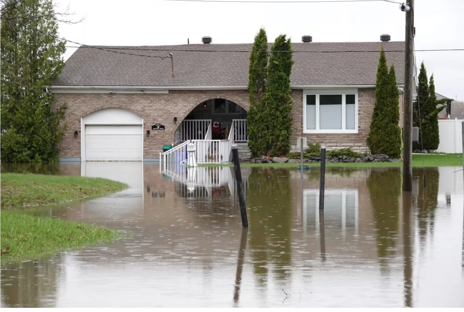
A home that backs onto the Ottawa River in Cumberland is surrounded by water on Tuesday. (Giacomo Panico/CBC)
SEE ALSO: Quebec premier heads to flood-torn town in Charlevoix region
Gooding estimated that about 130 private properties have implemented flood mitigation measures such as sandbags, of which the majority are located in West Carleton on the other side of the city from Cumberland.
The city has not seen a significant increase in demand for its sand and empty sandbags, Gooding said.
"At this time, we have observed minor impacts to roads and some parks, but nothing impacting critical infrastructure related to flood waters," she wrote.

People paddle kayaks through a flooded area of Gatineau, Que., on Wednesday. (Matéo Garcia-Tremblay/Radio-Canada)
Bridge, ferries closed
That note did come before Public Services and Procurement Canada announced it was fully closing the Chaudière Bridge to vehicles and pedestrians until further notice because of the high water level.
Vehicle traffic was already significantly restricted because of construction and the end of that construction has been pushed back.
The ferries between Alfred and Plantagenet, Ont., and Montebello, Que., Thurso, Que., and Clarence-Rockland, Ont., and Cumberland and Masson-Angers in Gatineau are closed until further notice.
DON'T MISS: Everyone needs a home emergency kit. Here's what to stock yours with
The ferry between Quyon in the Pontiac, Que., and rural west Ottawa is open.
The City of Gatineau set up a relief centre for flood victims at the Jean-René-Monette community centre at 89 rue Jean-René-Monette in Lac-Beauchamp, according to a news release from the city. It's open 8:30 a.m. to 10:30 p.m.
Residents in flooded areas are asked to register with the city for wellness checks using 311 or go to that support centre. The city has a hub for sandbag locations, road closures and other flood information.
Those road closures include both the eastbound on- and off-ramps from Highway 50 to rue Saint-Louis, as well as Saint-Louis in that area.
With all this rain, the Ottawa River is rising and people living along the water’s edge are bracing for yet more flooding. Hallie Cotnam is out in one of the wettest parts of Gatineau.

A pile of sandbags sits on East Shore Road in Cumberland, awaiting use to hold back rising water levels. (Giacomo Panico/CBC)
MRC de Pontiac sent a Tuesday afternoon news release for L'Isle-aux-Allumettes, Chichester and Sheenboro about several private roads being closed and sandbags at the municipal garage at Demers-Centre at 450 chemin du Rang 5.
Volunteers are needed there, it said, asking them to show up starting Wednesday at 8 a.m.
There are no other local flood warnings off the Ottawa River. The monitoring board for Lake Ontario and the St. Lawrence River is, for the first time this spring, saying vulnerable areas may flood because of recent heavy rain.
This article was originally published for CBC News. Contains files from Giacomo Panico.