Rare scenario plays out as twin typhoons target Asia
It's been a slow year so far for tropical systems, but even as the Atlantic remains quiet, the Pacific basin sprang to life in a big way this week, and now twin massive storms are churning toward Asia.
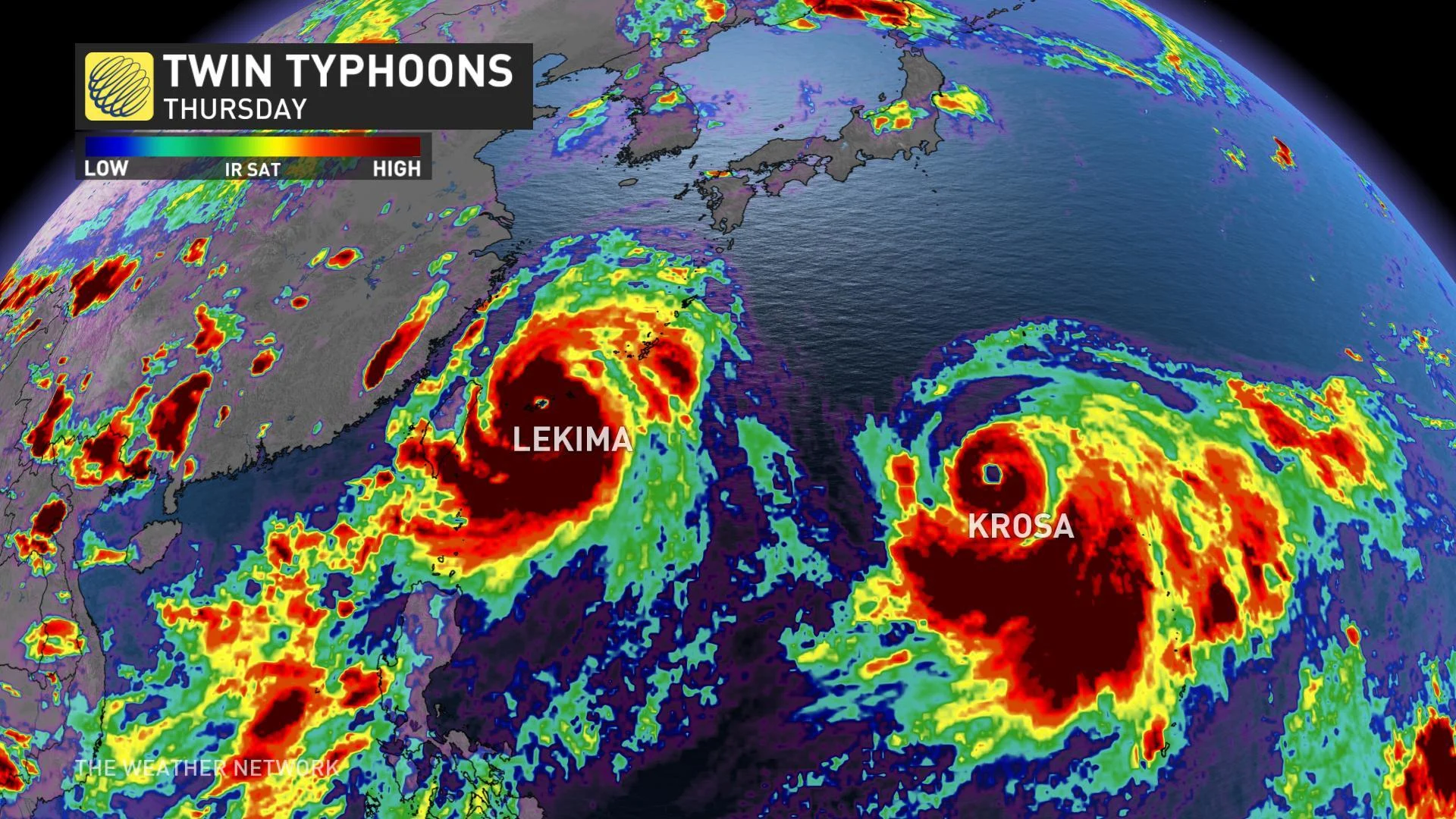
Super Typhoon Lekima and Typhoon Krosa make an impressive pair on satellite as both storms continued to intensify on Thursday. As of Thursday night, local time, Lekima boasted winds of 130 kts (240 km/h) with gusts as high as 160 kts (296 km/h) -- the equivalent of a Category 4 hurricane in the Atlantic Basin. At the same time, its closely-following shadow, Krosa, had reached 100 kts (185 km/h) with gusts up to 125 kts (230 km/h), making it the equivalent of a Category 2 storm.
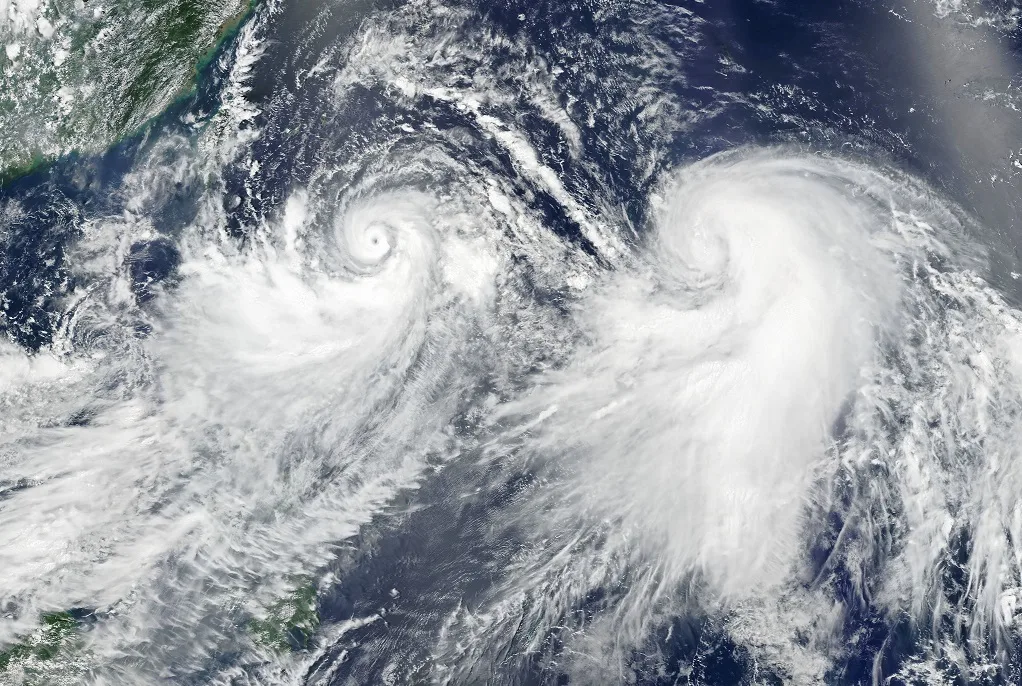
Storms Lekima and Krosa as seen on visible satellite August 7, 2019. Image courtesy NASA Earth Observatory.
SEE ALSO: NOAA updates 2019 Atlantic Hurricane Season forecast
Both storms are expected to have impacts to land over the course of the next week, with Lekima targeting Japan's southern-most islands, Taiwan, and eastern China, including Shanghai, through the weekend.
Krosa is expected to take a more northerly track toward the larger islands of Japan, and is currently on a path that would take it toward Kyoto early next week, though its exact track is uncertain -- more on that, below.
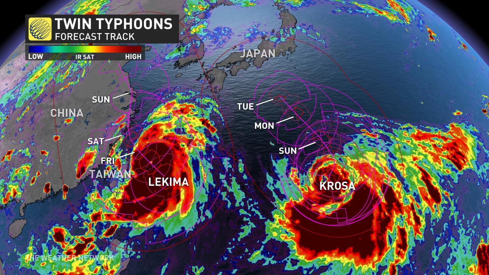
Fortunately, both storms are expected to weaken from this point, but significant impacts to land are still likely, especially from the potent Lekima, which is expected to sweep northern Taiwan and eastern China with damaging winds, flooding rains, and the potential for mudslides.
What happens to the pair after the weekend is up for debate, however, and that has to do with their unusually-close proximity. The two are close enough that one will feed off the other, with Krosa drawing in some of Lekima's moisture. In turn, Lekima's track will influence Krosa's; as the first tracks up the coast of China and starts to deteriorate, its wind field may serve to steer or deflect the latter.
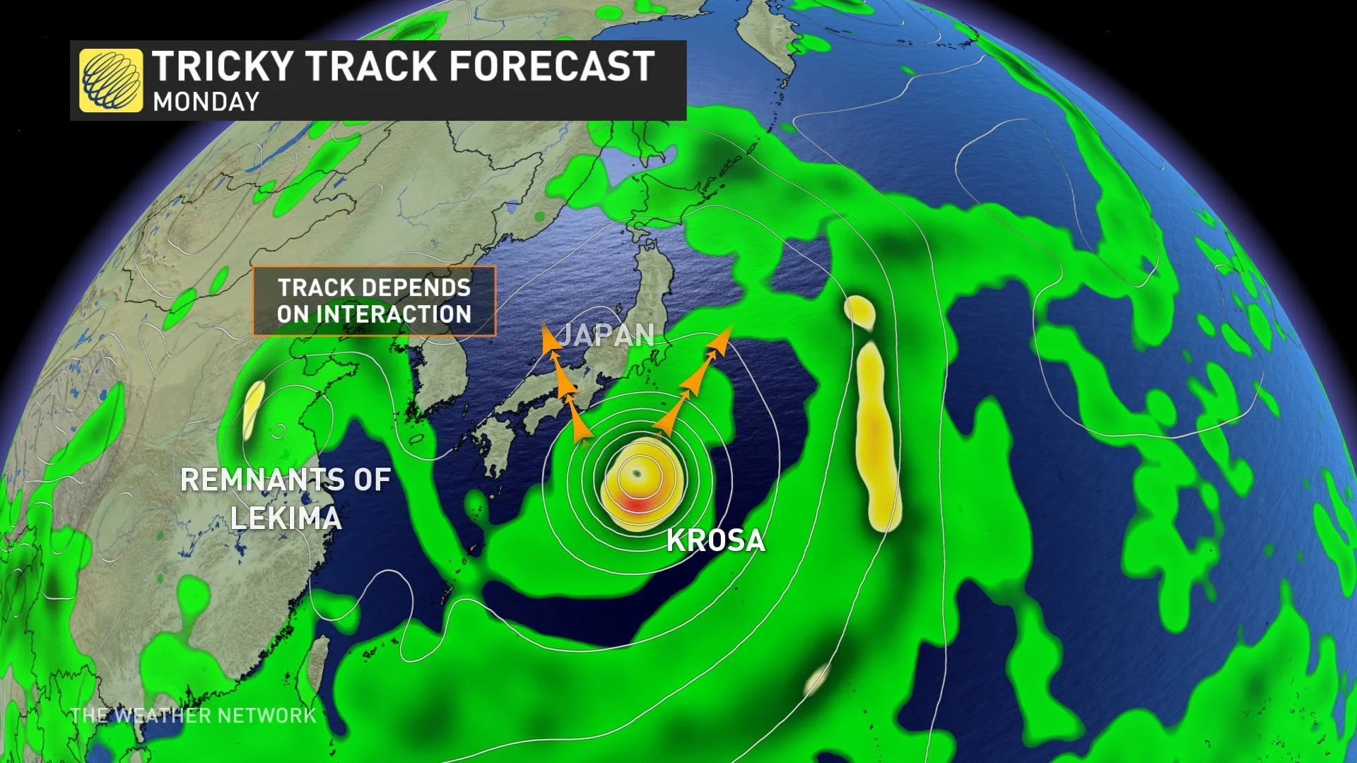
Wherever they end up, these storms may ultimately have an impact on the weather pattern over North America, either in the form of storm remnants adding fuel to Pacific-crossing low pressure centres or by deflecting the jet stream pattern to steer home-grown systems.


