Travel issues likely in Ontario as vast storm threatens heavy snow

Warnings are in place for portions of Ontario as heavy snow looms overnight Thursday into the day on Friday.
An assortment of winter weather alerts are in place for portions of southern and eastern Ontario ahead of a vast winter storm sliding across the eastern half of the country.
It’s one of those tricky storms where marginal temperatures and the precise track of the storm are key to precipitation types and totals from one community to the next. Small shifts can have a big implication for how this storm plays out—as folks in the Greater Toronto Area (GTA) may find out firsthand.
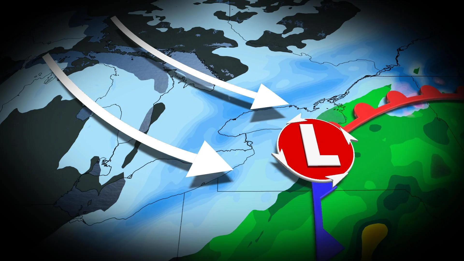
A Colorado low tracking south of the border is responsible for the issues we’ll see across Ontario heading into the day on Friday.
We’ll see a general north-south divide in precipitation types for the duration of the storm. Warmer air hanging on in the south will lead to rain (and spotty freezing rain) changing over to snow for portions of southern and eastern Ontario, including for folks around the GTA.
Weather models on Thursday tended to bring the storm a tad farther south than originally predicted, which could both cut down on the amount of snow expected in the GTA and bump up totals for portions of eastern Ontario.
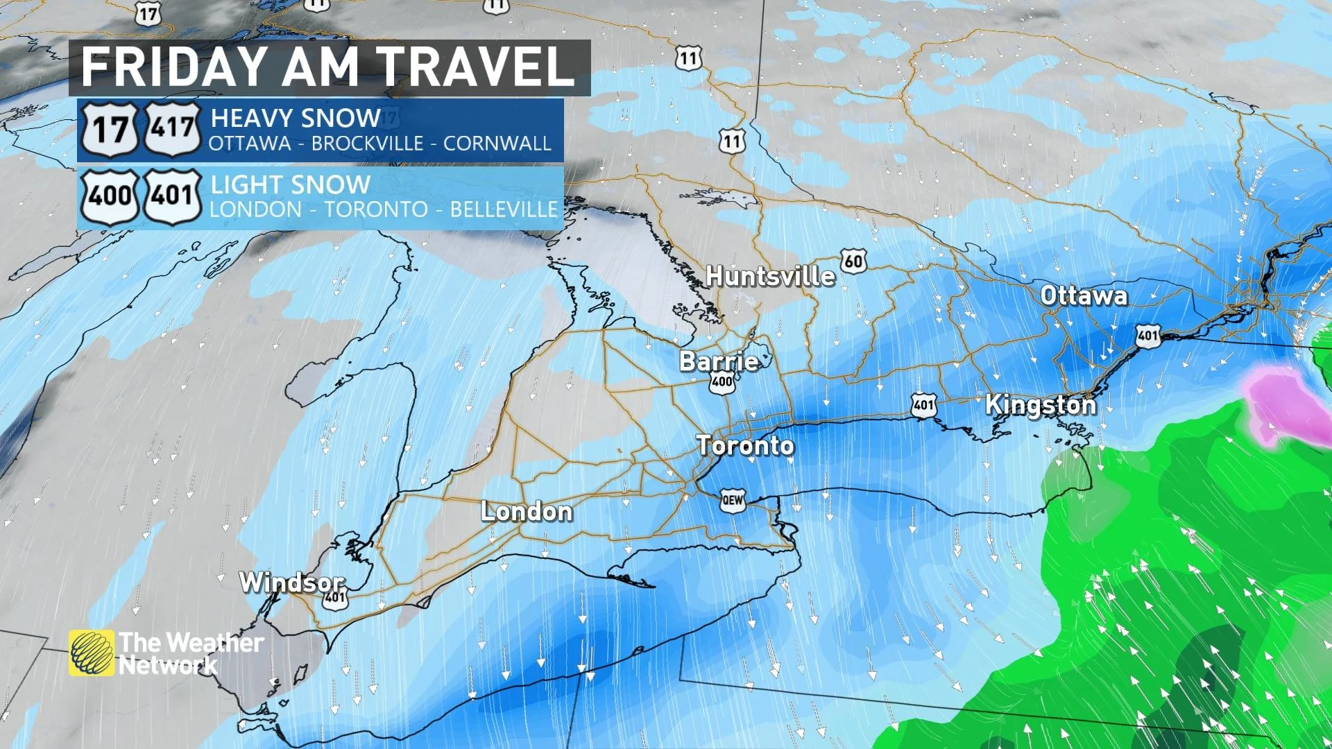
We’ll see rain and freezing rain change over to snow through the overnight and pre-dawn hours on Friday from Toronto south toward Niagara.
Around 5 cm of snow is expected across the GTA and sections of southwestern Ontario. While that’s certainly not much by January standards, it could be enough to threaten a slick Friday morning commute.
SEE ALSO: Newfound comet not seen for 50,000 years will soon swing by Earth
The system’s heaviest snow will fall across eastern Ontario and southern Quebec. Snow will begin in earnest Thursday evening and continue through Friday afternoon, making Friday morning’s commute extremely difficult for folks who have to venture into work.
This will be a solid snowfall for the National Capital Region, where folks around Ottawa could wind up with 20-30 cm of snow by the end of Friday.
“Consider postponing non-essential travel until conditions improve,” Environment and Climate Change Canada (ECCC) urged in its winter storm warning for the National Capital Region.
“Surfaces such as highways, roads, walkways and parking lots may become difficult to navigate due to accumulating snow.”
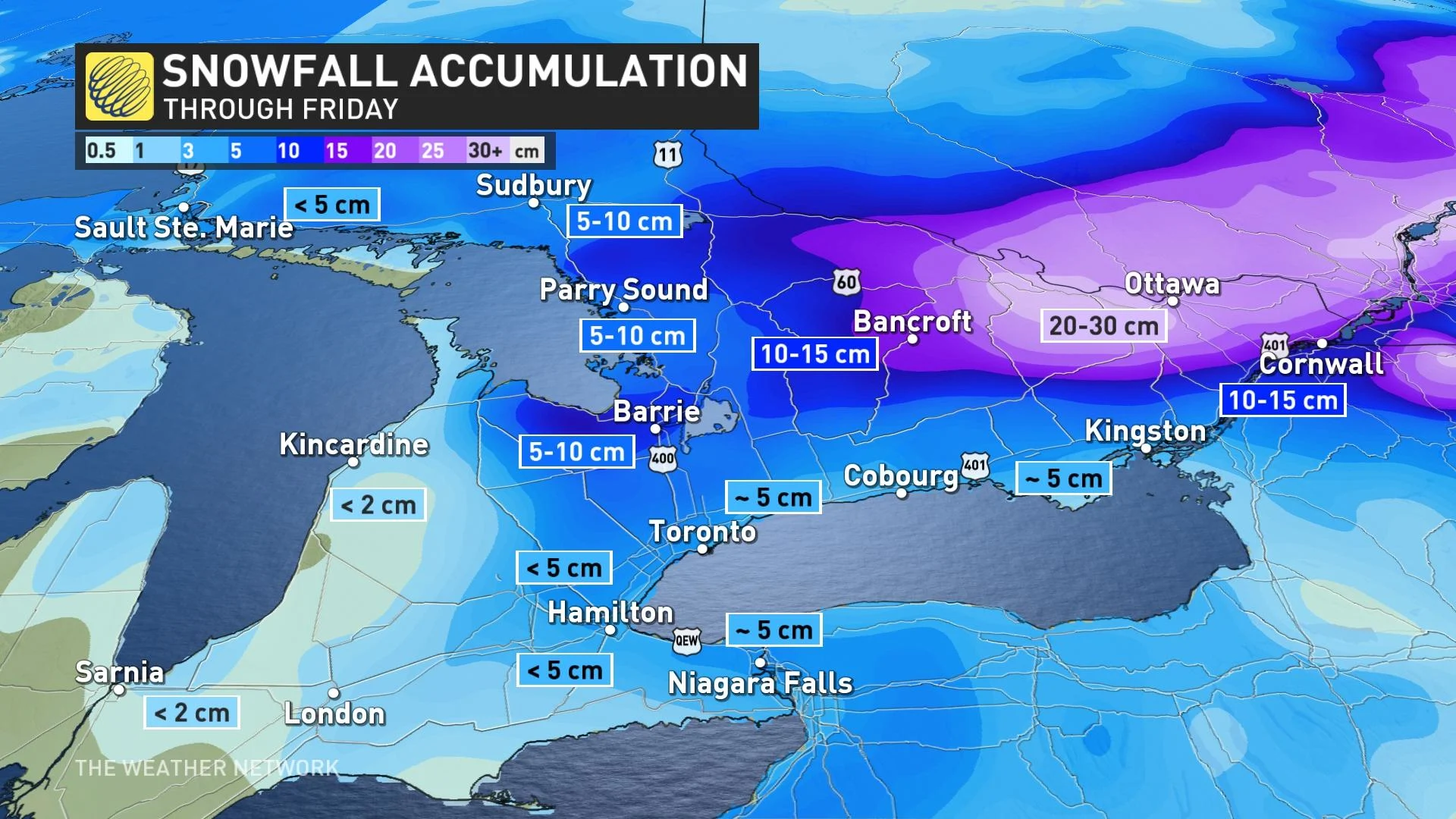
The latest forecast nudges snowfall totals up a bit in eastern Ontario as a result of the storm’s southward trend in the models. A more southerly track will allow rain to change over to snow a little more quickly, allowing for slightly greater accumulations for some areas.
Accordingly, forecasters now expect 5-15 cm of snow across much of eastern Ontario, with totals steadily dropping off with proximity to Lake Ontario.
Over in cottage country, totals will range between 5-15 cm with lower totals in the west and higher totals in the east.
The system will move out of the province and into Quebec by Friday afternoon, with all snow departing with it by Friday evening.
WATCH: Hidden icy danger present across Ontario through Friday
Sunshine finally arrives behind this system
A much-needed spell of sunshine will arrive this weekend in the wake of the departing storm. Temperatures will remain slightly below seasonal, though the joyful sunshine should lighten the mood enough to break the chill in the air. Daytime highs will quickly rebound into above-seasonal territory for much of next week.
An active pattern will continue next week and beyond, with a train of Colorado lows tracking into the region every couple of days. Milder temperatures suggest that rain is more likely for southern areas, but significant snows would be expected well north of each system’s track.
WATCH: Mark Robinson reports from Ottawa as the capital braces for heavy snow
Stay tuned for the latest updates on conditions across Ontario.