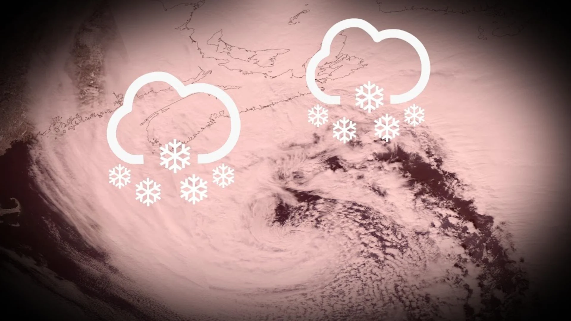
This Atlantic blizzard is giving shades of White Juan, here's the comparison

Almost 20 years ago, White Juan ensnared parts of Nova Scotia with one of Canada's record snowfall events. Now, the province is on tap to see another system similar to the nightmare setup.
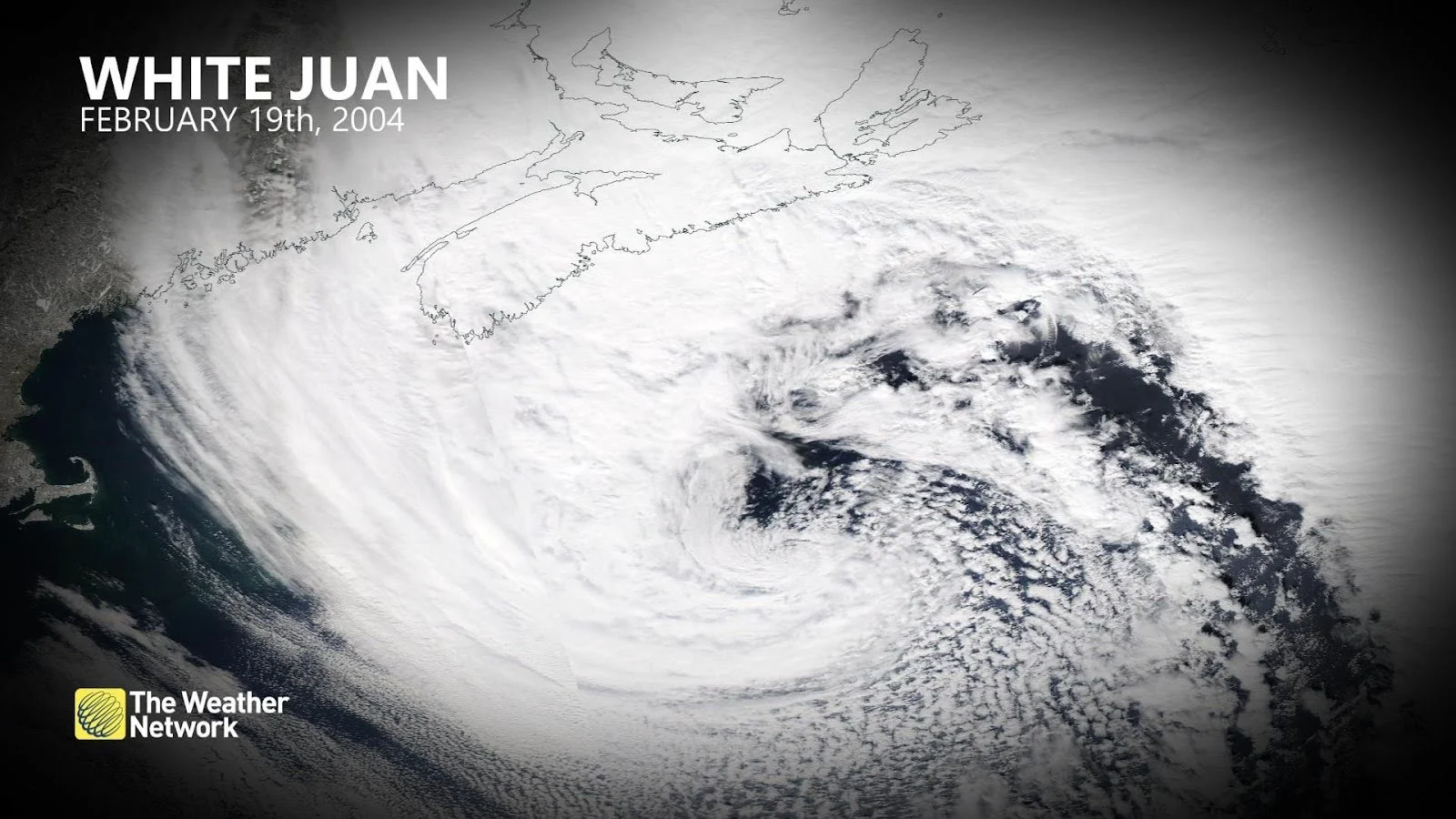
Nearly 20 years ago, on February 19, 2004, 88 cm of snow fell in Shearwater, a suburb of Halifax, marking one of the greatest daily snowfall events in Canadian history.
Those totals gave rise to the nickname ‘White Juan,” the snowstorm event named after destructive Hurricane Juan the previous fall hurricane season.
RELATED: How Omega blocks and Rex blocks can affect Canada's weather
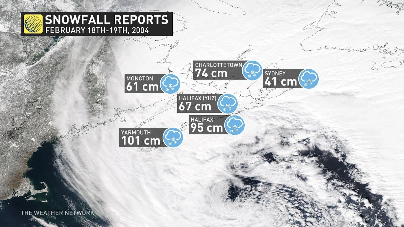
Halifax Airport recorded 66 cm of snowfall on February 19, 2004, while Sydney, Nova Scotia topped out with just over 40 cm of accumulation. Halifax remained in official blizzard criteria for an incredible 16 straight hours. The nightmare caused provincial-wide states of emergency and widespread school cancellations. Such whiteout conditions are not widely forecast with this storm and are more targeted toward Cape Breton.
SEE ALSO: Multi-day storm threatens heaps of snow and poor travel in Atlantic Canada
How do the next few days compare to the White Juan event?
White Juan was a much faster-moving nor'easter that reached a deep barometric pressure and then crossed the province of Newfoundland on February 21, 2004. It reached a barometric pressure of 959 hPa as it slipped east of Nova Scotia.
In comparison, this low-pressure system will stall for nearly 36 hours southeast of Sable Island, rather than move towards Newfoundland. The deepest low-pressure reading is forecast to be 25 hPA weaker at around 982 hPa on Sunday afternoon, meaning the wind speeds will be significantly lower - but still bring very dangerous and impossible travel conditions for Cape Breton.
Winds will remain in the 40-70 km/h range along the coast, versus White Juan’s 60-100 km/h roaring winds. There is a risk of thundersnow associated with the heaviest of snowfall bands across Eastern Nova Scotia, which was also observed during White Juan.
The stalling nature of this low makes this setup remarkable for eastern Nova Scotia. Although on paper it’s a weaker storm, the amount of available moisture that’ll continuously sweep across Cape Breton will bring an extraordinarily high amount of snowfall over the next few days, much more than this region saw in February 2004.
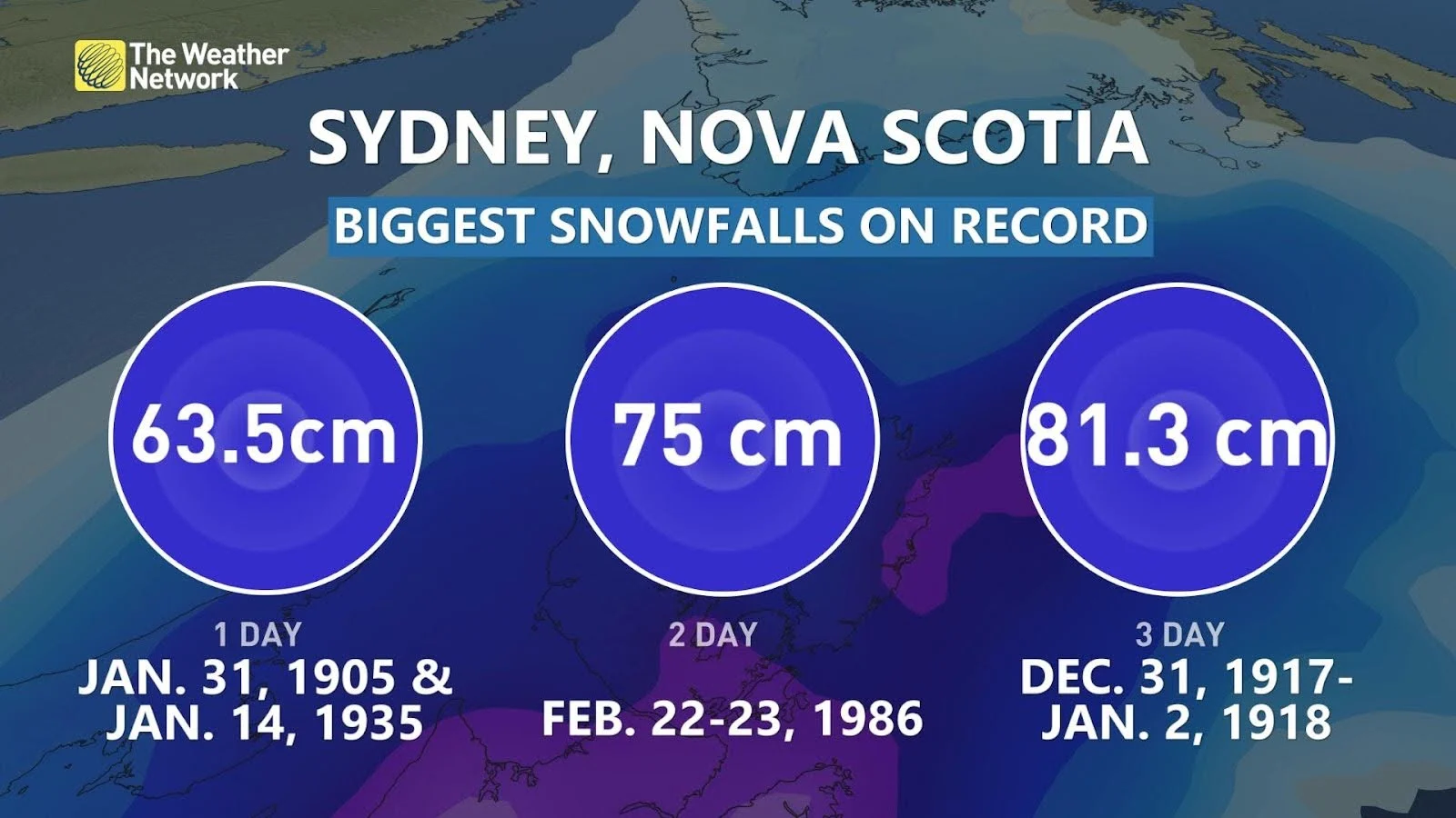
Sydney Nova Scotia may be staring down the greatest multi-day snowfall event in recorded history, with over 80 cm forecast over the next few days. The weight of the snowfall is of concern for some structures not designed for such excessive snowfall accumulation.
It’s no White Juan, but for a select few it’ll be worse.
Stay tuned to The Weather Network for more forecast updates for Atlantic Canada.


