Severe storms to hit Saskatchewan with high winds, large hail
Stay alert for watches and warnings across portions of southern Saskatchewan on Thursday
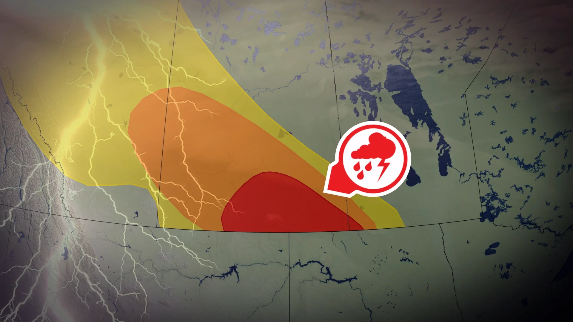
An active setup will allow a round of severe thunderstorms to bloom over southern Saskatchewan during the day Thursday.
Expect these storms to build through the afternoon and evening hours as heat and moisture stream over the region.
Rotation is possible. Stay alert for rapidly changing conditions, and pay close attention to watches and warnings as you go about your day.
DON’T MISS: Canada’s July outlook holds a major flip-flop across the country
Severe storms likely during the day Thursday
Plenty of instability and moisture parked over southern Saskatchewan on Thursday will set the stage for severe thunderstorms to build across the region.
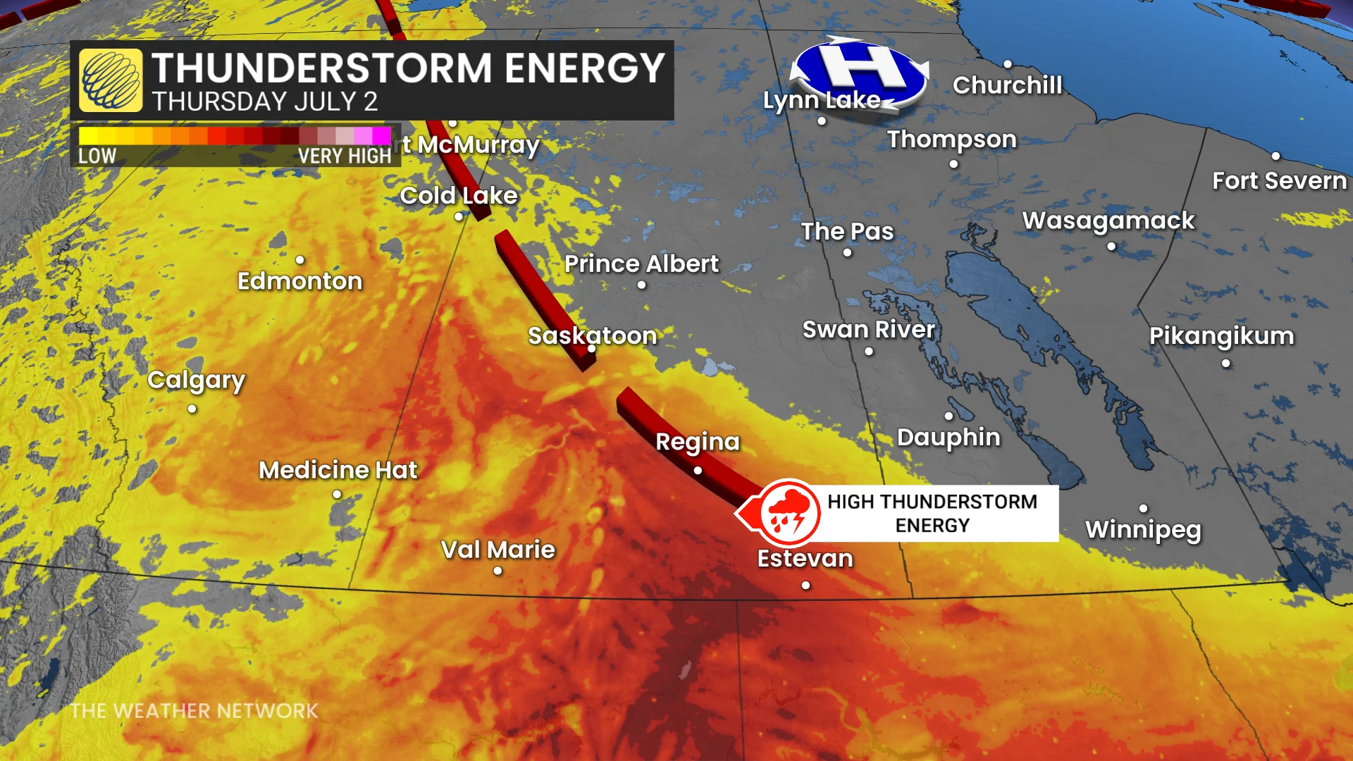
We can expect these storms to begin during the afternoon hours and continue through the evening, fuelled by daytime heating and fed by a healthy stream of moisture flowing in from the Gulf of Mexico.

The greatest threat for severe weather will cover communities including Regina, Moose Jaw, Weyburn, and Estevan, though the severe storm potential will stretch as far north as Saskatoon.
All modes of severe weather are possible on Thursday, including very large hail, strong wind gusts, and heavy rainfall. One or two tornadoes can’t be ruled out, especially along the international border and in the southeastern corner of the province.
Always have a plan in place in case a tornado warning is issued for your location. We’re quickly approaching the peak of tornado season across Canada.