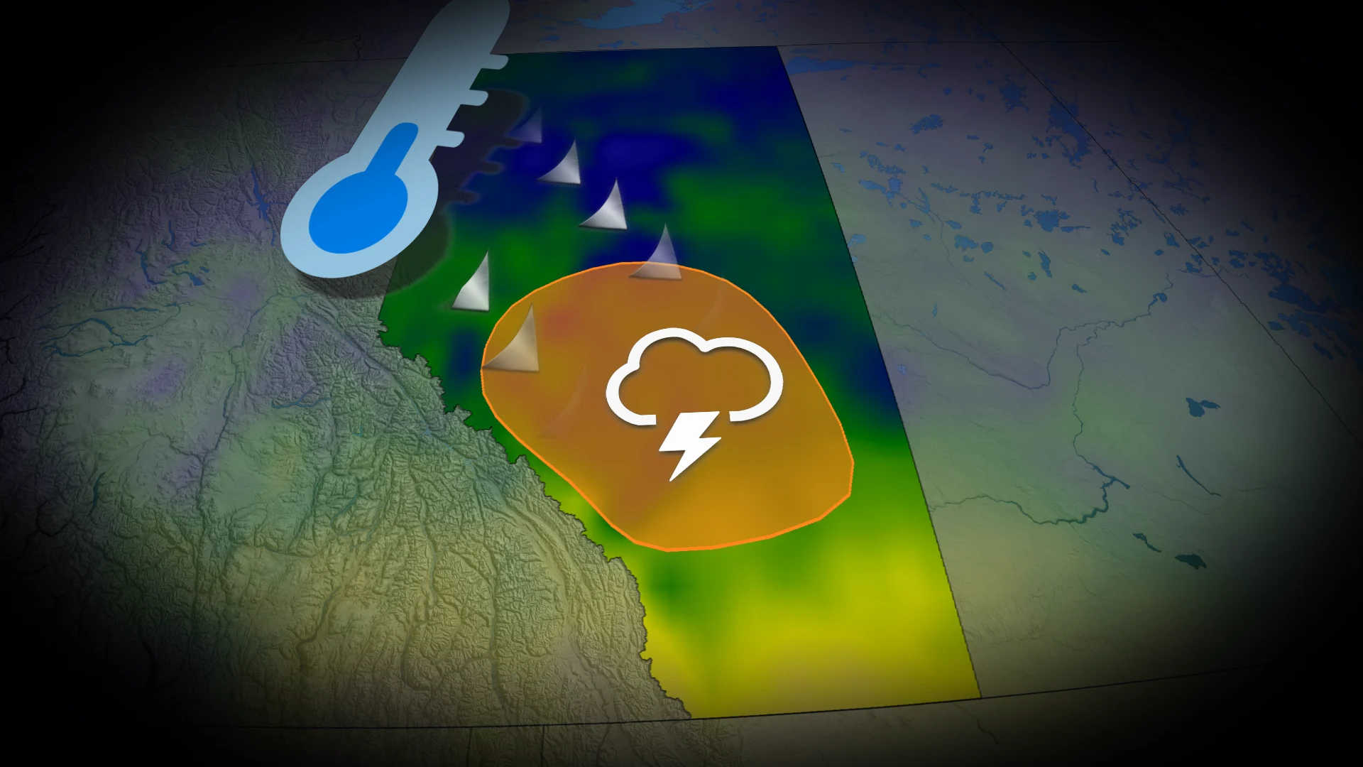
Severe storms and a major temperature drop expected in Alberta this week

Fall-like temperatures arrive in Alberta this week with days of instability and active weather
A stationary boundary over the Rockies is triggering severe storms across Alberta.
Scattered non-severe thunderstorms are anticipated in northern regions on Monday, while a narrow zone between Edmonton and Calgary could see more intense storms during the afternoon.
DON'T MISS: Summer of severe weather: Alberta a 'hot spot' for this year's biggest storms
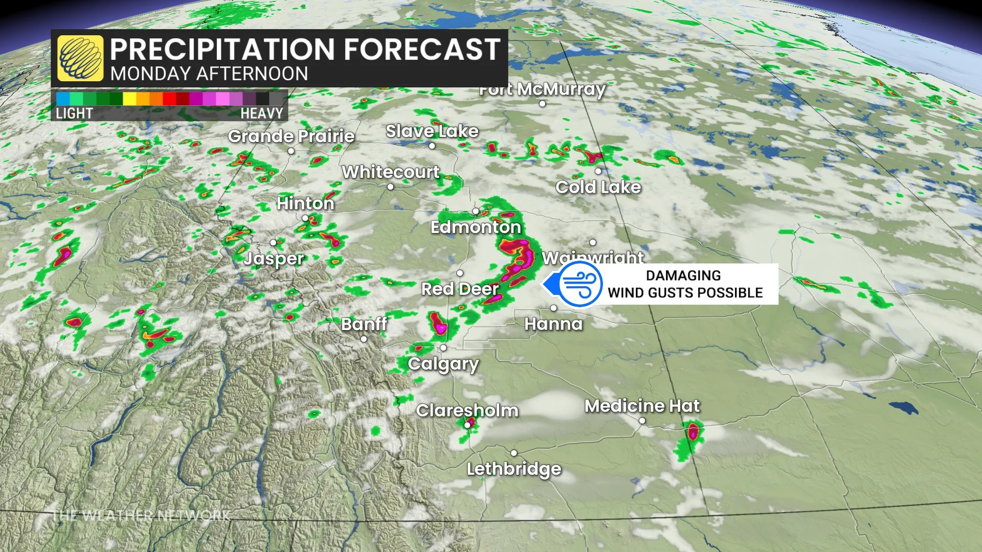
Initial isolated storms will transition into a more linear structure along the surface front.
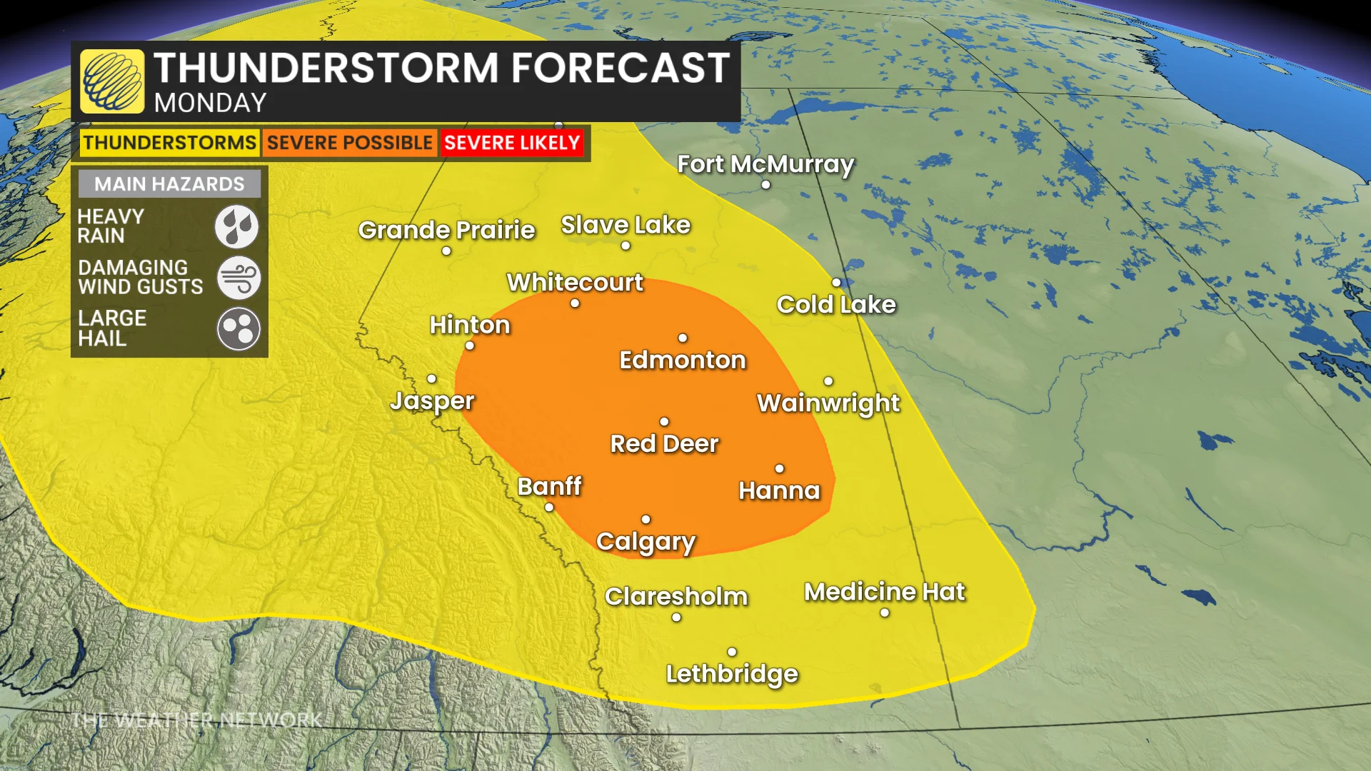
The primary concern with storms that develop is damaging winds, with speeds reaching 100–110 km/h.
Heavy rainfall and large hail, potentially up to the size of quarters, are also likely in impacted areas.
Major temperature drop and chance for high elevation snow
Looking ahead, temperatures are set to drop significantly as another wet system moves in, bringing heavy rainfall later this week.
A surface trough developing over B.C. and Alberta will enhance precipitation across the Rockies.
RELATED: Precise, targeted severe weather warnings coming to Canada
While there is high uncertainty in rainfall totals, computer models suggest amounts ranging between 30 mm and 50 mm.
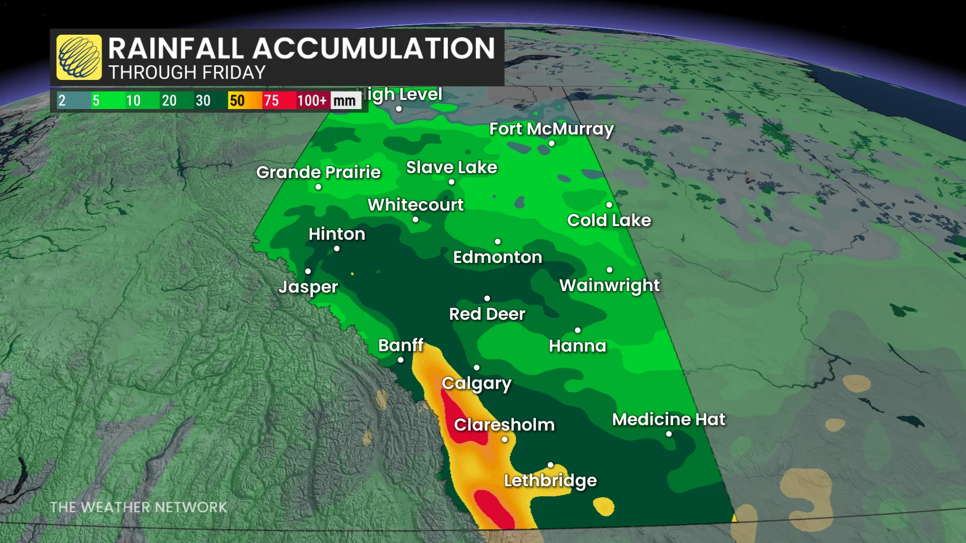
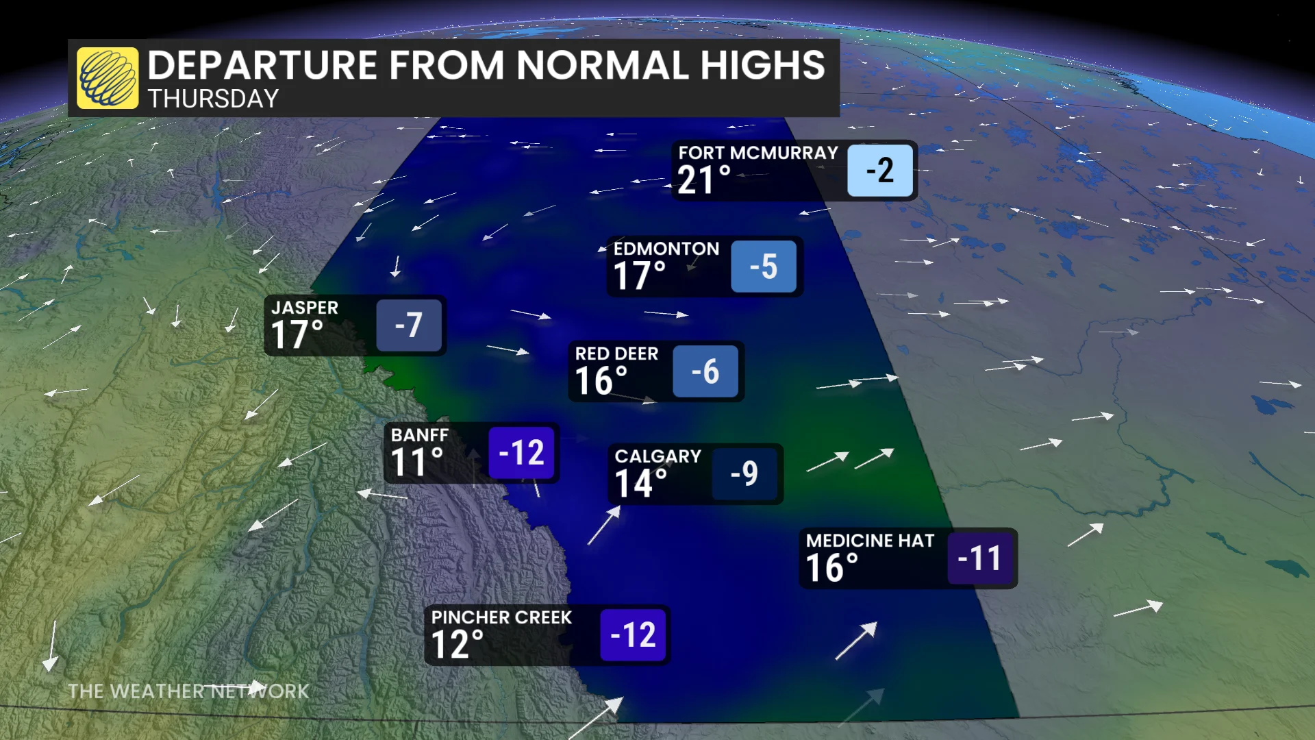
By Thursday, temperatures are forecast to fall 9–12°C below seasonal norms due to a northerly flow. Freezing levels will drop to approximately 2,400 m, resulting in snowfall at higher elevations.
Residents should prepare for rapidly changing weather conditions this week and monitor any further updates or alerts.